Coordinate Reference Systems (CRS)
1. Description
The Coordinate Reference System (CRS) refers to which geospatial reference system is used to assign horizontal coordinates and vertical elevation values to visualized data.
A CRS establishes the relationship between the 2D information and the actual physical world location using the coordinates.
2. Set Project CRS
Setting the CRS used for a Project is the first step to take when creating a Project on Aether.
The Project CRS can be defined in a couple of ways:
- During the Project Creation.
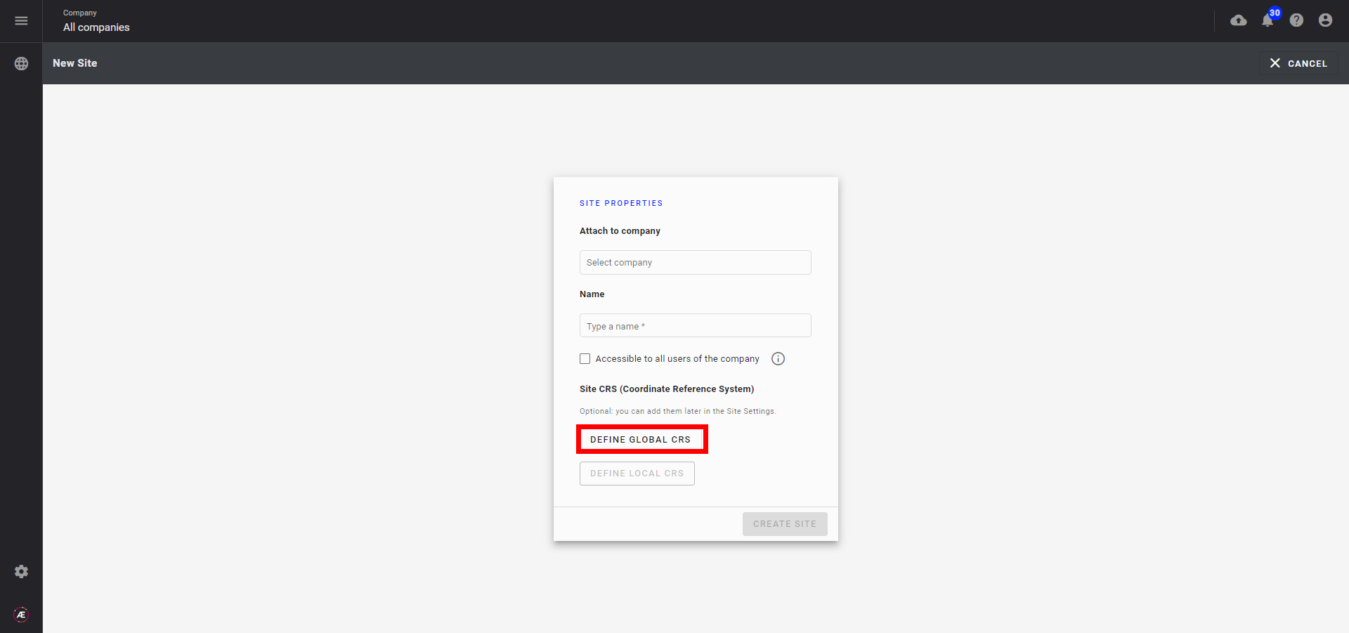
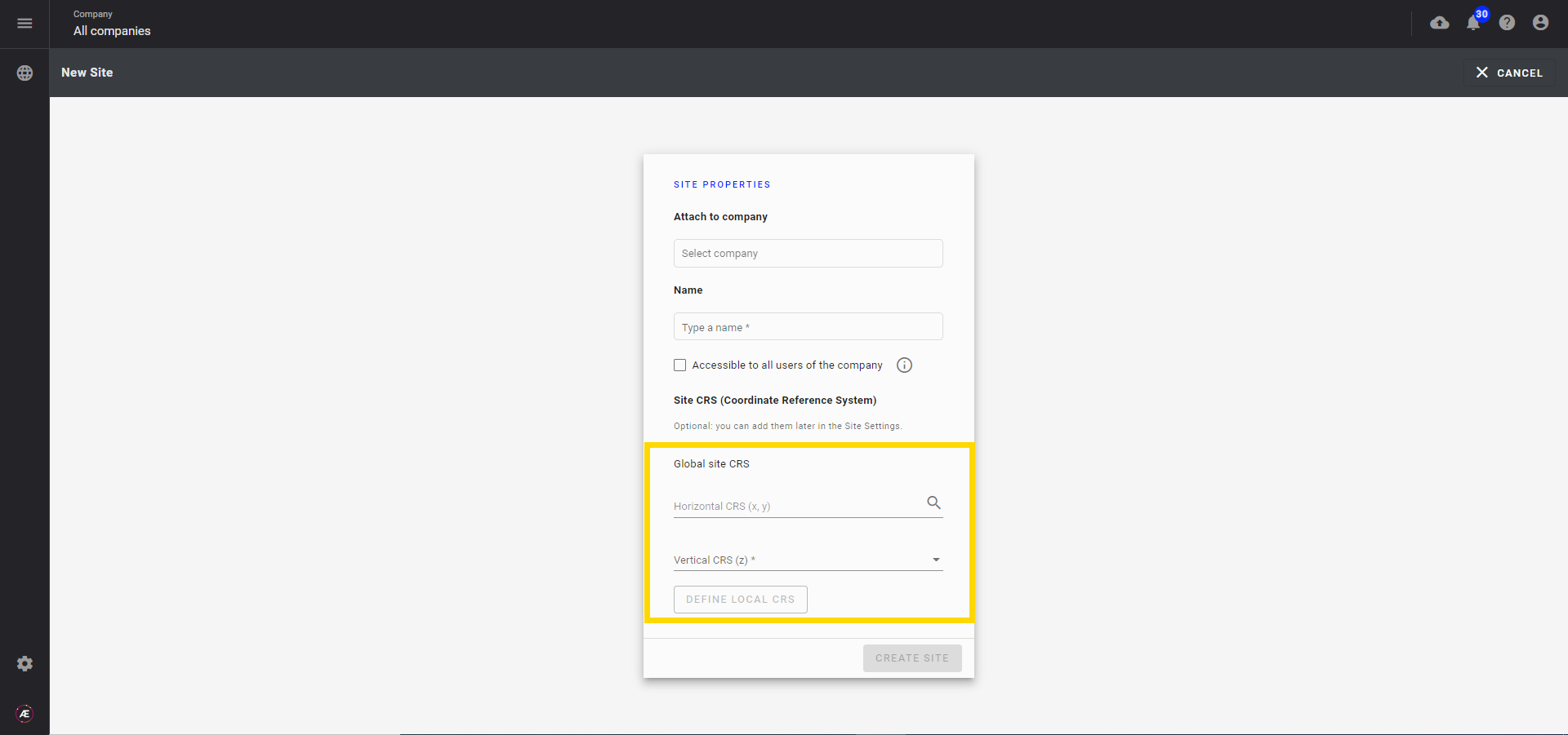
- Or later in the Project Info Panel (manager role required)
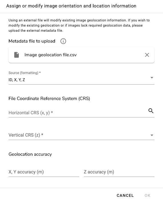
3. Set image CRS
Set image CRS when uploading a survey (Upload Survey), or after the selected images have been uploaded.
- If the picture has metadata, the input CRS will be filled automatically.
- If not, after adding the geolocation coordinates file (generally in a CSV file format), choose the appropriate formatting source and the File CRS :
4. Photogrammetry CRS
Every time a user requests photogrammetry processing, Aether will always request the desired output CRS system.
Important
The output of most of Alteia analytics is delivered with the CRS of the Photogrammetry except for a file that has a standard CRS (ex: GEOJSON, KML which are in standard WGS84).
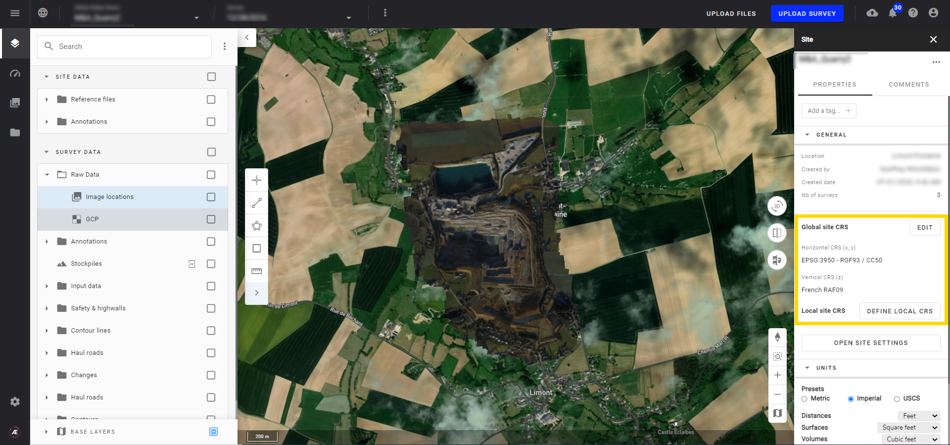
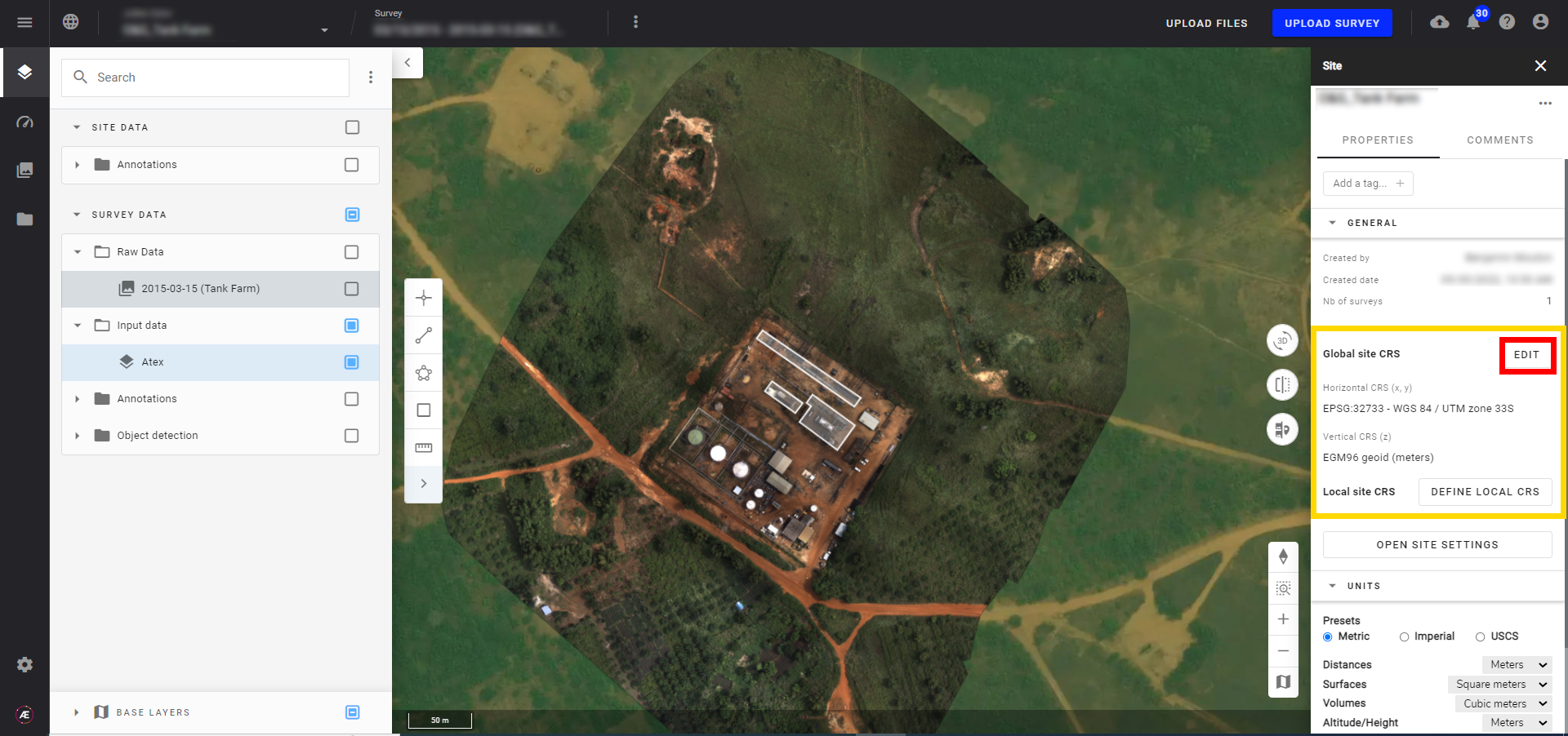
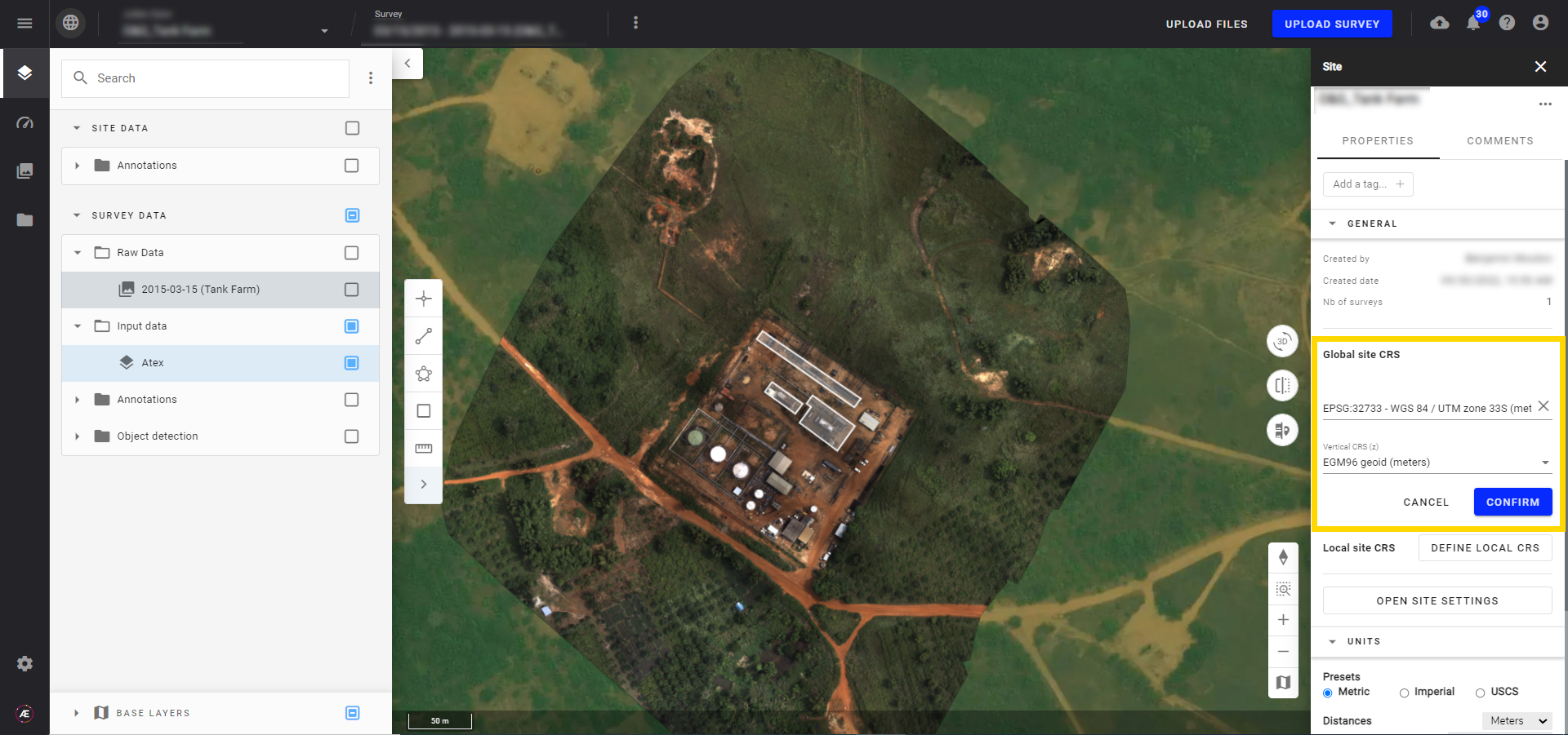
5. Consult the Project CRS
The Project CRS is displayed on the Project Info Panel.