

Local Coordinates
1. Description
Aether allows data storage and conversion in Local Coordinates systems for a unified visualization with data in known or global coordinate reference systems.
A Local Coordinate System is a geospatial reference system in which unique, localized position values are employed to minimize visual distortion and simplify measurement in a targeted region.
Please consult the CRS article if needed.
Info
In Aether, Local Coordinates are based on a transformation, or project calibration, that is performed with the help of GCPs that are measured in both the global datum and the desired local coordinates values.
Consequently, the Ground Control Points being utilized must be measured with the desired local coordinates and also in WGS84 (long, lag) DATUM.
2. Workflow
Local coordinates can be specified during the project creation.
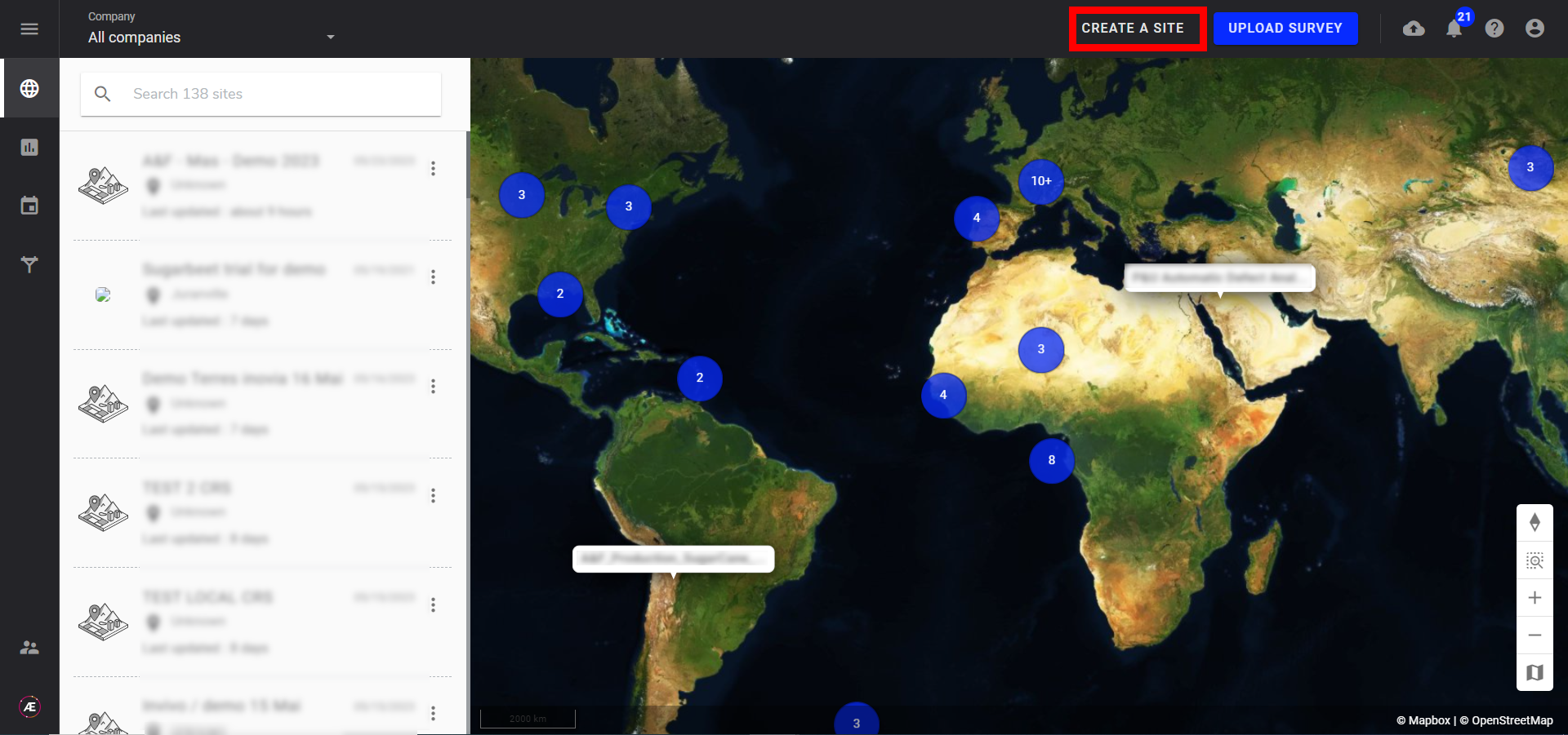
Step 1 - Click on "CREATE A PROJECT".
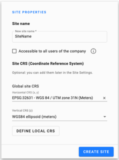
Step 2 - In the project properties, choose the global project CRS.
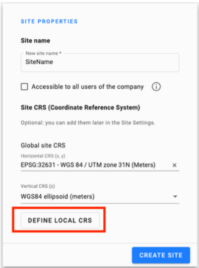
Step 3 - After choosing the global project CRS please click on "DEFINE LOCAL CRS".
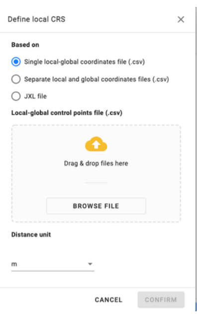
There are three ways to define the Local CRS:
- Single local-global coordinates file (CSV)
- Separate local and global coordinates files (CSV)
- JXL file
IMPORTANT
- The global coordinates mentioned here in the file name do not correspond to the GLOBAL PROJECT CRS but rather to the WGS84 reference positions used for the transformation. WGS84 (EPSG:4326) is required for the transformation. Alternatively, the GLOBAL PROJECT CRS refers to the desired reference system you are using on the platform for any specific project.
- DO NOT forget to choose the unit in which the local coordinate is written
Find below example files:
- coordinates.jxl
- Single Local global Control point.csv
- Local Control point.csv
- Global Control point.csv
1.1 Single local-global coordinates CSV file
Allows the user to embed in one single CSV file, the positions for a given point on the earth in both the global system (WGS84) and the target local coordinate system.
This CSV file must respect the following rules:
- No Header
- Must contain at least 3 points.
- The supported separator must be ",".
- Global coordinates of the GCP must be in WGS84 (EPSG:4326).
- Must have the following structure as shown in the example table below (The column must have the same order (first local coordinates followed by the WGS84 coordinates)).
| GCP ID | Easting or X axes (local units) | Northing or Y axes (local units) | Elevation (local units) | Latitude (deg) | Longitude (deg) | Ellipsoid Height (m) |
| gcp 0 | 11728.371 | 9951.901 | 788.614 | 34.71285 | -118.13166 | 677.058928 |
| gcp 1 | 11796.451 | 9864.197 | 790.885 | 34.71261 | -118.13143 | 679.331512 |
| gcp 2 | 11671.38 | 9793.678 | 787.715 | 34.71242 | -118.13185 | 676.168511 |
| gcp 3 | 11570.888 | 9887.278 | 788.415 | 34.71267 | -118.13218 | 676.866717 |
1.2 Separate local and global coordinates files (.csv)
- No Header.
- Must contain at least 3 points.
- The supported separator must be ",".
- Global coordinates of GCP locations must be in WGS84 (EPSG:4326).
- Must have the following structure as shown in the example table below (The column must have the same order (first local coordinates followed by the WGS84 coordinates)): GCP Global CRS CSV.
| GCP ID | Longitude (deg) | Latitude (deg) | Ellipsoid Height (m) |
| gcp 0 | -118.13166 | 34.71285 | 677.058928 |
| gcp 1 | -118.13143 | 34.71261 | 679.331512 |
| gcp 2 | -118.13185 | 34.71242 | 676.168511 |
| gcp 3 | -118.13218 | 34.71267 | 676.866717 |
GCP Local CRS CSV:
| GCP ID | Easting or X axes (local units) | Northing or Y axes (local units) | Elevation (local units) |
| gcp 0 | 11728.371 | 9951.901 | 788.614 |
| gcp 1 | 11796.451 | 9864.197 | 790.885 |
| gcp 2 | 11671.38 | 9793.678 | 787.715 |
| gcp 3 | 11570.888 | 9887.278 | 788.415 |
1.3 JXL file
Supported Projection:
| Projection | Supported by Trimble | Supported by Aether |
| Mercator | ✔ | beta |
| Transverse Mercator | ✔ | ✔ |
| UTM | ✔ | beta |
| Lambert Conformal Conical | ✔ | beta |
| Oblique Mercator | ✔ | |
| Oblique Conformal Cylindrical | ✔ | |
| Oblique Stereographic | ✔ | |
| Polar Stereographic | ✔ | |
| RD Stereographic | ✔ | |
| Albers Equal Area | ✔ | beta |
| Cassini Soldner | ✔ | beta |
| Krovak | ✔ | |
| New Zealand Map Grid | ✔ | beta |
| United Kingdom National Grid | ✔ | |
| Denmark | ✔ | |
| Hungarian EOV | ✔ | |
| Stereographic Double | ✔ | |
| Rectified Skewed Orthomorphic (RSO | ✔ | |
| UPS North | ✔ | beta |
| UPS South | ✔ | beta |
| Projection Grid | ✔ |
Supported Datum Transformation:
| Projection | Supported by Trimble | Supported by Aether |
| No Datum | ✔ | ✔ |
| Helmert Three Parameters | ✔ | beta |
| Helmert Seven Parameters | ✔ | beta |
| Grid Datum | ✔ | |
| RTCM Grid | ✔ |
Supported Geoid Model:
| Trimble Name | Proj4 filename | Supported |
| EGM96 (Global) | egm96_15.gtx | ✔ |
| GEOID12A (Conus) | g2012au0.gtx | ✔ |
| GEOID12A (Alaska) | g2012aa0.gtx | ✔ |
| GEOID12A (American Samoa) | g2012as0.gtx | ✔ |
| GEOID12A (Guam) | g2012ag0.gtx | ✔ |
| GEOID12A (Hawaii) | g2012ah0.gtx | ✔ |
| GEOID12A (Puerto Rico) | g2012ap0.gtx | ✔ |
| GEOID12B (Conus) | g2012bu0.gtx | ✔ |
| GEOID12B (Alaska) | g2012ba0.gtx | ✔ |
| GEOID12B (American Samoa) | g2012bs0.gtx | ✔ |
| GEOID12B (Guam) | g2012bg0.gtx | ✔ |
| GEOID12B (Hawaii) | g2012bh0.gtx | ✔ |
| GEOID12B (Puerto Rico) | g2012bp0.gtx | ✔ |
| Atlantic Canada HT2 | HT2_0.gtx | ✔ |
2. Update the local CRS of an already existing project
It is possible to define the local CRS of a project from the info panel.
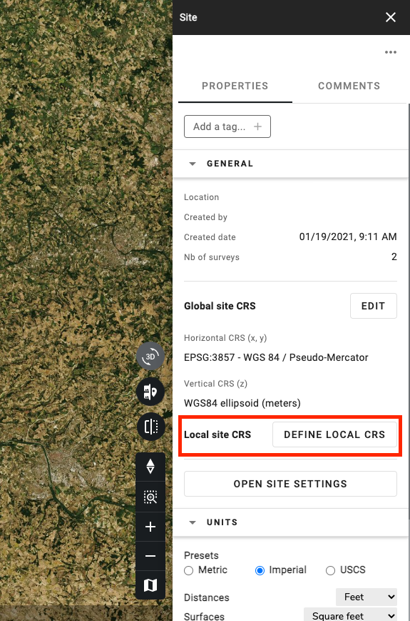
To make the transformation possible, a global system must be defined previously.
With this method, Aether users can export older datasets into the local system as we now have the transformation with both systems.
3. Set the Local coordinates during Project Creation with images
Set the local coordinate during the image download of the project creation process.
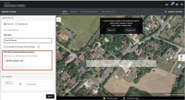
As mentioned above, the global Project Coordinate Reference System must be also defined.
4. Data importation in local CRS
- Vector: The user can upload a vector file with the local CRS.
- Raster: For the moment a raster file can only be uploaded as a File in local CRS which means it will not be displayed on the map.
- Point Cloud: Not supported yet in Local CRS.
5. Data exportation in local CRS
Datasets can be exported in a Local CRS. Please click here to learn about exporting data on Aether.
In the download section, during the export, click on "Switch to Local CRS".
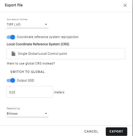
- Vector: The user can export in local CRS.
- Raster: The user can export in local CRS.
- Point Cloud: The user can export in local CRS using the analytics "Point Cloud geographic conversion".
