Ground Sampling Distance (GSD)
1. Description
In aerial mapping applications, the Ground Sampling Distance (GSD) represents the distance measured on the ground between the centers of two adjacent pixels within a digital image. For example, an image with 5cm/pixel GSD means the locations of two consecutive pixels are 5cm apart on the ground.
2. Reminder
- A higher GSD indicates a lower image resolution, meaning fewer details will be visible in the image ("higher GSD => lower resolution")
- GSD is an indicator for the area represented by one pixel. For example, a 2cm/px GSD means a pixel accounts for a ground area of 2 cm x 2 cm = 4 cm²
3. View GSD with Aether
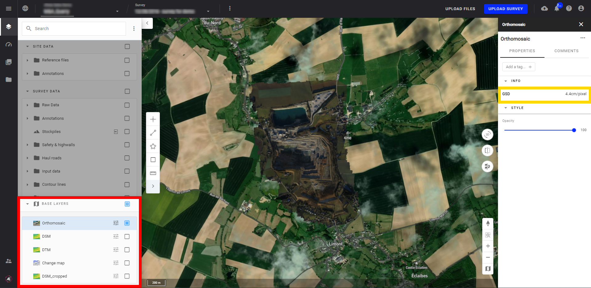
3.1 On a Base Layer Raster
The GSD information in an Aether survey is indicated on any layer in the "BASE LAYERS" section.
In the example below the GSD is 0.2 inch/pixel.
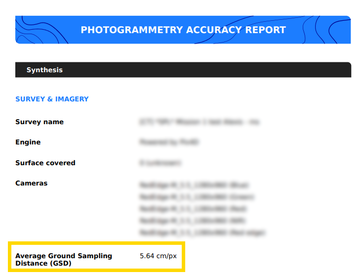
3.2 On the Photogrammetry Accuracy Report
For surveys where the photogrammetry process was launched within Aether, the GSD information is also indicated on the Photogrammetry Accuracy Reports.
In the example below, the average GSD is 5,6 cm/pixel: