Data Acquisition - Introduction
1. Description
The Data Acquisition Module allows users to plan and track their data acquisition process, ensuring acquisitions are made at the right time and in accordance with the specifications.
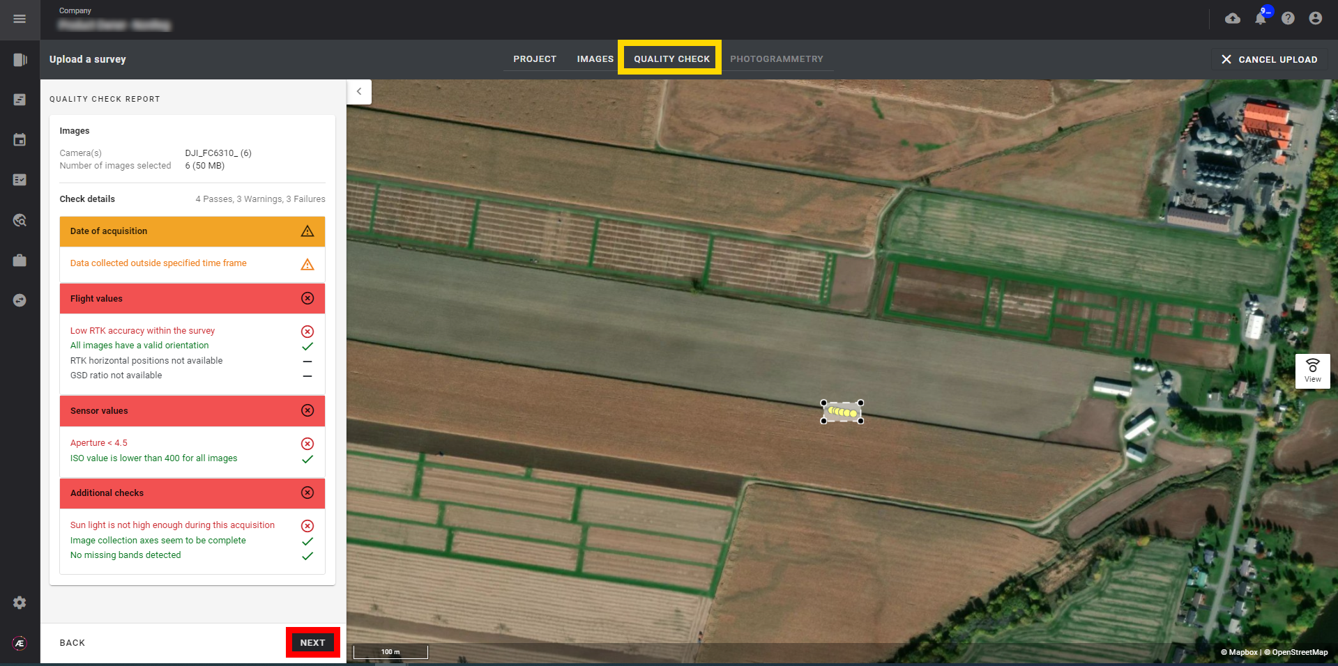
The module integrates a quality check tool to ensure the data can be used in the desired analysis process.
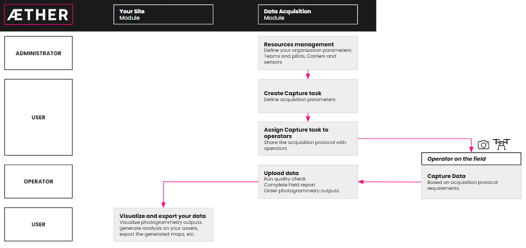
5-step workflow:
- Manage your teams, equipment, and sensor allocation.
Define your organization's resources by creating data acquisition teams and list the available acquisition equipment such as carriers and sensors.
- Plan your data collection campaigns and task the right operator for the job.
Create collection tasks describing the data acquisition protocol by defining acquisition parameters (date, location, carrier and sensor type, etc.) and assigning tasks to operators to share the acquisition protocol.
- Monitor your collection tasks throughout the acquisition workflow.
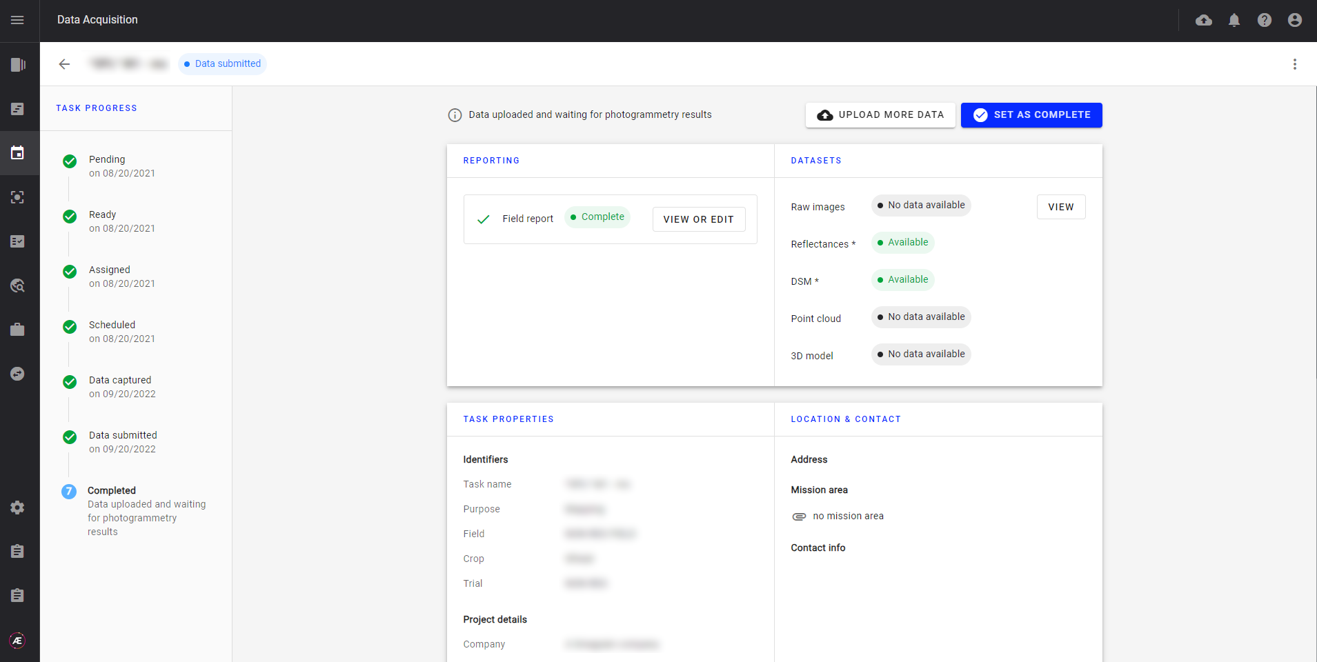
Operators fill in the field report describing the acquisition conditions in this step.
A data quality check is performed at data upload to ensure that the data collected meets the specified requirements.
- Streamline the data upload, data contextualization, and quality check.
Leverage Aether photogrammetry pipeline to generate different types of outputs (reflectance maps, orthomosaic, spectral indices (eg. RGB, NDVI, NDRE), DSM, 3D models, and reports).
- Leverage embedded photogrammetry pipelines for automated data processing.
Visualize and export your data and generated outputs.
Use Aether off-the-shelf analytics to capitalize on generated outputs.
Easily integrate with your tools leveraging various export formats.
2. Workflow overview
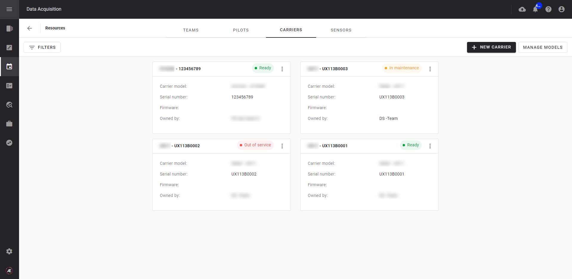
2.1 Manage your resources
Define the resources available for data acquisition. Create teams of operators to assign data collection tasks, according to the type of equipment and sensor they have.
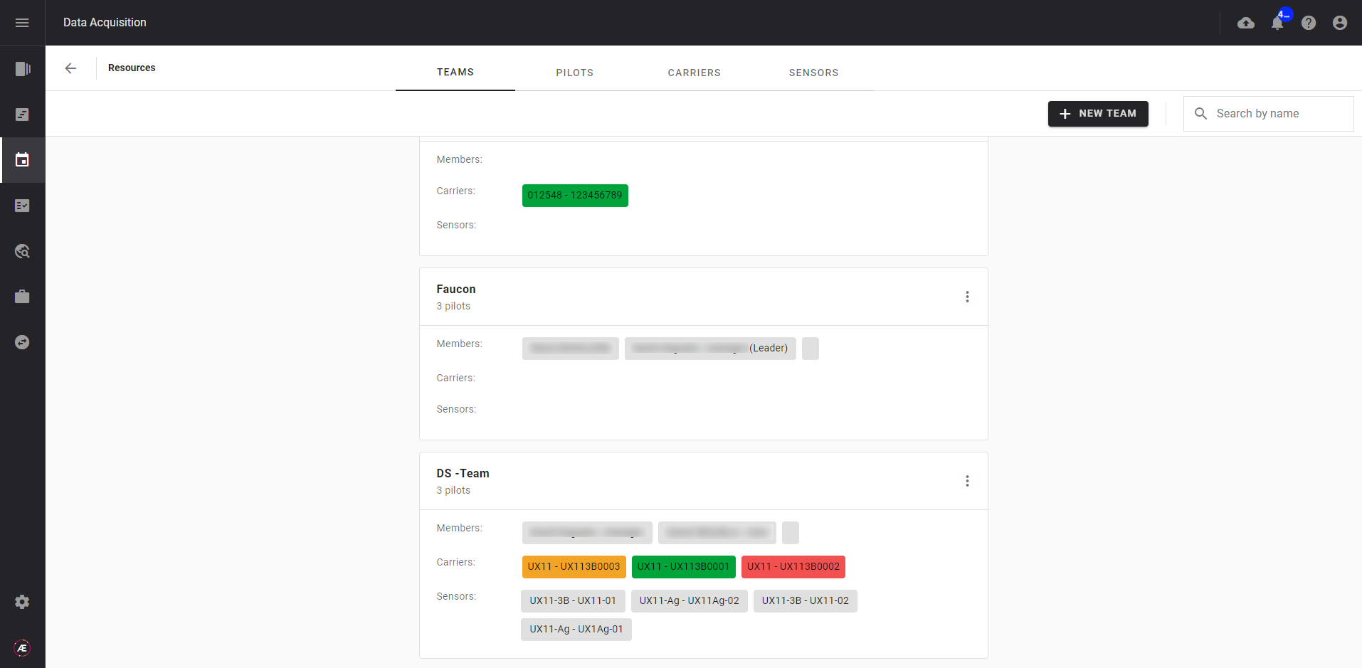
For each team of operators, configure which carriers and sensors they have access to. Operators can indicate whether their equipment is operational or not, allowing detailed knowledge of the resources available for the acquisition tasks to be planned.
2.2 Manage data
Create data collection tasks and assign them to operators. Data acquisition tasks can be monitored and their parameters refined at any time from the Data Acquisition module.
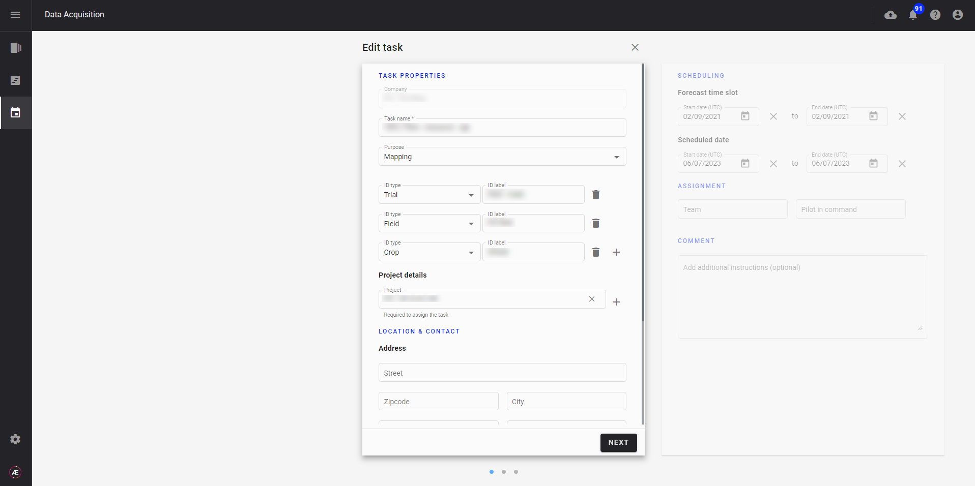
Operators can access their assigned data collection tasks to prepare the mission based on data collection parameters. Once the data has been collected, they complete the field report describing the actual acquisition conditions (carrier and sensor used, weather, etc.).
2.3 Data Collection and Upload
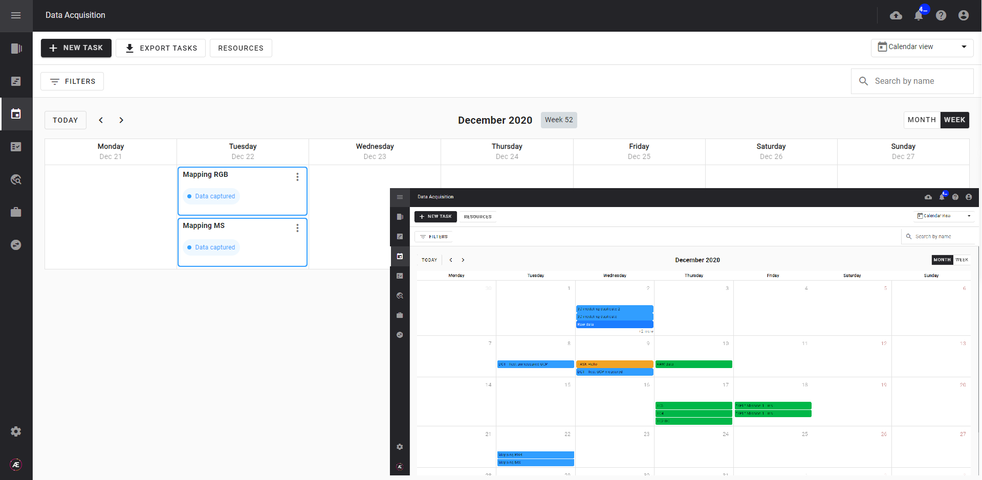
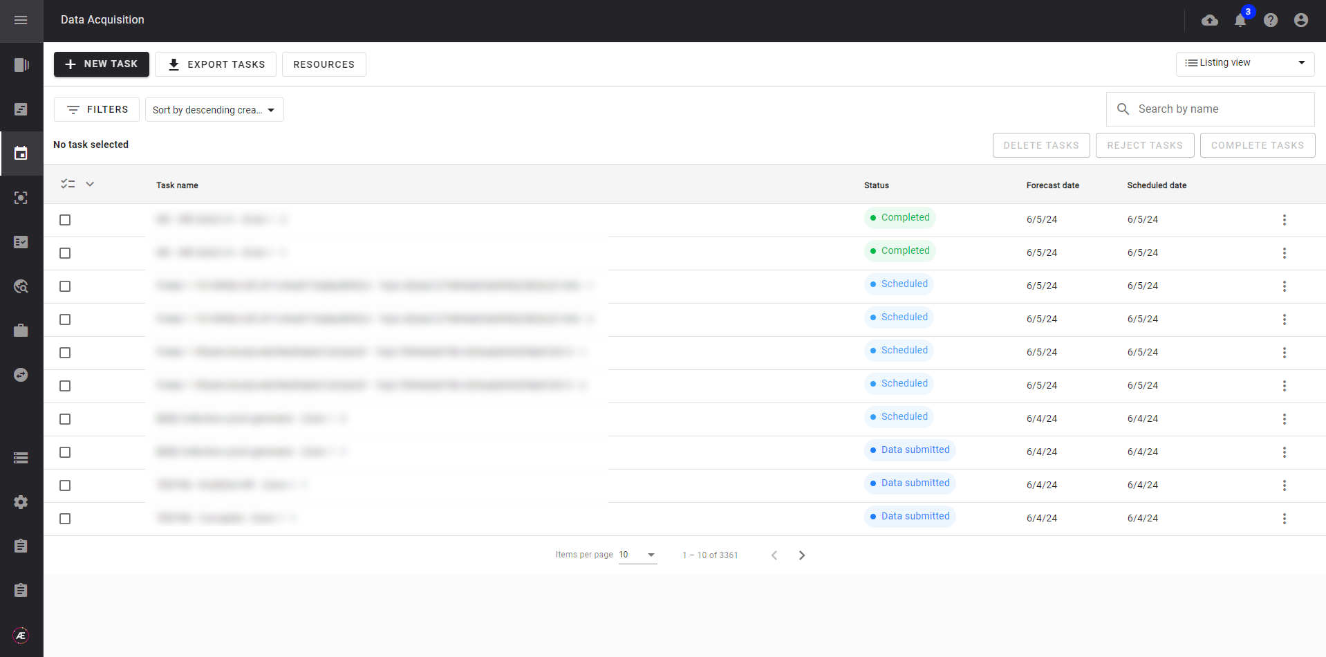
Monitor the collection tasks throughout the acquisition workflow.
- Pending: The task has been created but information is missing: task name, project, and expected mission date.
- Ready: The task has been updated with a name, linked to a project in Aether and the expected mission date has been specified.
- Assigned: The task has been assigned to a team and an operator, and the acquisition parameters have been specified as needed.
- Scheduled: The task has been scheduled: the date and time for the acquisition have been updated.
- Data Captured: The operator has completed the field report describing the acquisition conditions: date and time, weather, flight parameters if applicable, etc...
- Data Submitted: The operator has uploaded the collected data, and the quality check has vetted the data quality.
- Completed: The data collection task has been validated and closed.
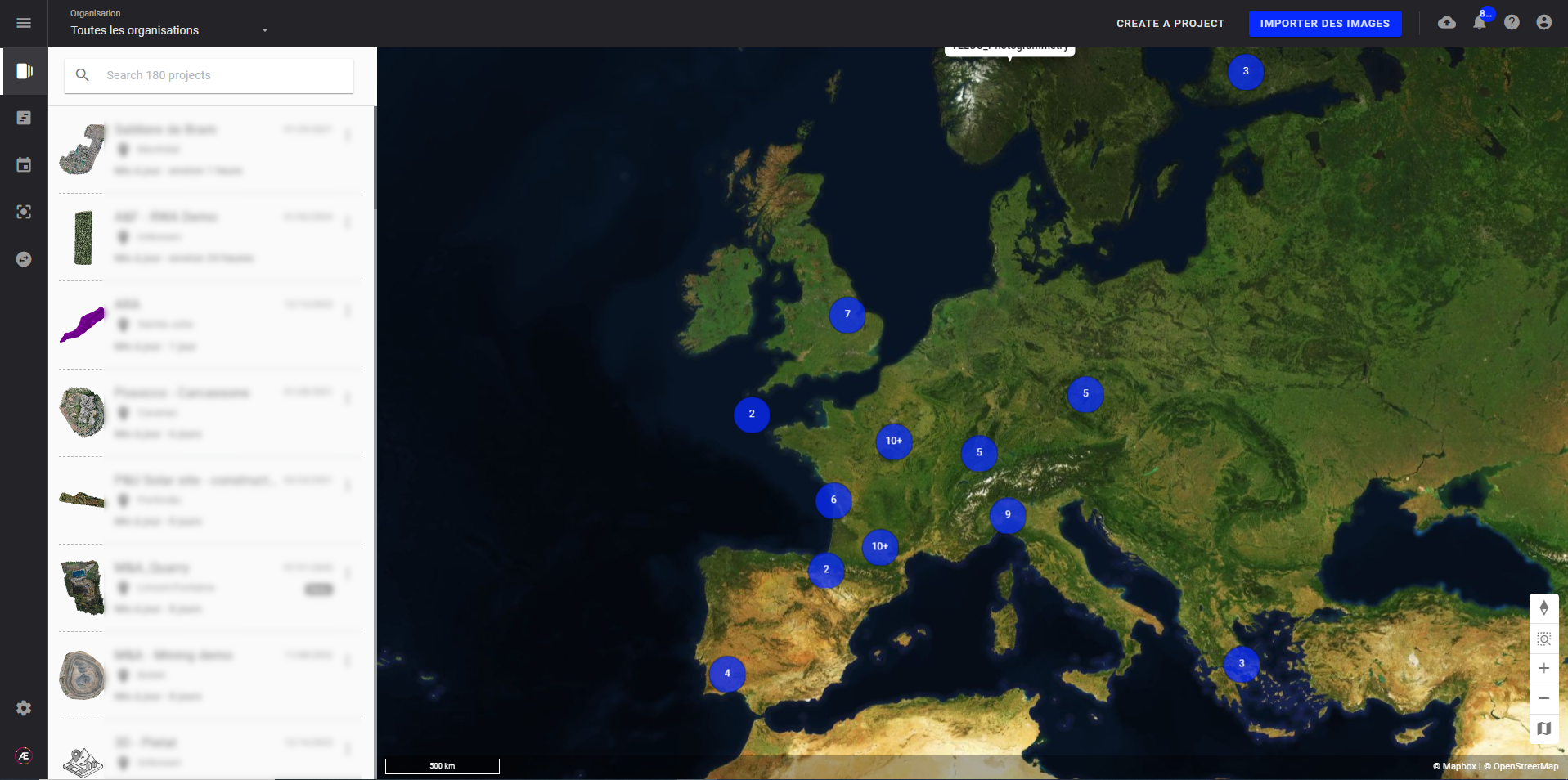
Tracking view.
![]()
Calendar week or month view.
Listing view
2.4 Leverage our photogrammetry pipeline
Operators upload the data using the unique link generated with each task allowing data to be automatically contextualised to the correct project.
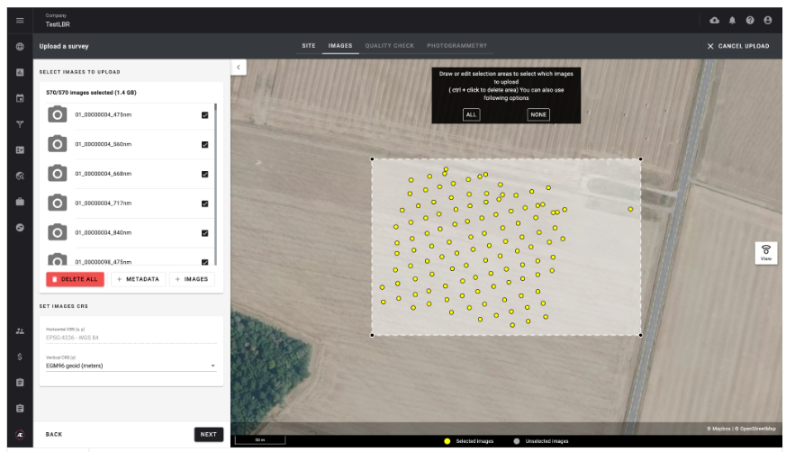
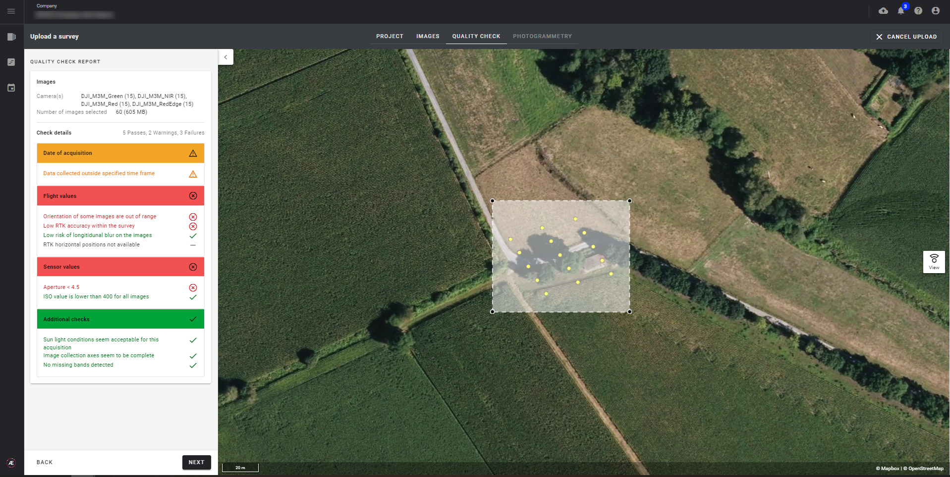
A quality check is performed during the data upload (available offline in the desktop app) to ensure that the data meets the specifications: type of sensor used, flight time, RTK accuracy, overlap, risk of blur, resolution, sharpness, contrast.
2.5 Visualize and export data
Leverage the photogrammetry pipelines as needed to generate various maps and other types of files. Configure and run photogrammetry on collected data.
Examples of outputs include but are not limited to reflectance maps, orthomosaics, spectral indices (NDVI, NDRE), DSM, and 3D models.
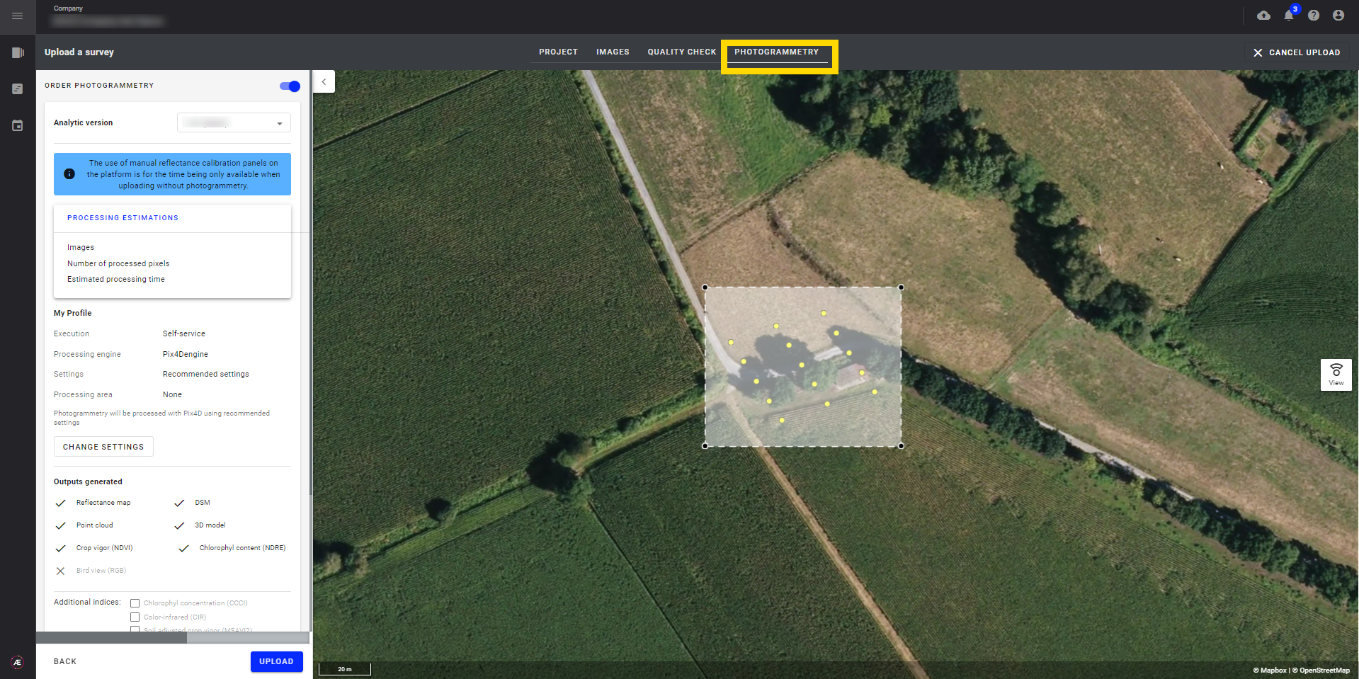
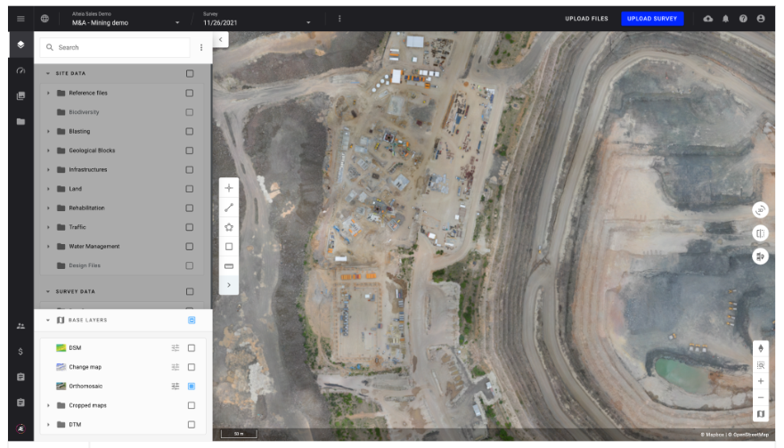
Visualize the generated files in 2D or 3D. Access the project directly by clicking on the view button on your collection task.
3. Use case example
Orchestrate seamlessly various service providers for multi-project data acquisition.
1. Resource management
The Head of Data Acquisition of an engineering firm configures the Data Acquisition module in order to access its service providers and their available drones, carriers, and sensors.
Result: Seamless management of multiple service providers in different geographies.
2. Collection schedule definition
The Head of Data Acquisition can easily synchronize the planning of all the projects requiring data and create data collection tasks to assign to available service providers, based on geographic location and owned equipment.
Result: Parallel management of orders is made easier, allowing missions to be shared more effectively.
3. Data collection process validation
The Head of Data Acquisition can validate the acquisition process or request a re-flight from the service providers if required.
Result: All collected data goes through our data quality check, which ensures consistent data quality and enables seamless processing of all collected data, regardless of the collection method.