

Building Information Modeling (BIM)
1. Description
Aether manages several Building Information Modeling (BIM) activities, as the platform is built to manage real-life data inputs such as orthomosaic data, 3D models, and annotations as well as building theoretical data from 2D or 3D Computer Aided Design (CAD) files. This functionality is especially useful for analyzing as-built information with as-designed documentation.
2. 3D Reconstruction of Assets and Buildings
In order to build an accurate digital twin of an asset, 3D point cloud data, and ground-based camera images are needed. Using the built-in Pix4D photogrammetry engine option, process RGB pictures for this purpose.
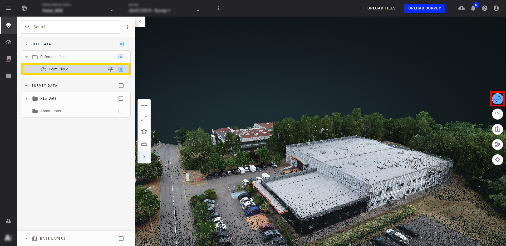
2.1 Facility building reconstructed in 3D
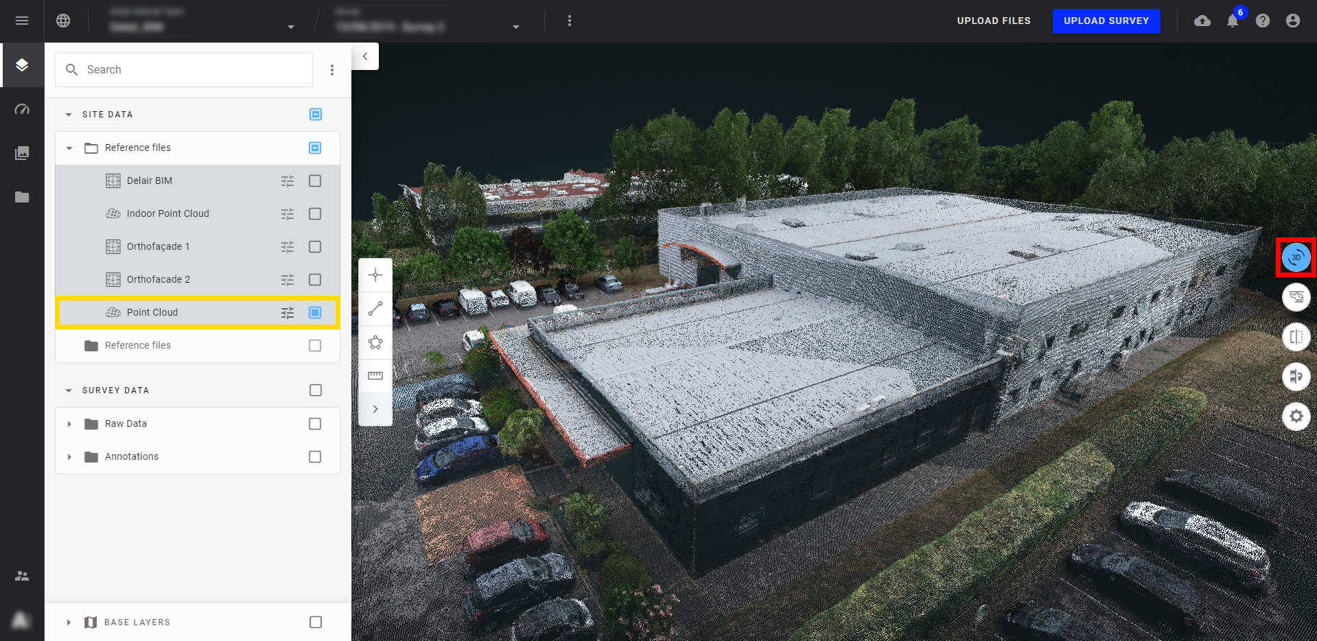
In the example below, a facility building is reconstructed in 3D from a dataset of 232 images gathered with a DJI Phantom 4 RTK drone.
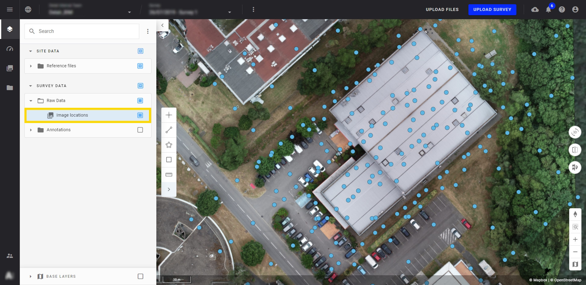
Display the 3D view by clicking on the red boxed button below, and display the point cloud framed in yellow to get a 3D representation of your images.
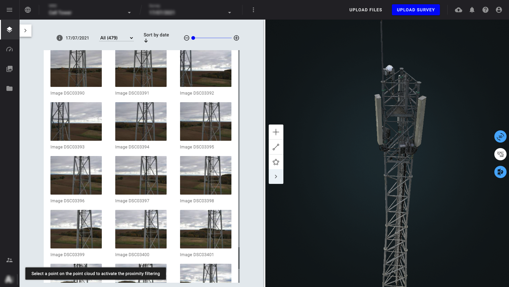
2.2 Infrastructure recreated in 3D
In this example, 479 images were used to recreate this infrastructure in 3D.
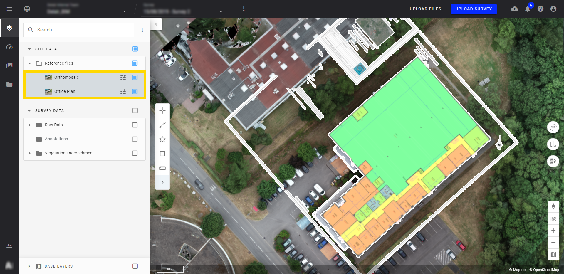
3. 2D as-built VS 2D as-designed analysis
To create an as-built VS as-designed analysis on a structure, a CAD file is ingested (for example, a building floorplan) and overlaid on the 2D real layer (for example, orthomosaic of the building roof processed by Aether from a drone survey).
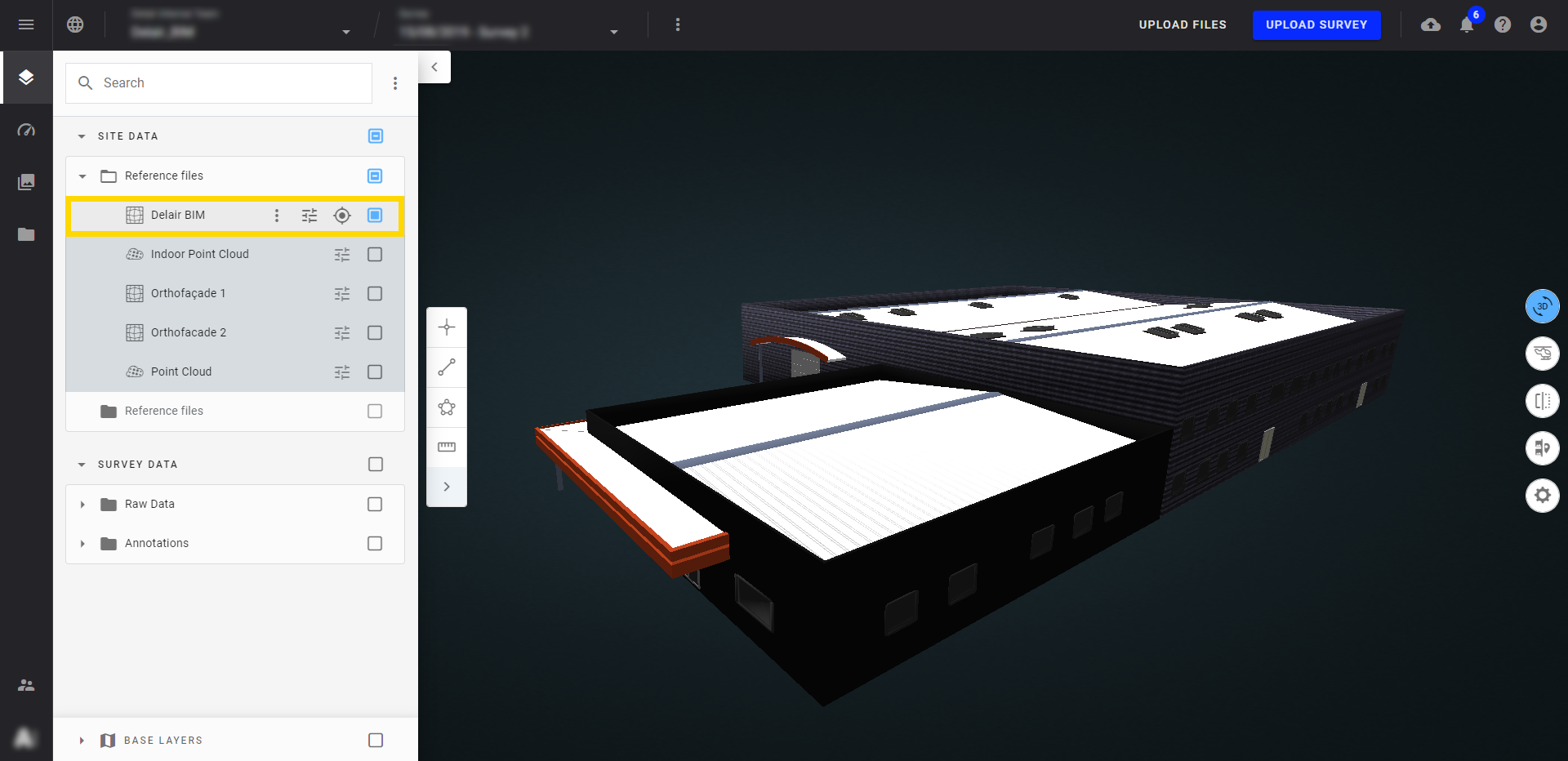
4. 3D as-built VS 3D as-designed analysis
The comparison can also be done in 3D view. For this, visualize both the point cloud created by the drone flight and the CAD model.
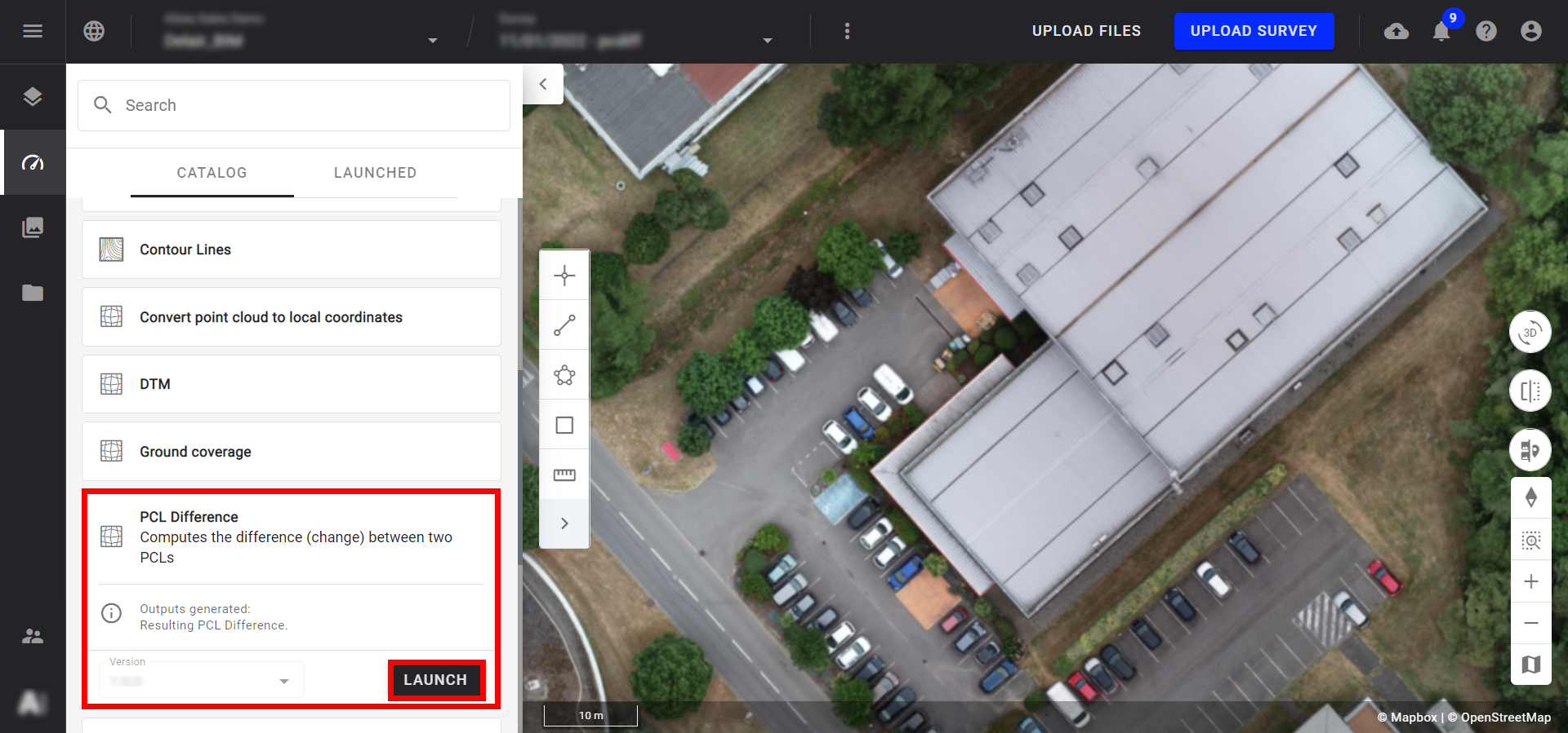
Then, a point cloud difference can be performed. To do this, run the "Point cloud difference" tools available in the "COMPUTING TOOL" section.
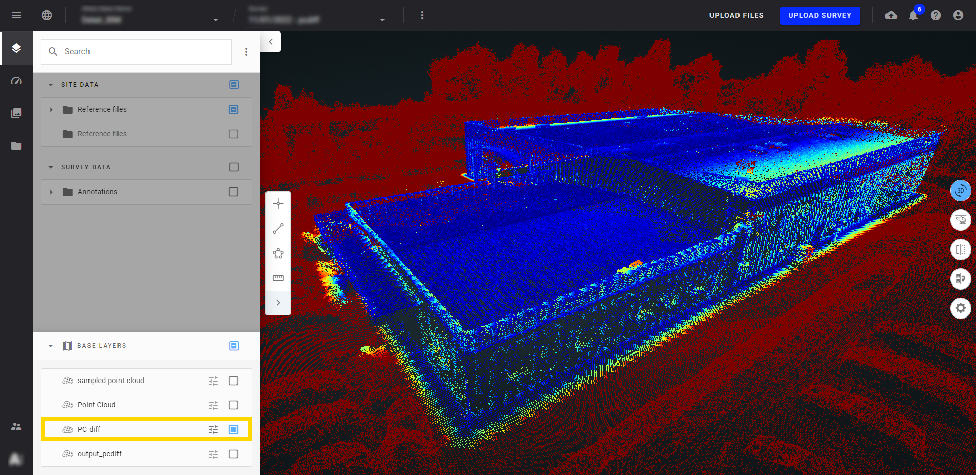
Below, 3D BIM is compared to a real 3D model. In blue, will find the identical points on both models. In red, are the points which do not correspond between the two models (that correspond here to points not modeled by CAD).
For more information on the 3D view, see 3D Viewer.
