

VIDEOS - How to use Alteia for Mining & Aggregates
Table of Contents
1. Presentation of the basic buttons of Alteia:2. How to view the Site info panel:3. How to view the Base Layers (Orthomosaic, DSM,…) and switch to 3D Mode4. How to import a vector, raster, or any compatible file on a specific site or survey5. How to change site information and other settings6. How to use the maps compare tool7. How to use the Elevation Profile tool8. How to view & use the DSM map, and how to change it into a slope view:9. How to create annotations and groups to classify annotation or other imported files10. How to request advanced analytics11. How to launch a Photogrammetry processing12. Stockpile Materials Type settings and management13. How to use and manage the Stockpile Module14. How to download or convert your files before downloading them15. How to access and use the Support Portal16. How to access Alteia's Knowledge base17. For Clients in France only - Comment commander un vol drone?Here you will find different videos that help you in different actions needed on Alteia to perform basic or advanced tasks.
1. Presentation of the basic buttons of Alteia:
This includes, how to:
- Edit your profile
- View Notifications
- User Management
- Process Monitoring (Storage)
- Credit consumption
2. How to view the Site info panel:
This video will allow you to:
- View Site information from different locations
- Edit the name of the site if needed
- Delete the site if needed
- Change the unit of measurements
- Change the Coordinate Reference System (CRS)
3. How to view the Base Layers (Orthomosaic, DSM,…) and switch to 3D Mode
This will teach you how to:
- Show or Hide the Orthomosaic
- Show or Hide the Digital Surface Model (DSM)
- Change the opacity if needed
- Switch to 3D mode
- Show and Hide point Cloud
- Show and Hide 3D Model
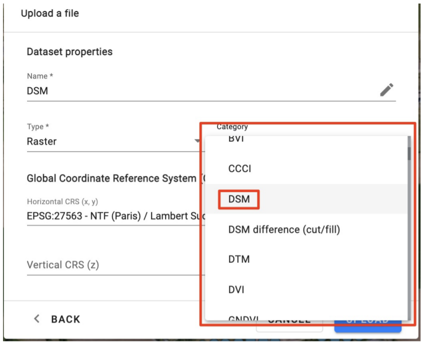
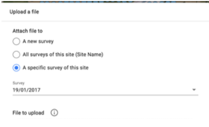
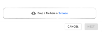
4. How to import a vector, raster, or any compatible file on a specific site or survey
5. How to change site information and other settings
Different settings that can be changed:
- Define the largest truck that circulates on-site (For Haul Road analytics)
- Define what is the highest permitted altitude for a Quarry Face / High wall (allows the change in the color display)
- Define what units of the slope grade to be displayed in, and which ones you consider as a steep, medium, or regular slope
- How to add material types to your company or site inventory, and/or how to import a list of material types if you have a long list.
6. How to use the maps compare tool
7. How to use the Elevation Profile tool
You can access it with the Measure tool or Line tool
8. How to view & use the DSM map, and how to change it into a slope view:
A DSM or Digital Surface Model is a dynamic interactive color-coded map. It allows you to visualize your site based on elevations represented in colors that can be identified in the histogram. You can define it to only show certain elevations based on your selection, or visualize your site in a precise manner.
9. How to create annotations and groups to classify annotation or other imported files
10. How to request advanced analytics
In the Mines & Aggregates and construction industry, Alteia offers different Advanced Analytics to be requested that can provide you more insight on your site. The different analytics can be requested directly within Alteia.
11. How to launch a Photogrammetry processing
If you have an external operator that provided you with raw images, and were uploaded to Alteia, and need to be processed, or if you received a notification telling you that images are uploaded on your account, just follow the video to learn how to launch the processing.
12. Stockpile Materials Type settings and management
This video will help you If you have a few or a list of materials types and you want to upload them to Alteia on a specific site or on a company level. If a list is at your disposition, make sure the file is in .CSV and is in the following format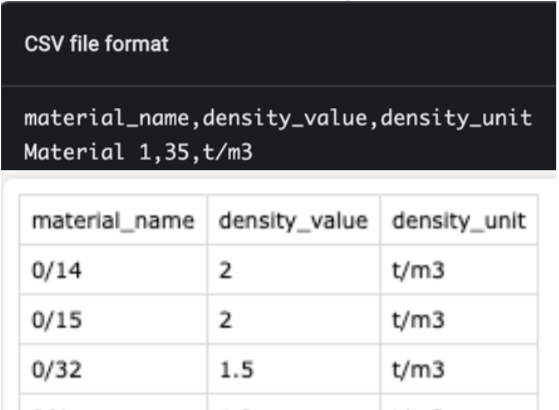
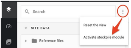
13. How to use and manage the Stockpile Module
 This icon means that no material type has been defined on the stockpile yet
14. How to download or convert your files before downloading them
You have the possibility to downgrade the quality of the desired file before downloading to have them in a lighter version or convert your files into a different format for them to be used on other software
