Field Digital Terrain Model
1. Description
For any use outside the agricultural sector, please consult the "Digital Terrain Models (DTM)".
Similar to a Digital Surface Model (DSM), a Digital Terrain Model (DTM) is a topographic model of the bare Earth. A DTM excludes objects above ground level such as buildings, structures, cars, and trees. Simply highlight elevated objects that you wish to remove from the DSM, and the DTM tool will automatically remove the associated elevation for these objects. A DTM can be used for a quarry or a mine site to remove unwanted ground objects from an area.
2. Inputs
The inputs required are a Digital Surface Model (DSM) and the field boundaries or microplots for the objects above ground that will be removed to generate the DTM.
3. Workflow
3.1 Generation
Step 1 - In the "Tools" Menu search and select "Field digital terrain model" in the "COMPUTING TOOL section".
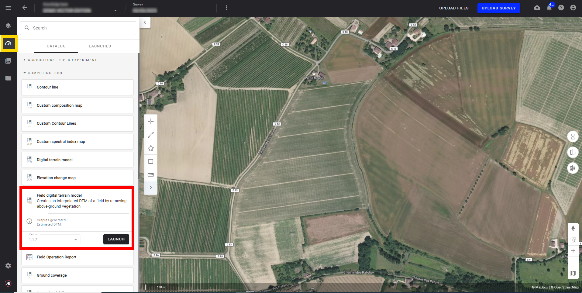
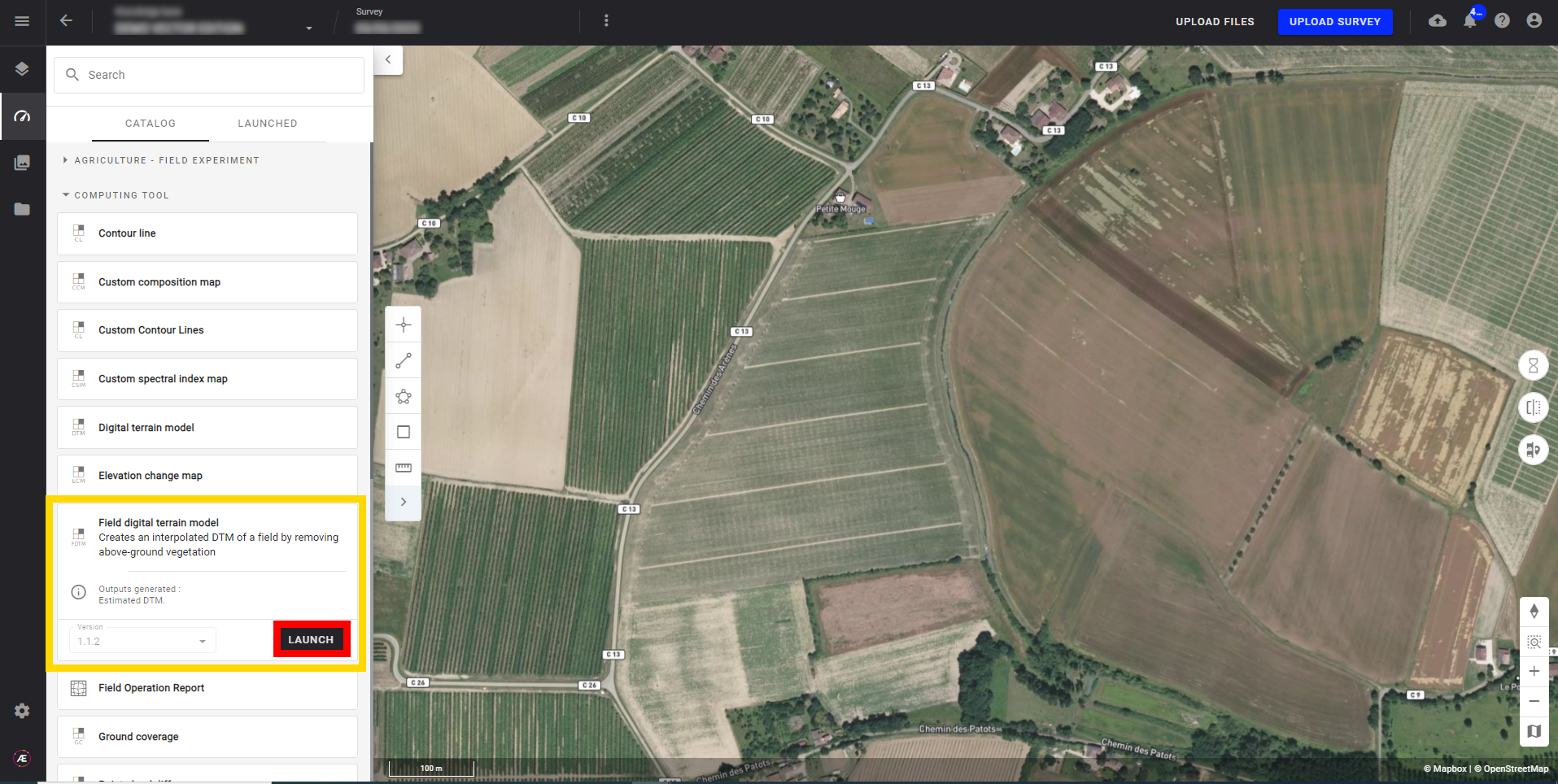
Step 2 - Click on "LAUNCH".
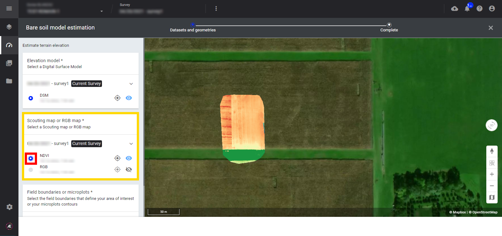
Step 3 - Select a DSM.
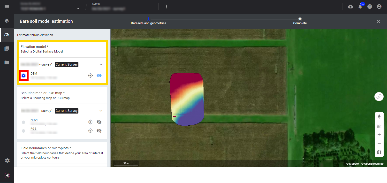
Step 4 - Select an associated spectral index map (RGB or Multispectral).
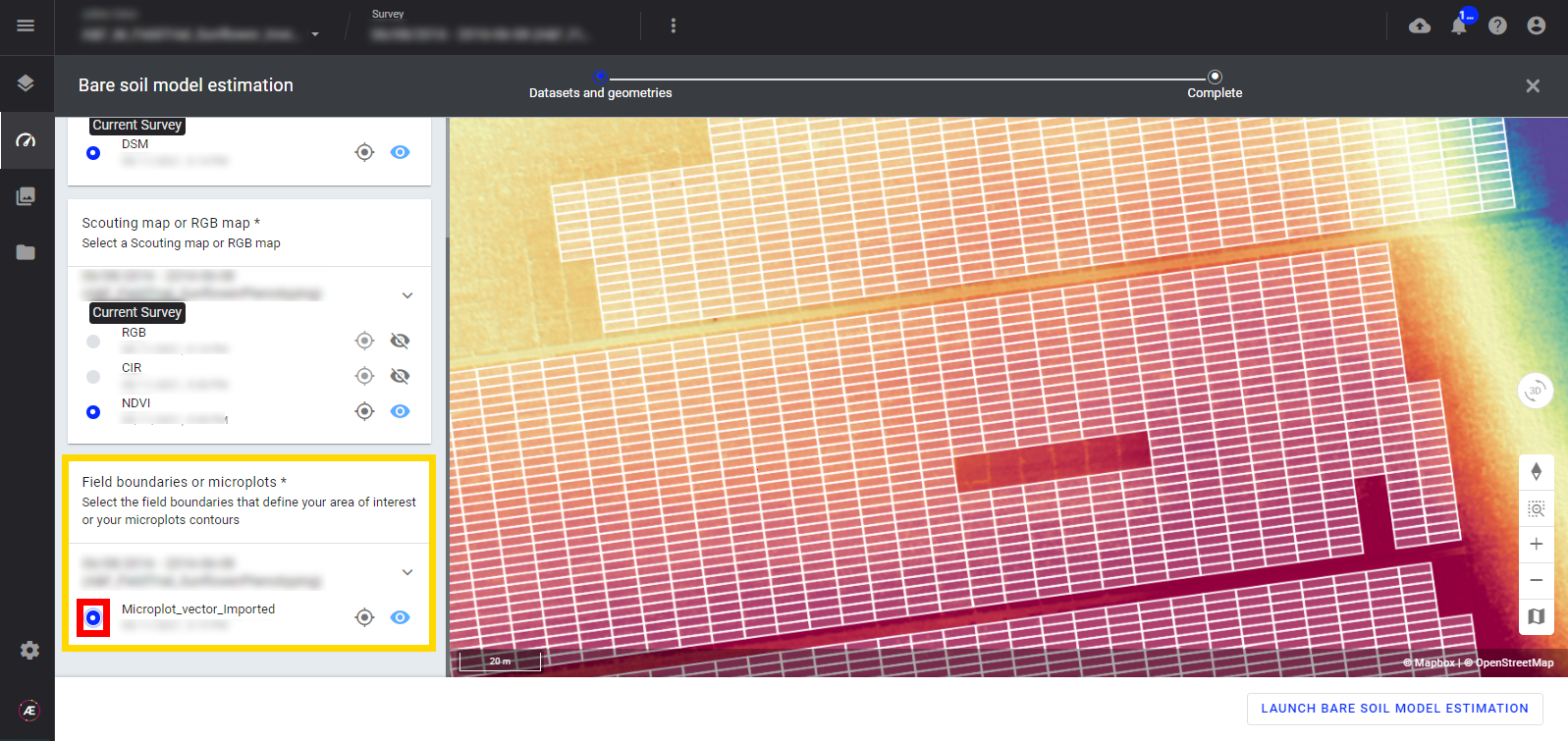
Step 5 - Depending on the type of project, select the “microplots” or, if running the production field tools select a vector file for “field boundaries".
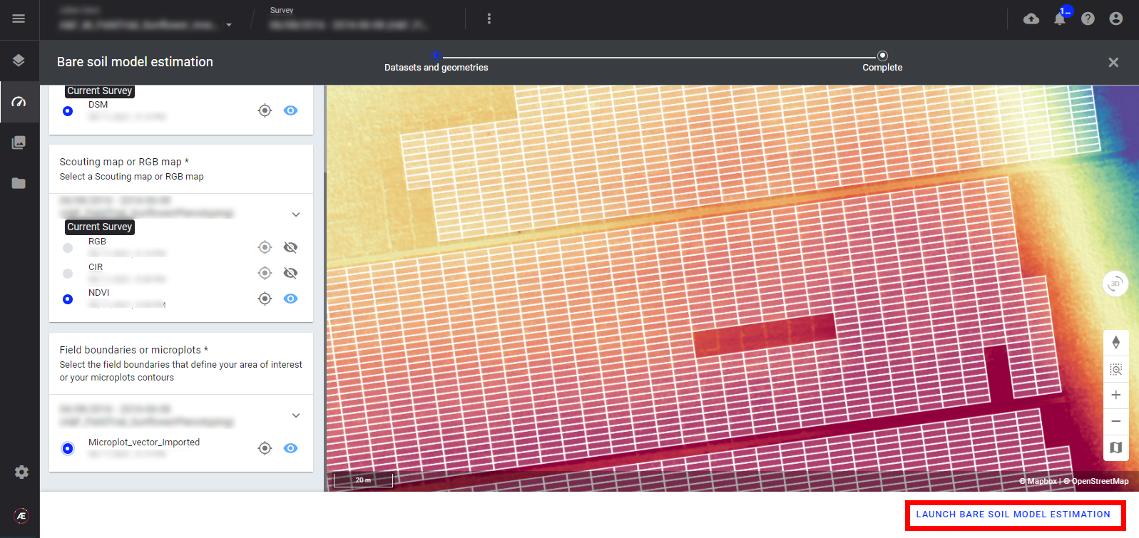
Step 6 - Click on "LAUNCH FIELD DIGITAL TERRAIN MODEL".
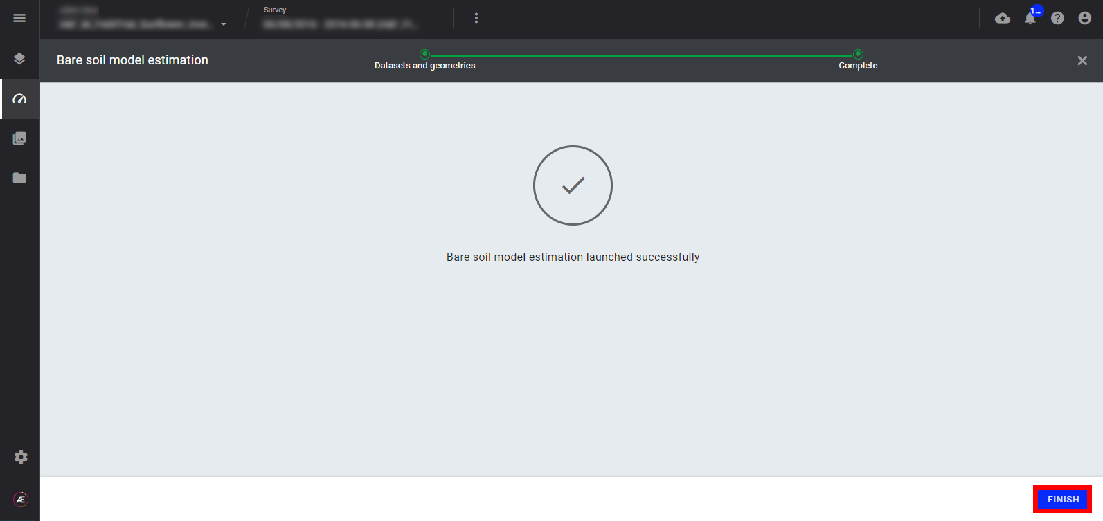
Step 7 - Click on "FINISH".
3.2 Progress Completion Status
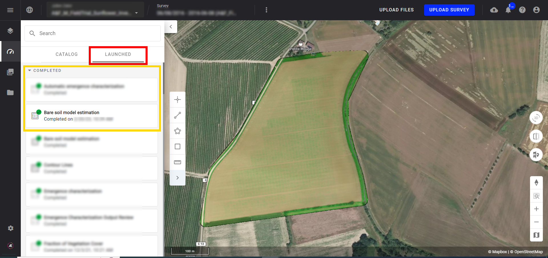
Step 1 - Click on the "LAUNCHED" tab of the "Tools" menu to see the progress.
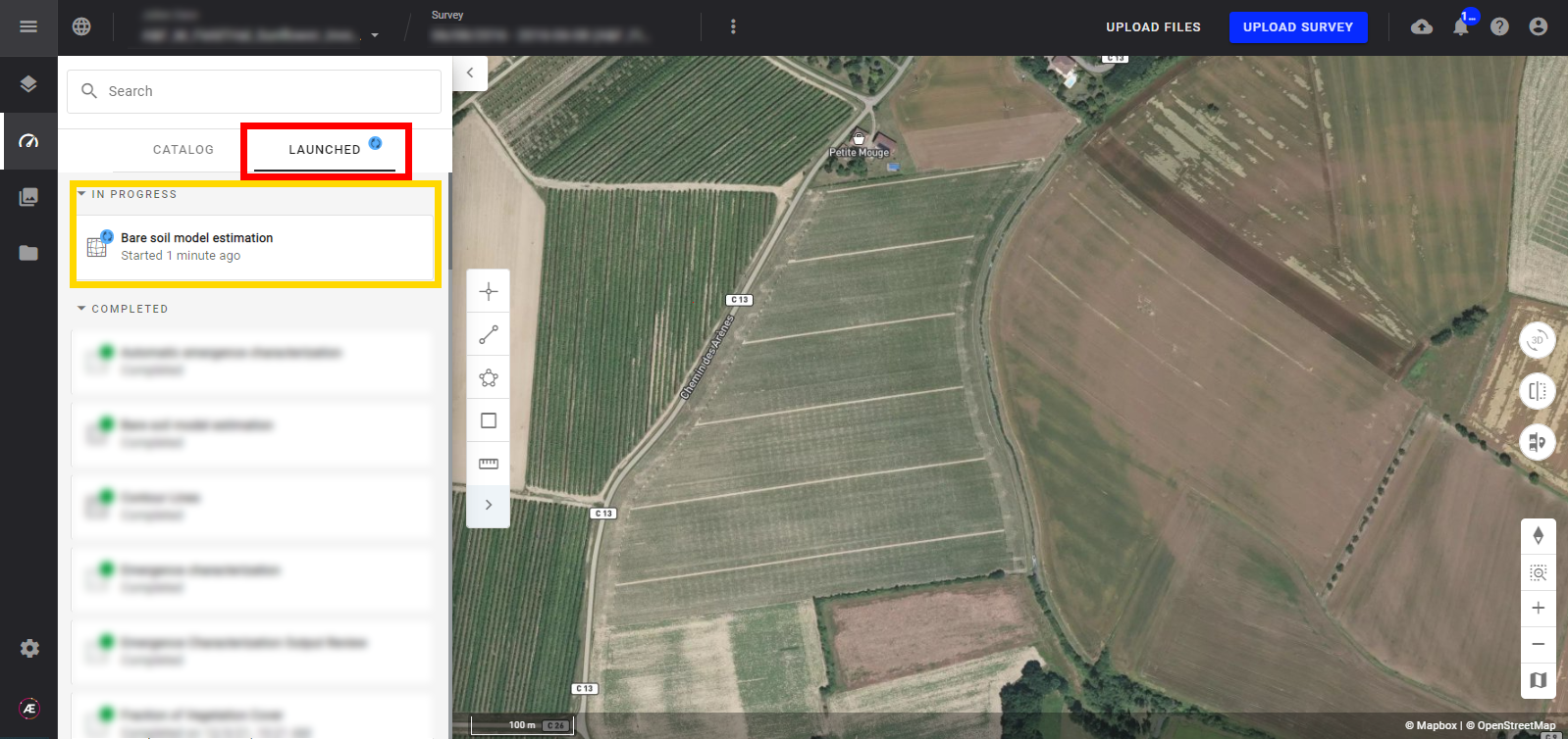
Step 2 - Aether notifies the user that it's done and in the "LAUNCHED" Tab the process is turned in "Completed" status.
4. Results
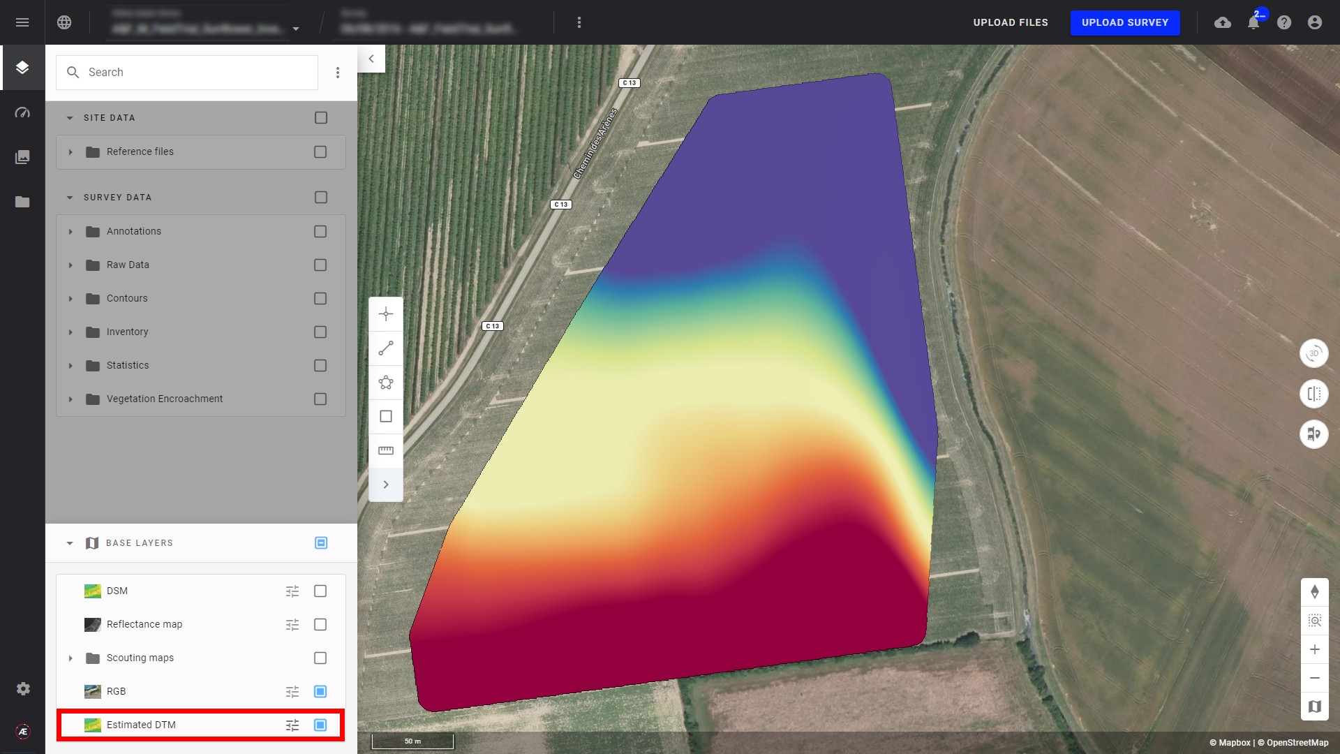
Click on "BASE LAYERS" to see the new available layer "Estimated DTM".
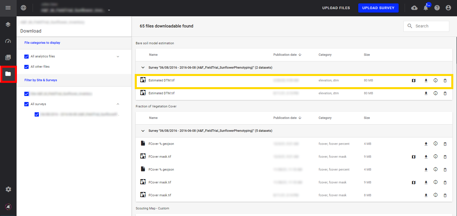
5. Deliverable
In the "Download" section, the Estimated DTM is downloadable as a tif file.