

Fraction of Vegetation Cover
1. Description
Fraction of vegetation cover, or FCOVER, estimates the fraction of ground covered by green vegetation. It quantifies the ratio between biomass (1) and soil (0).
This article will cover the 3 analytics:
- Fraction of vegetation cover from orthomosaic for microplot
- Fraction of vegetation cover from reflectance for microplot
- Fraction of vegetation cover from spectral index
2. Prerequisites
Fraction of Vegetation Cover from orthomosaic for microplot:
- RGB orthomosaic*
- Microplots vector file*
Fraction of Vegetation Cover from reflectance for microplot:
- Raster reflectance map*
- Microplots vector file*
Fraction of Vegetation Cover from spectral index
- Spectral index maps* (NDVI by default, MCARI2, and VARI can also be selected)*
- Microplots vector file* or Field boundaries* for production fields
- Grid Size* for production fields only
*Mandatory
3. Workflow
3.1 Fraction of vegetation cover from orthomosaic for microplot
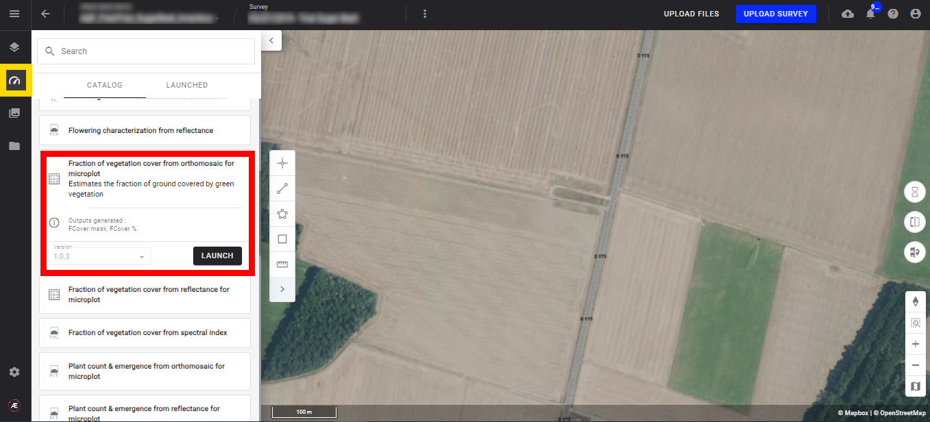
Step 1 - In the "Analytics" tab, search and select "Fraction of vegetation cover from orthomosaic for microplot" and click on "LAUNCH".
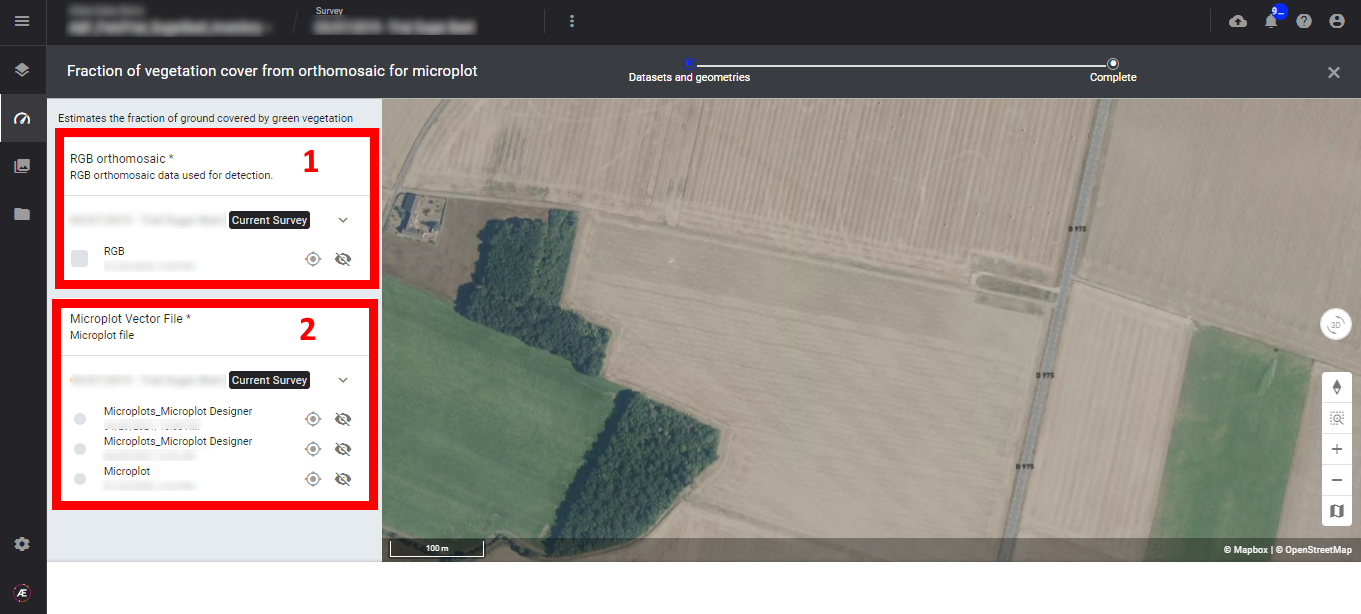
Step 2 - Select the inputs, RGB orthomosaic (1) and the microplot vector file (2).
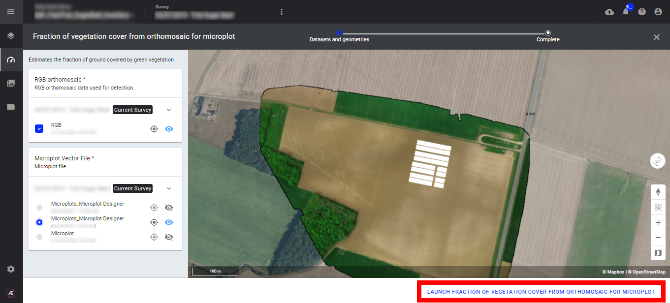
Step 3 - Click on "LAUNCH FRACTION OF VEGETATION COVER FROM ORTHOMOSAIC FOR MICROPLOT".
Step 4 - Click on "FINISH".

3.2 Fraction of vegetation cover from reflectance for microplot
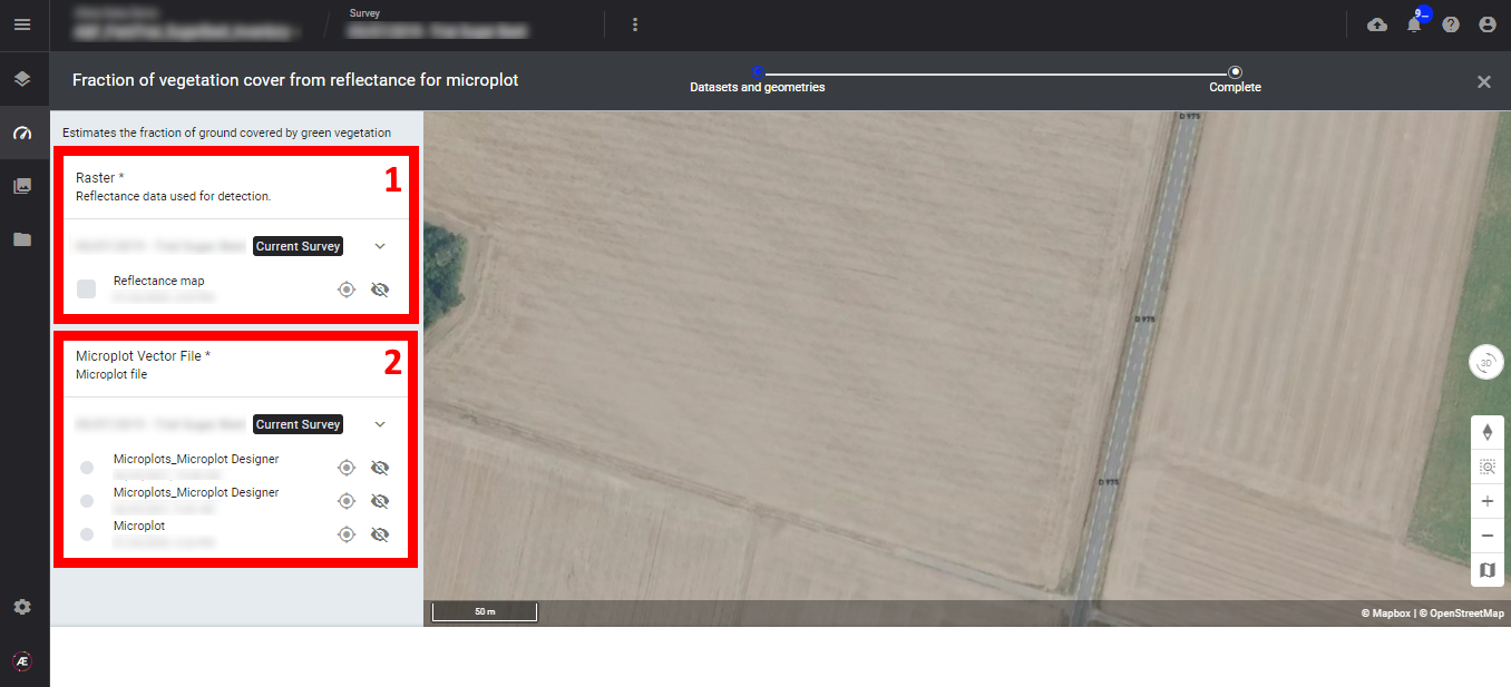
Step 1 - In the "Analytics" tab, search and select "Fraction of vegetation cover from reflectance for microplot" and click on "LAUNCH".
Step 2 - Select the inputs, the Raster (Reflectance map) (1), and the microplot vector file (2).
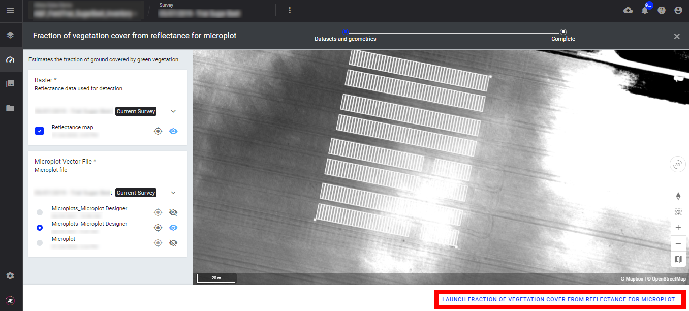
Step 3 - Click on "LAUNCH FRACTION OF VEGETATION COVER FROM REFLECTANCE FOR MICROPLOT".
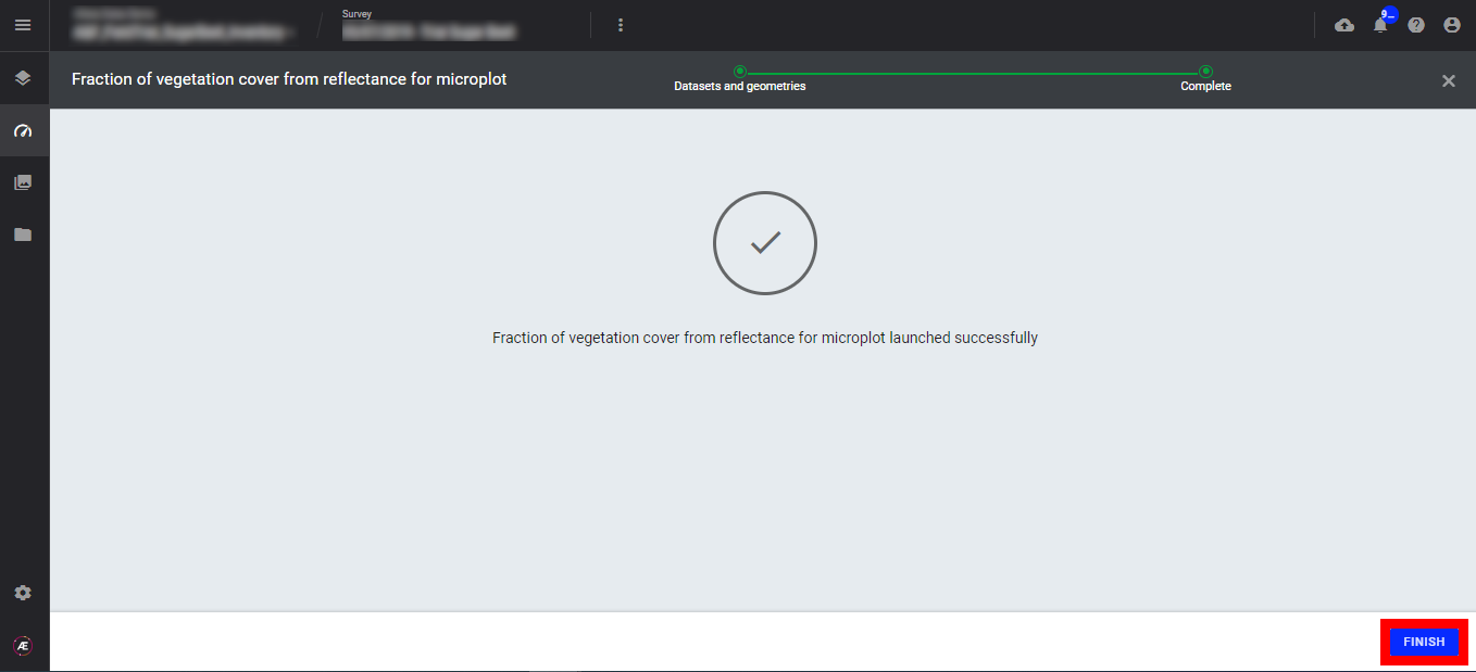
Step 4 - Click on "FINISH".
3.3 Fraction of vegetation cover from spectral index
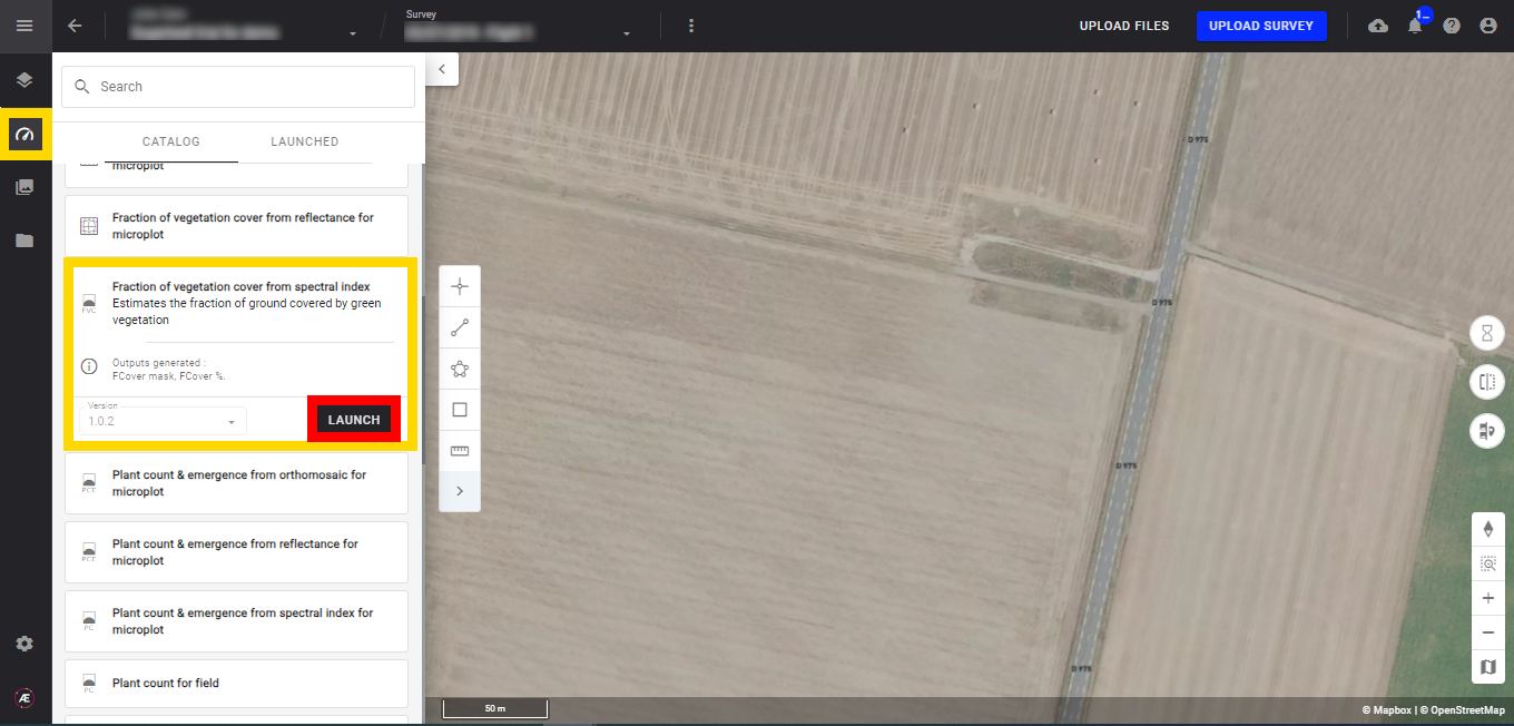
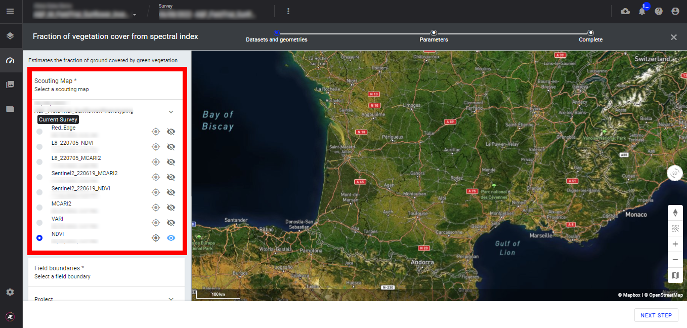
Step 1 - In the "Analytics" tab, search and select "Fraction of vegetation cover from spectral index" and click on "LAUNCH".
Step 2 - Select the "Scouting Map" (spectral index map).
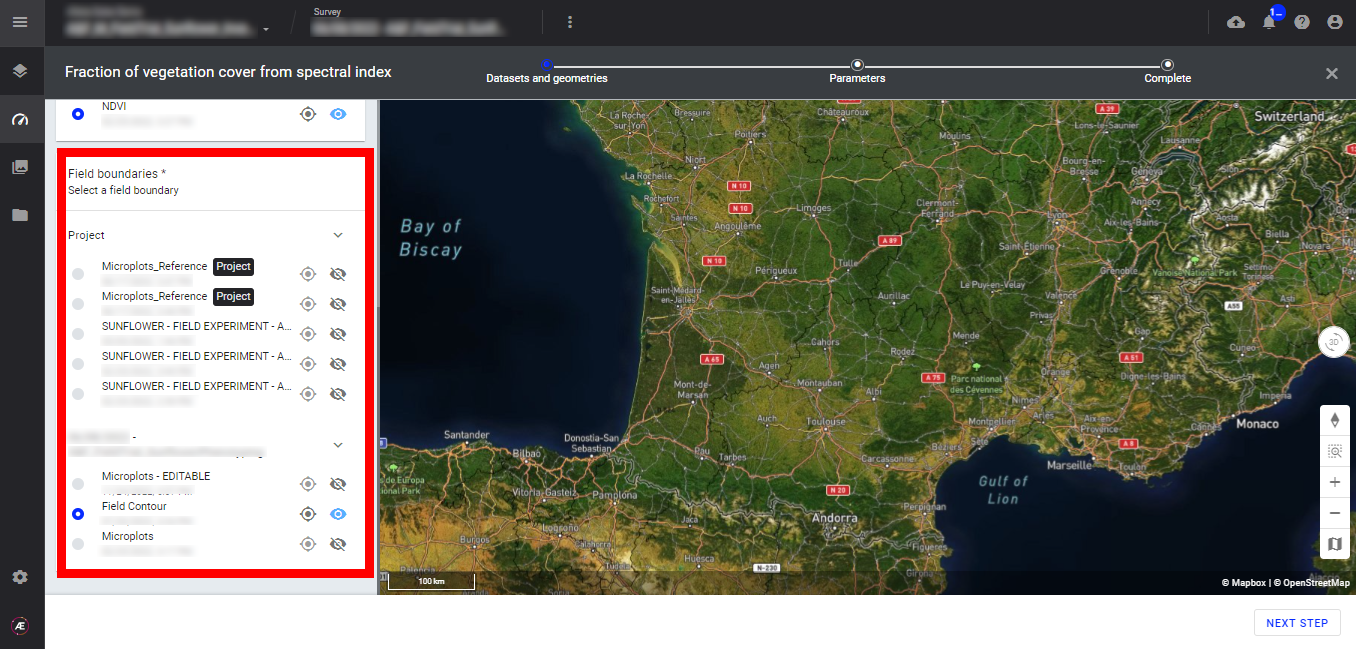
Step 3 - Select the "Field boundaries" (microplots vector or field boundaries vector).
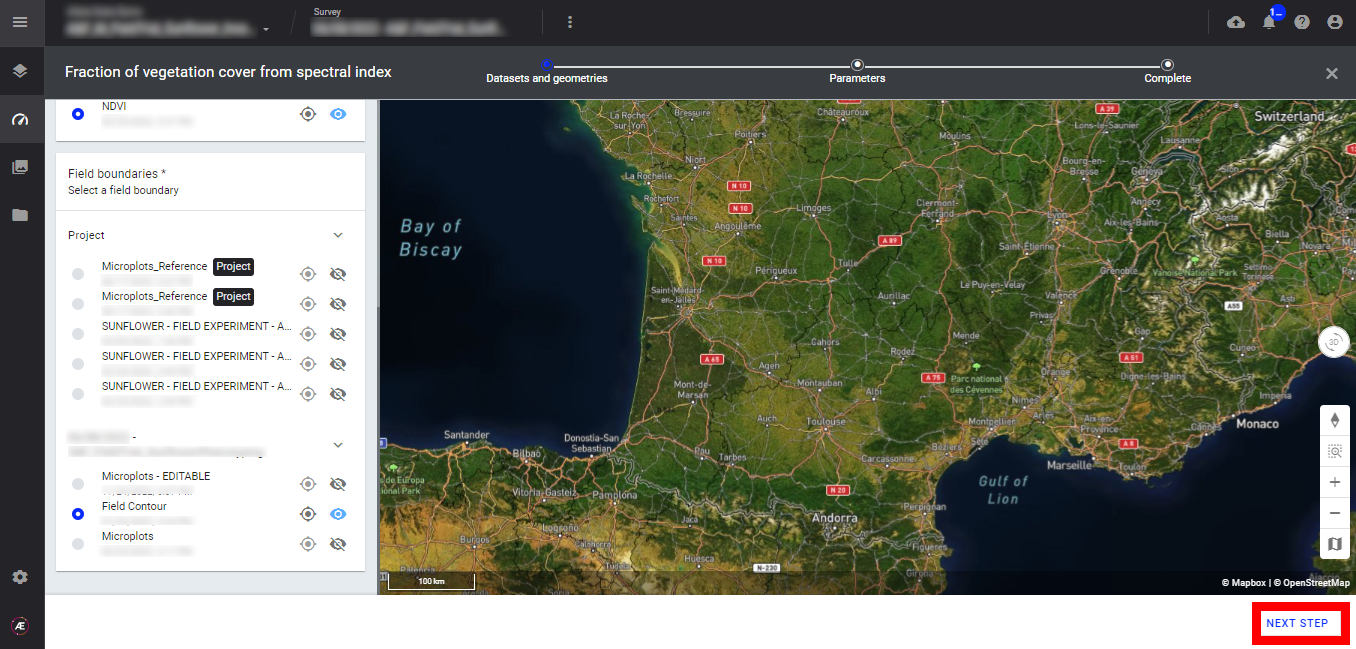
Step 4 - Click on "NEXT STEP".
Step 5 - If field boundaries (for production field) were previously defined, enter the size of the output grid and click on "LAUNCH FRACTION OF VEGETATION COVER".
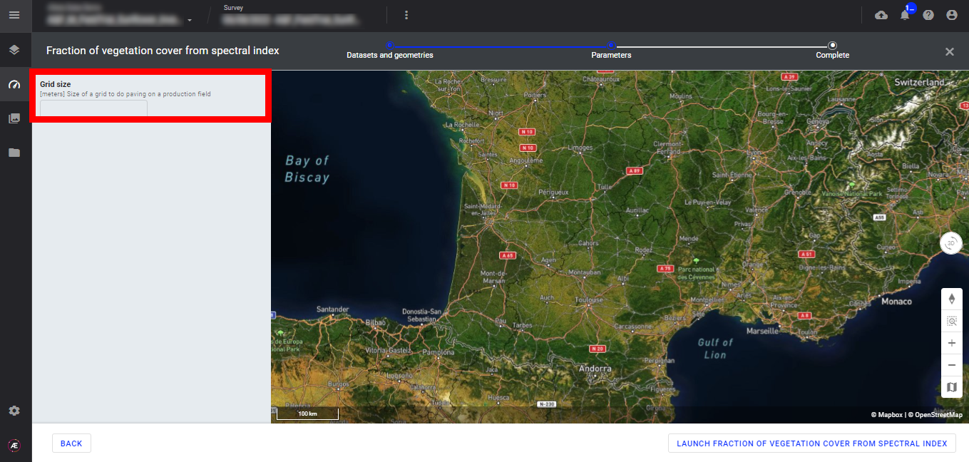
Step 6 - Click on "LAUNCH FRACTION OF VEGETATION COVER FROM SPECTRAL INDEX".
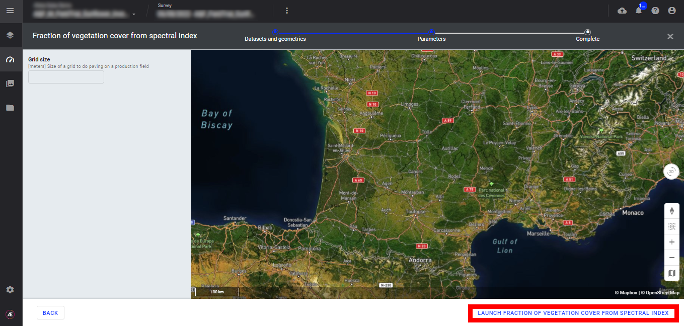
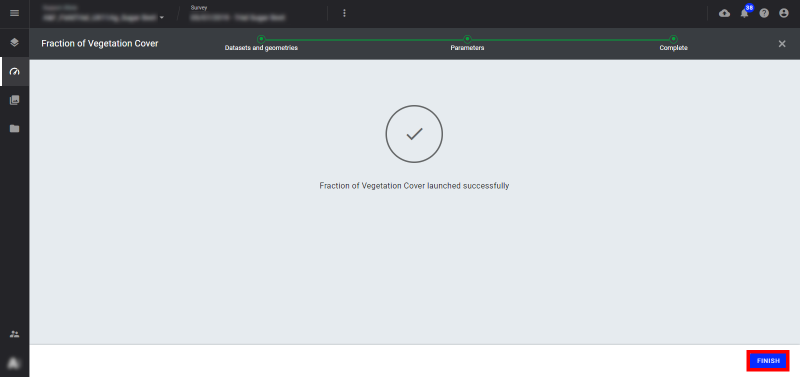
Step 7 - Click on "FINISH".
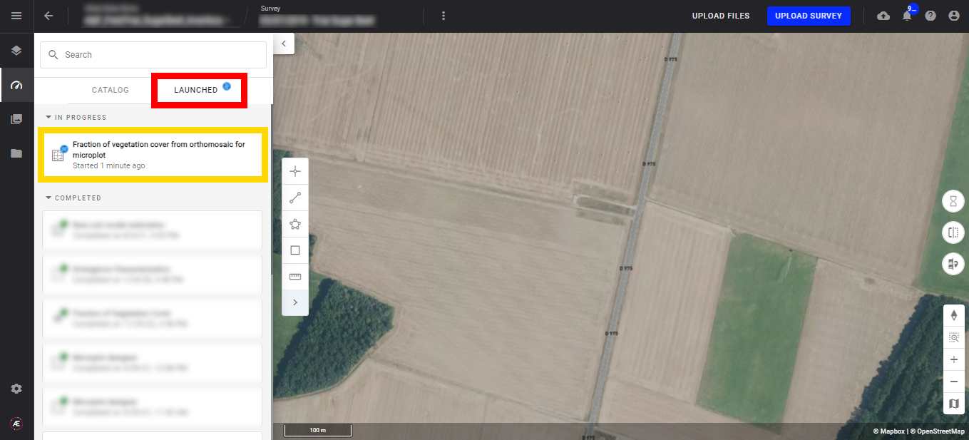
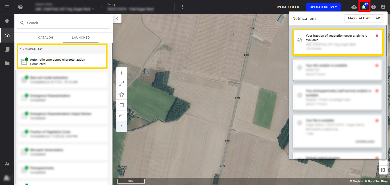
4. Progress & Completion Status
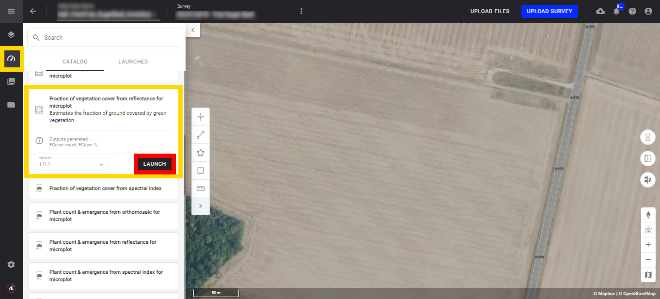
Check the status anytime from the analytic LAUNCHED tab.
A notification is sent to inform of the end of the treatment, see Notification Center.
5. Results
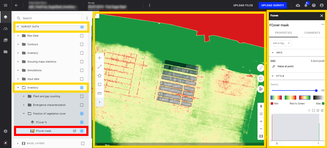
Find the group "Inventory" on "survey data" and open it to find the subgroup "Fraction of vegetation cover".
Find the 2 layers resulting from the analytics inside. Left-click on a layer to open the layer info panel, "FCover %" and "FCover mask".
- Microplot FCover %
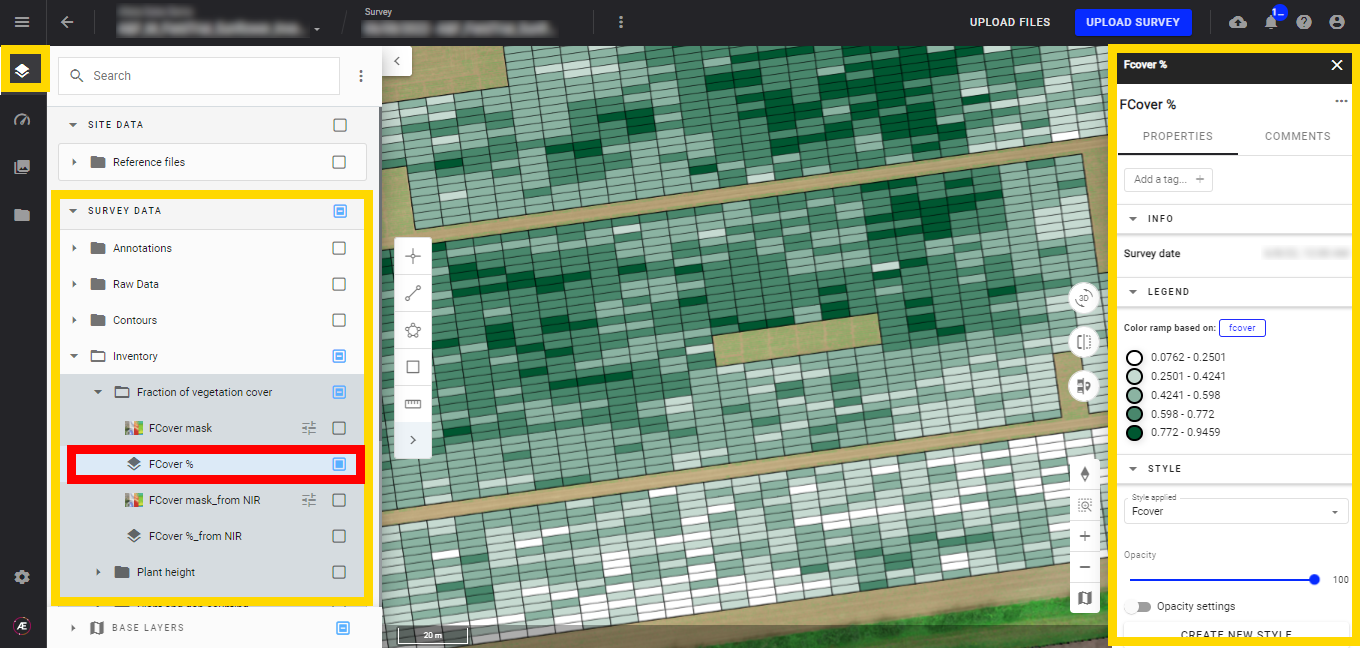
- Field FCover %
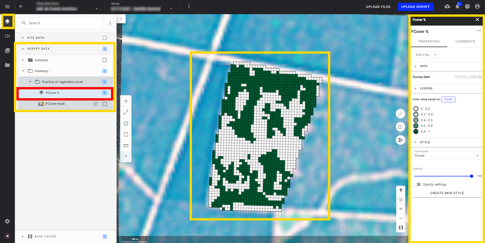
- FCover mask
Biomass mask is under the same layer subgroup; Click any location to view the value for any point on the map, see Measurement Tool.
- Customize the layer styles, see Vector Layers Styling.
6. Deliverables
6.1 Files
In the "Download" section, find files issue from the analytics.
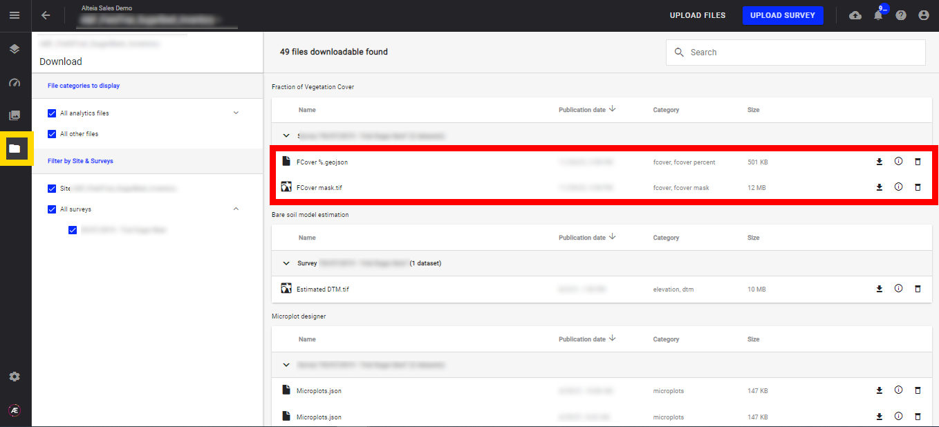
- FCover%.geojson
- FCover mask.tif
6.2 Geojson output attributes
FCover% Geojson output for microplot:
- Attributes from the input vector file (md_trial_id, md_plot_plot_id,… if the vector is from Aether)
- fcover: Fraction of vegetation cover per microplot
- vegetation_surface: the surface of vegetation per plot (m²)
FCover % Geojson output for production field:
- id: Id of the grid cell
- id_x: column number
- id_y: row number
- fcover: Fraction of vegetation cover per microplot
- vegetation_surface: the surface of vegetation per plot (m²)
