Haul Road Analysis
1. Description
Haul road analysis automates the assessment of conditions on tracks in a quarry or mining site, thereby enhancing machine efficiency, productivity, and safety. It utilizes geospatial data from image surveys to associate various attributes with the tracks, such as their outlines, width, or slope.
2. Inputs
To launch the Haul Road Analysis, the survey needs to have one orthomosaic, one DSM (or DTM) and an Area Of Interest (optional) if you want to compute it on one or several part of your site..
3. Workflow
Step 2 - Click on "LAUNCH".

Step 3 - Select the inputs (area of interest, orthomosaic and DSM or DTM).
Step 4 - Click on "LAUNCH HAUL ROAD ANALYSIS"

4. Results
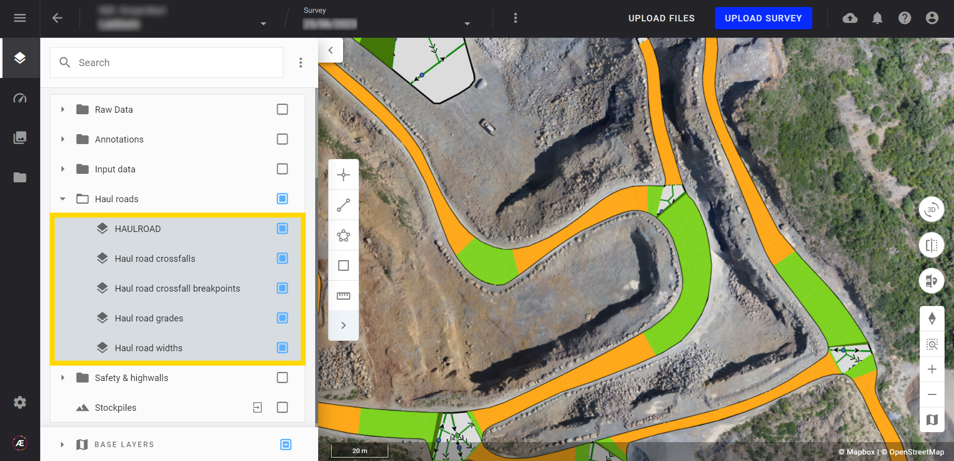
The Haul Road Analysis generates:
- Haul road boundaries (called "HAULROAD")
- Haul road crossfalls
- Haul road crossfall breakpoints
- Haul road grades
- Haul road widths
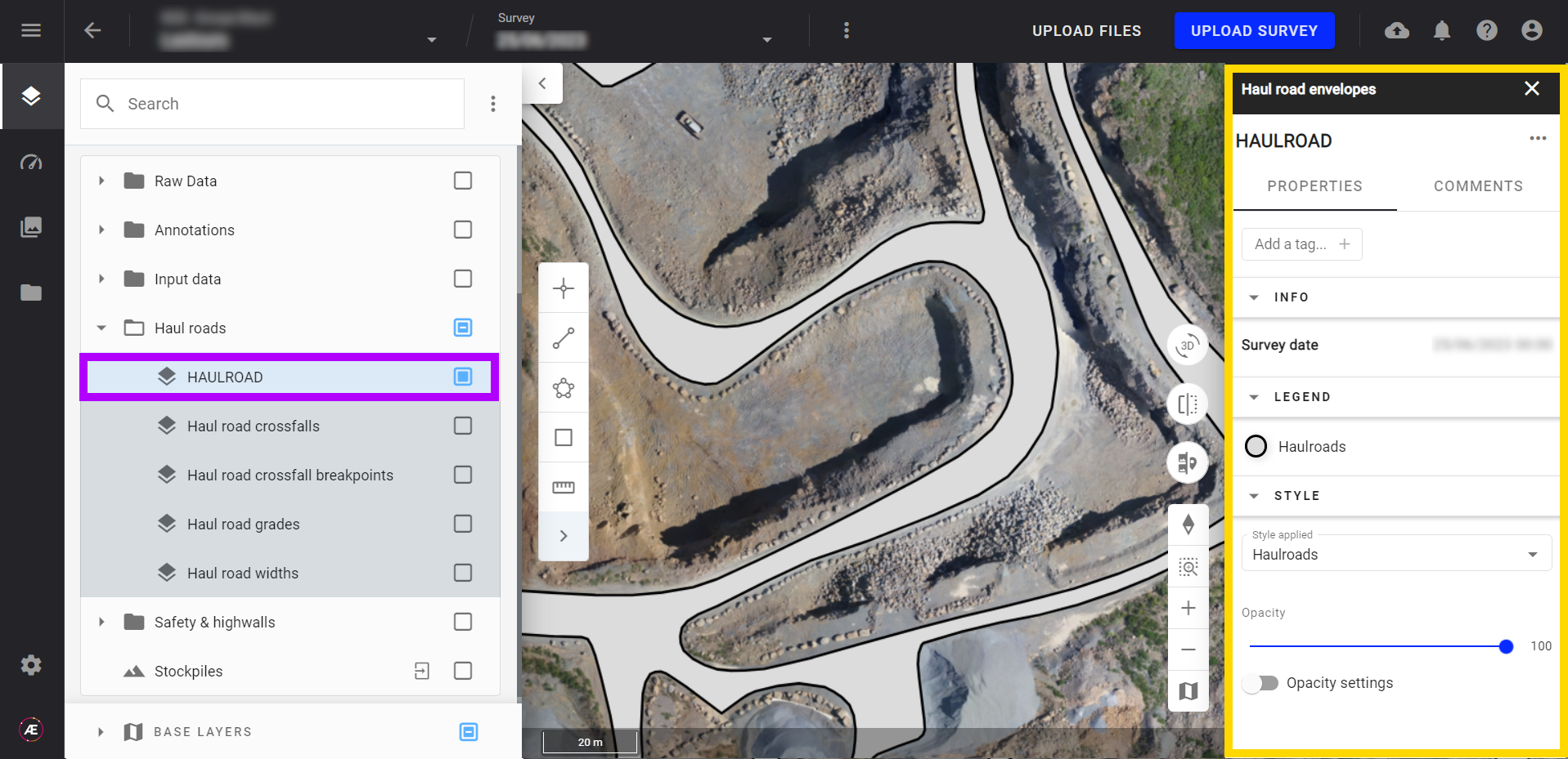
4.1 Haul road boundaries
The Haul road boundaries or envelopes represent a contiguous surface of the detected road.
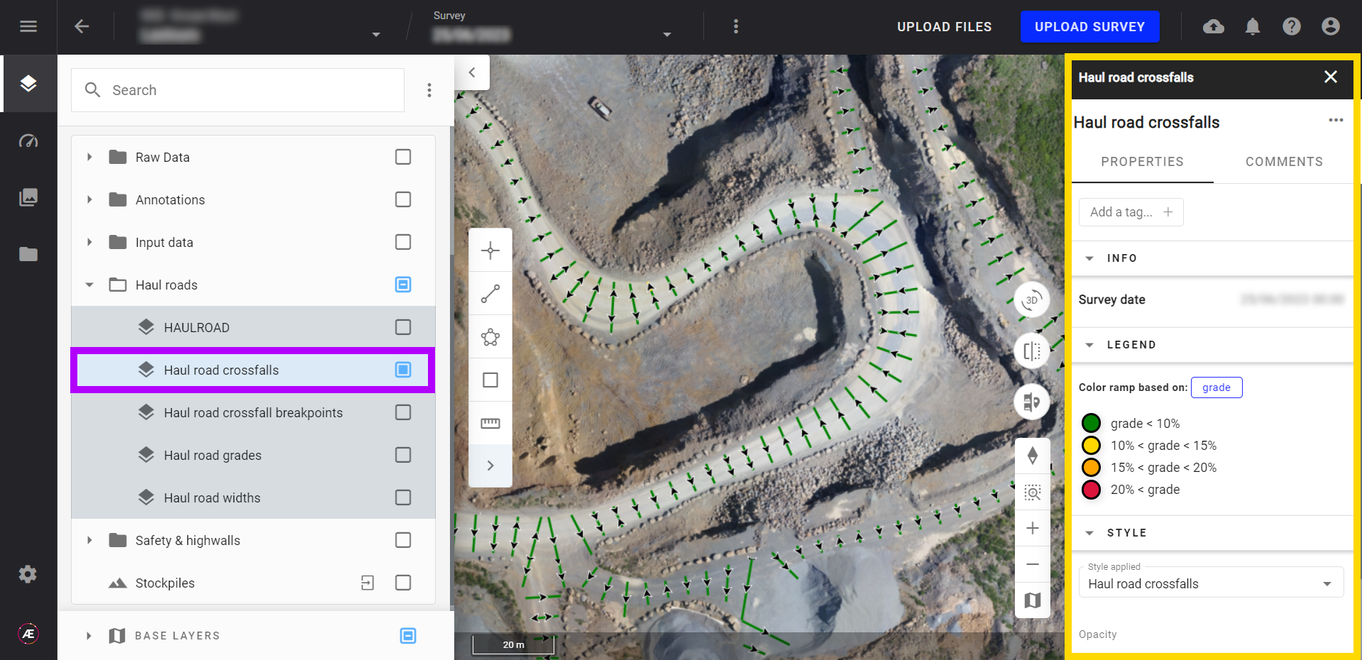
4.2 Haul road crossfalls
Crossfalls are displayed with colored bars across the haul roads. The color and the inclination of the arrows represent the slope. Clicking one of these bars enables the user to read and understand the width, grade, breakpoint, and change in elevation of the selected cross fall in the information panel.
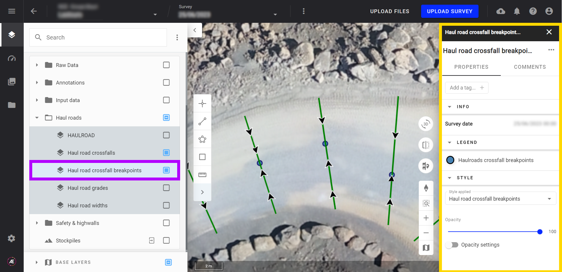
4.3 Haul road crossfall breakpoints
Position of the breakpoint for each crossfall segment. This feature can be used to manage water flow.
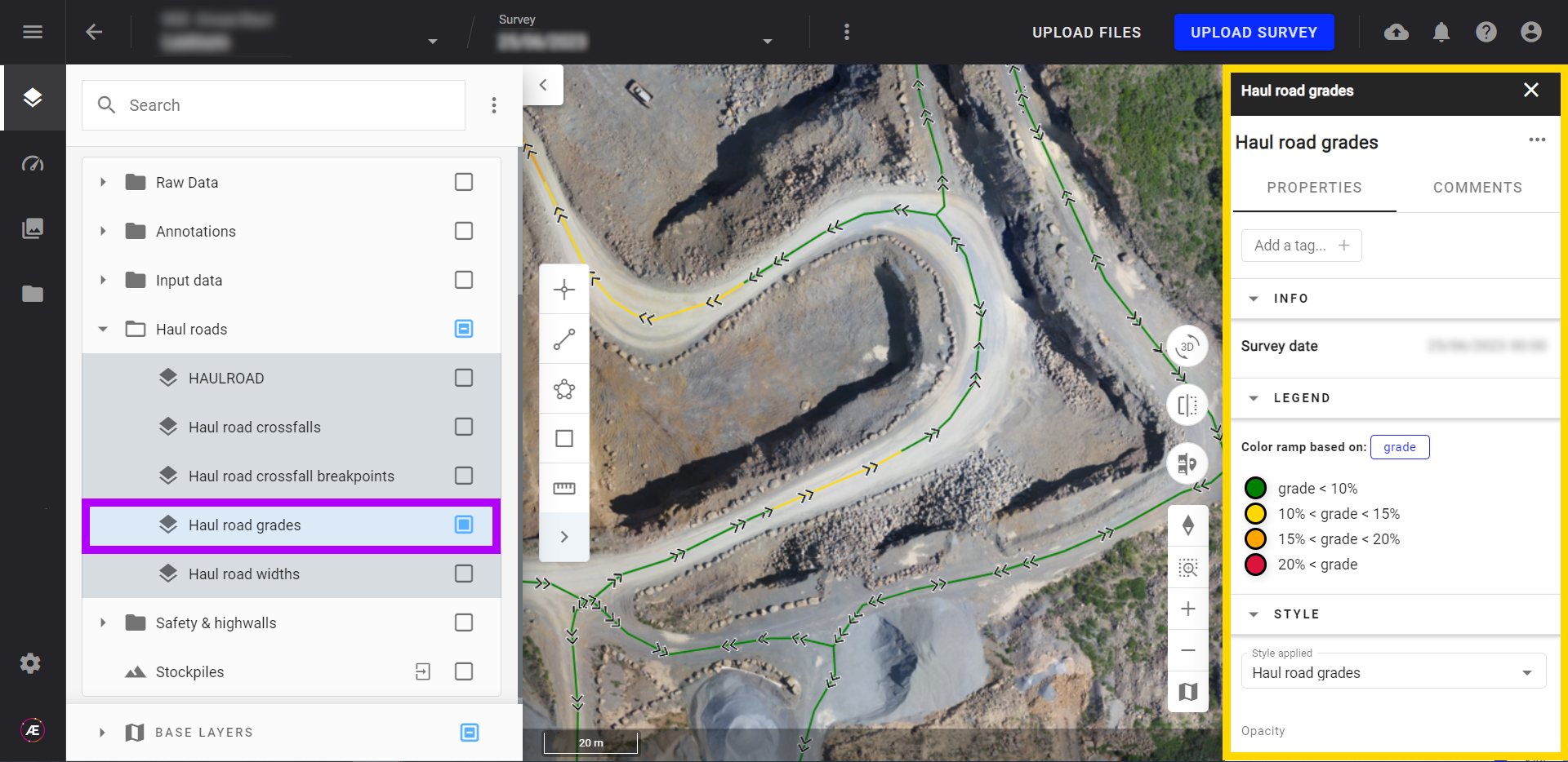
4.4 Haul road grades
The grade of the haul roads can be displayed in a color scale based on slope percentage. The legend can be modified based on the user's safety standards.
See article: Project Settings for Mines & Aggregates.
 4.5 Haul road widths
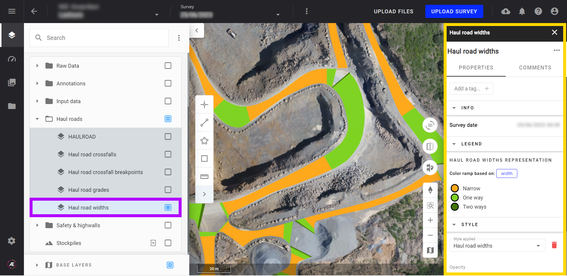
Represents track width according to user-defined settings. Legends can be modified by creating new styles.
See article: Project Settings for Mines & Aggregates.
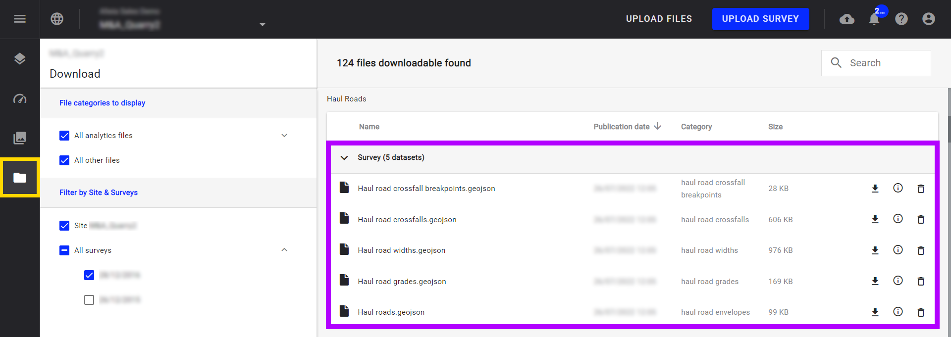
5. Deliverables
All these outputs can be downloaded in geojson format by clicking on the downloads folder.