Elevation Model to Point Vector
1. Description
The Elevation model to point vector analytics transforms an elevation model file that has been uploaded to Aether into a point vector file. You will then be able to explore it as a dxf, for example, to use it in CAD software.
2. Inputs
| Required | Definition |
| Elevation model | Select the Elevation model to convert |
3. Launching analytics "Elevation model to point vector"
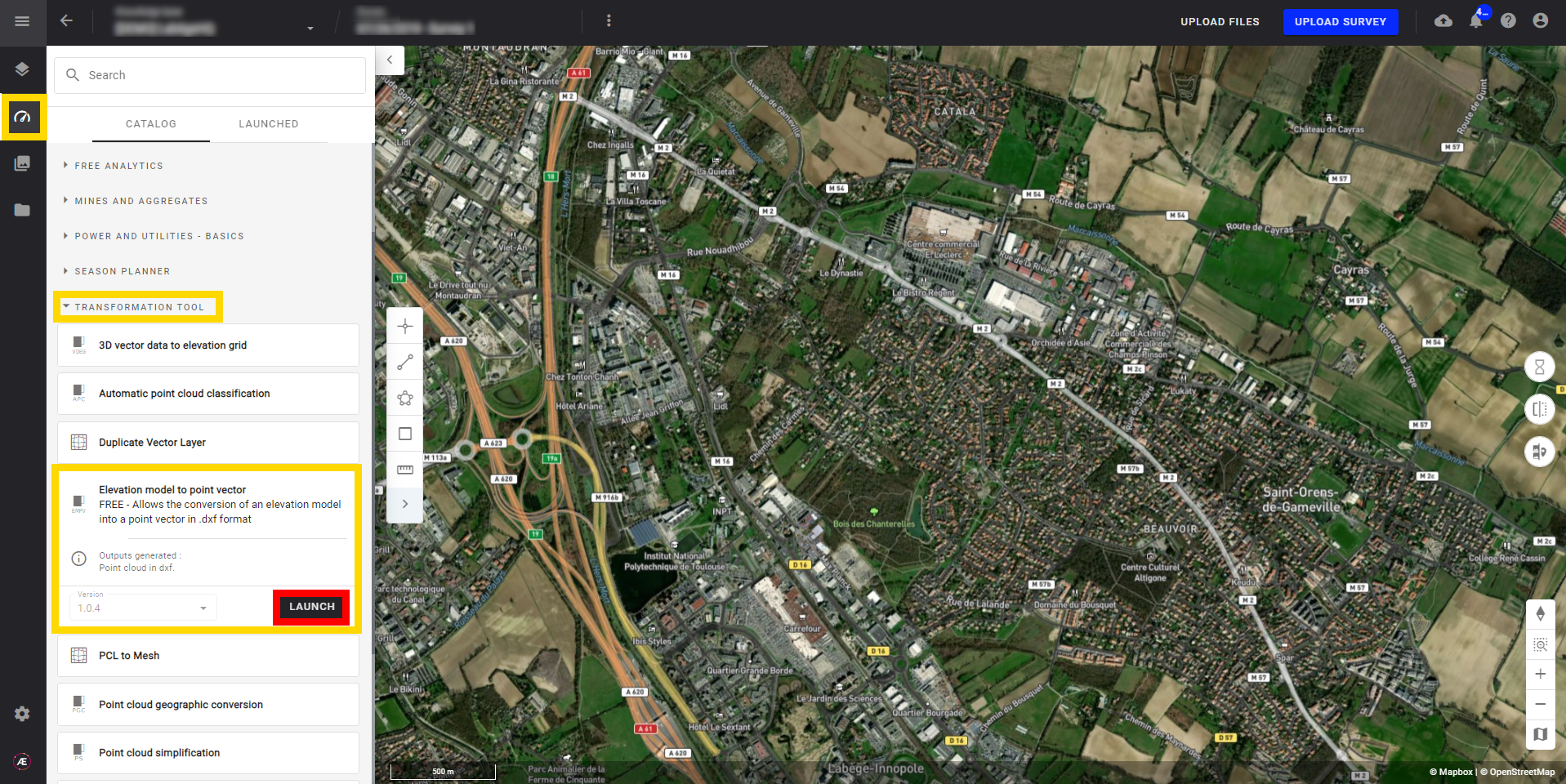
Step 1 - Find the "Elevation Model to Point Vector" analytics in the left menu in the analytic section. It can be found in the search bar or under the "TRANSFORMATION TOOL" section and click on "LAUNCH".
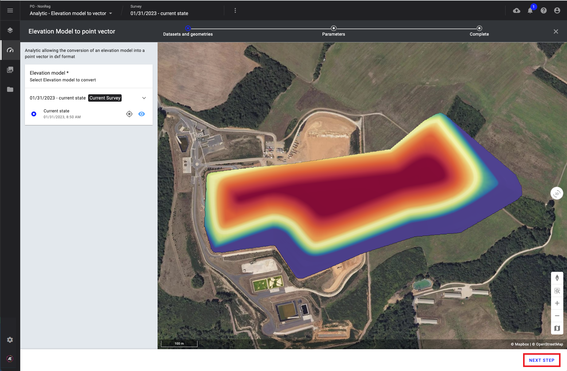
Step 2 - Select the elevation model and click on "NEXT STEP".
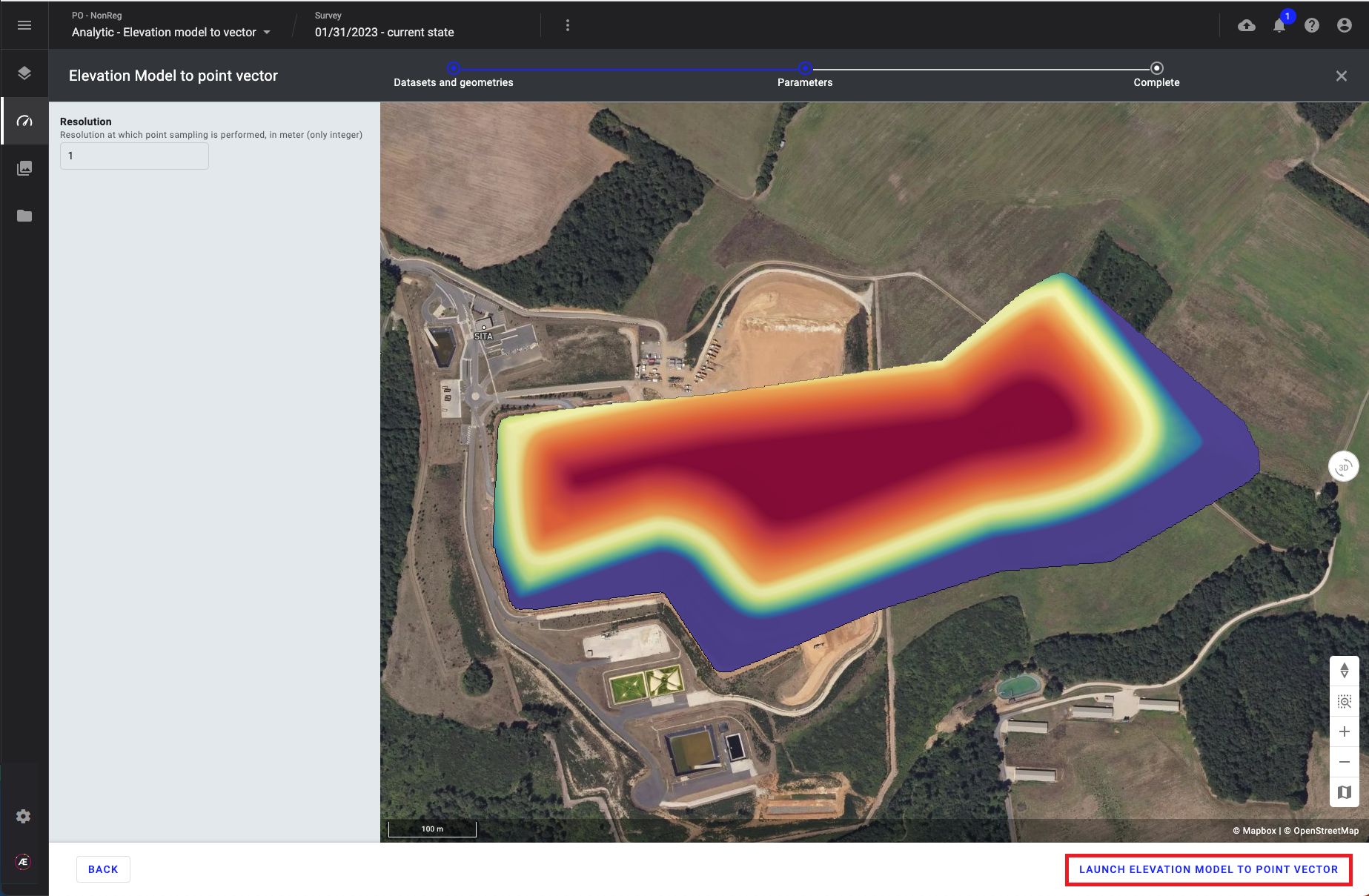
Step 3 - If necessary fill in the optional parameter and click on "LAUNCH ELEVATION MODEL TO POINT VECTOR":
- Resolution (optional): Resolution at which point sampling is performed, in meters (only integer) - Default value 1 meter.
4. Result
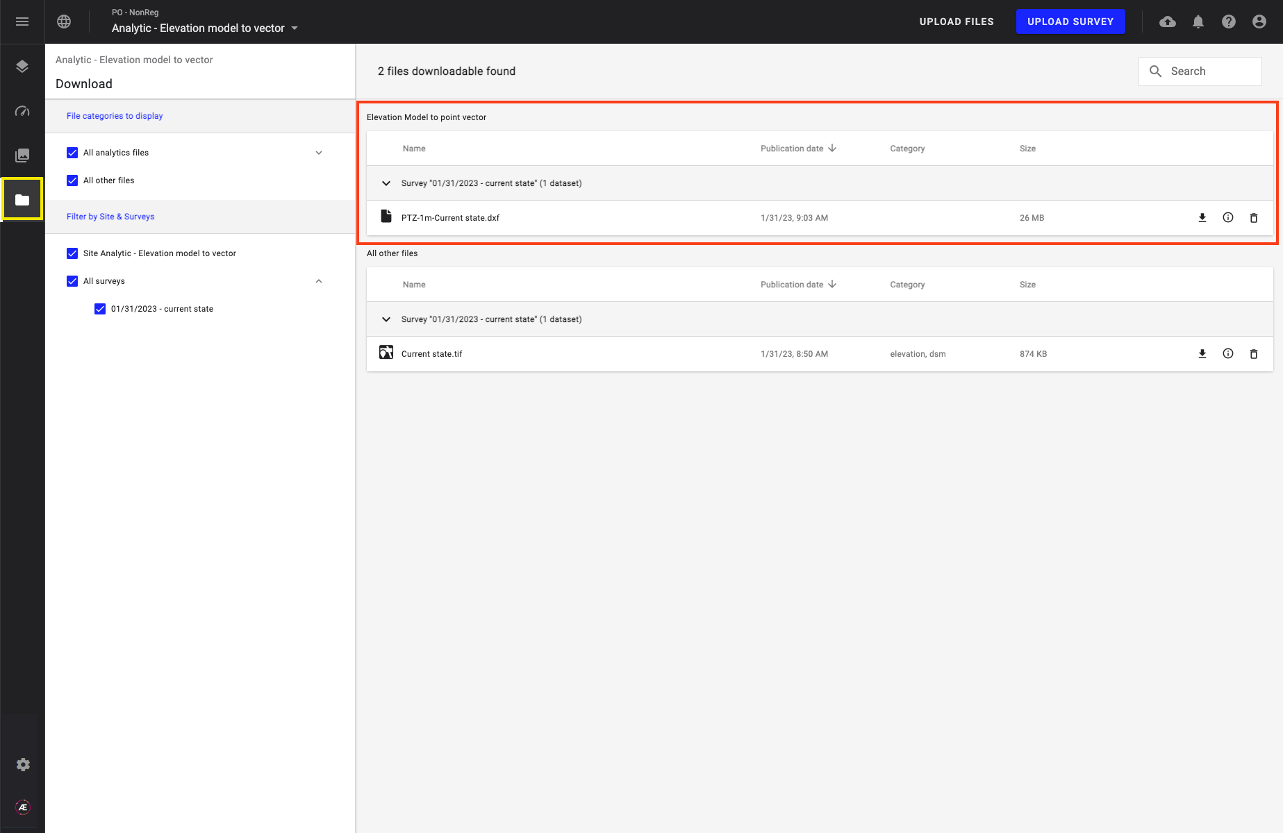
- The point vector file (dxf format) will be available in the Download menu.
- The point vector file is generated according to the elevation model CRS.