

3D Local Frame
Discover how to define a 3D local frame, to facilitate 3D asset inspection
1. Context
Some assets have specific frame of reference (ex: ship local frame). For 3D inspection, it may be simpler for users to use this local frame instead of geographic coordinates.

This article explains how to define and use a 3D local frame on the Aether platform.
Limitations
- There is no automatic control to check that the defined local frame is orthonormal. Please be precise in the local frame definition.
- The 3D local frame can be used in 3D only, it can't be used in the 2D viewer.
- It's not possible to define both Local CRS and 3D local frame.
- Only one local frame can be defined on a project. To update the local frame, the previous one shall be deleted before creating the new one.
- The 3D local frame axis can't be visualized once defined.
2. Definition of the 3D local frame
Note
Definition of 3D local frame is only available for users with “manager” core role. Other users can use the local frame for measures and export as soon as it's defined.
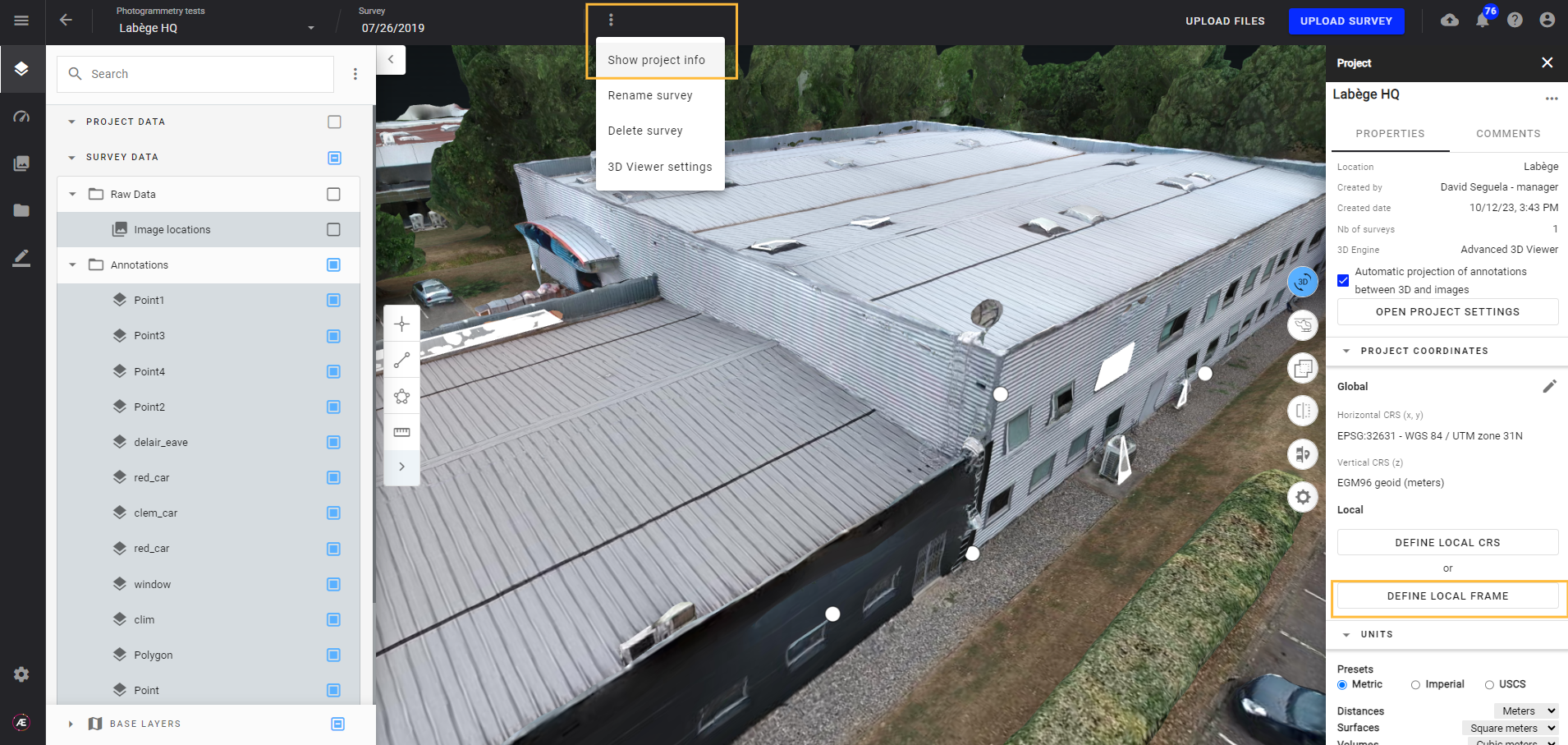
To define a 3D local frame on a project, open the project in Data Studio and switch to 3D viewer.
Open the project settings, and click on “DEFINE LOCAL FRAME”.
It opens the following interface. Tag 4 reference points and fill in their coordinates in the 3D local frame.
The user can also give a name to the local frame.
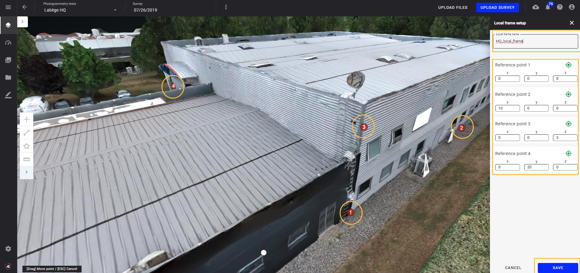
Click on “SAVE” once ready.

The local frame is now defined and visible in the “PROJECT COORDINATES” section of the Project Info layer. The checkbox “Use local frame” is automatically activated.
3. Use local frame
3.1. Measures and coordinates
When the checkbox “Use local frame” is activated, measures and coordinates are displayed in local frame.
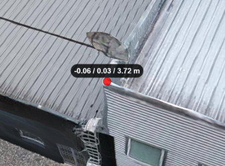

Point annotation coordinates are also displayed in local frame, in the annotation layer panel and in the annotation explorer.

3.2. Export
The local frame can also be used to export a point cloud in local frame coordinates instead of geographic coordinates. To do so, open the layer panel of the point cloud you want to export, click on the  button and select the “export” menu.
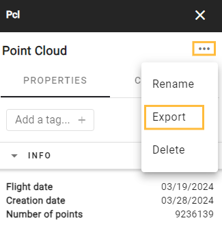
It opens the following pop-up.
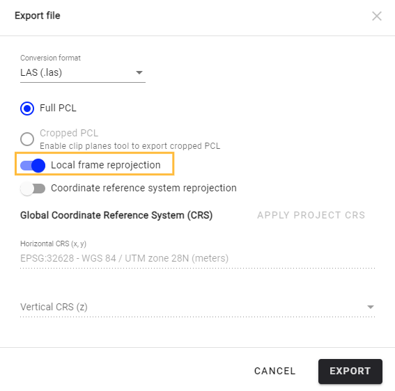
Activate the “Local frame reprojection” option and click on export to export PCL in 3D local frame. The export is available for download a few minutes later in the “Download” section of Data Studio.
