Infield Mobile App - Introduction
1. Description
Infield is an Aether mobile application that enables users to enrich their in-field experience such as field annotations for ground truthing.
This article will describe the possibilities offered by Infield.
Infield is available for Android on Play Store and for IOS on App Store.
An Aether account is necessary to log in to the application.
- Visualize generated outputs directly on your smartphone
- Explore on site data by overlaying your position over the maps using your smartphone’s georeferencing
- Create georeferenced annotations and upload them directly on Infield or to the Aether platform
- Enhance your models by modifying predictions via ground truthing
2. Overview of Infield
2.1 Visualize
With mobile apparel, visualize generated Aether outputs.
2.2 Explore
On-site data explore by overlaying in real time the position over the map using mobile device's georeferencing.
2.3 Create
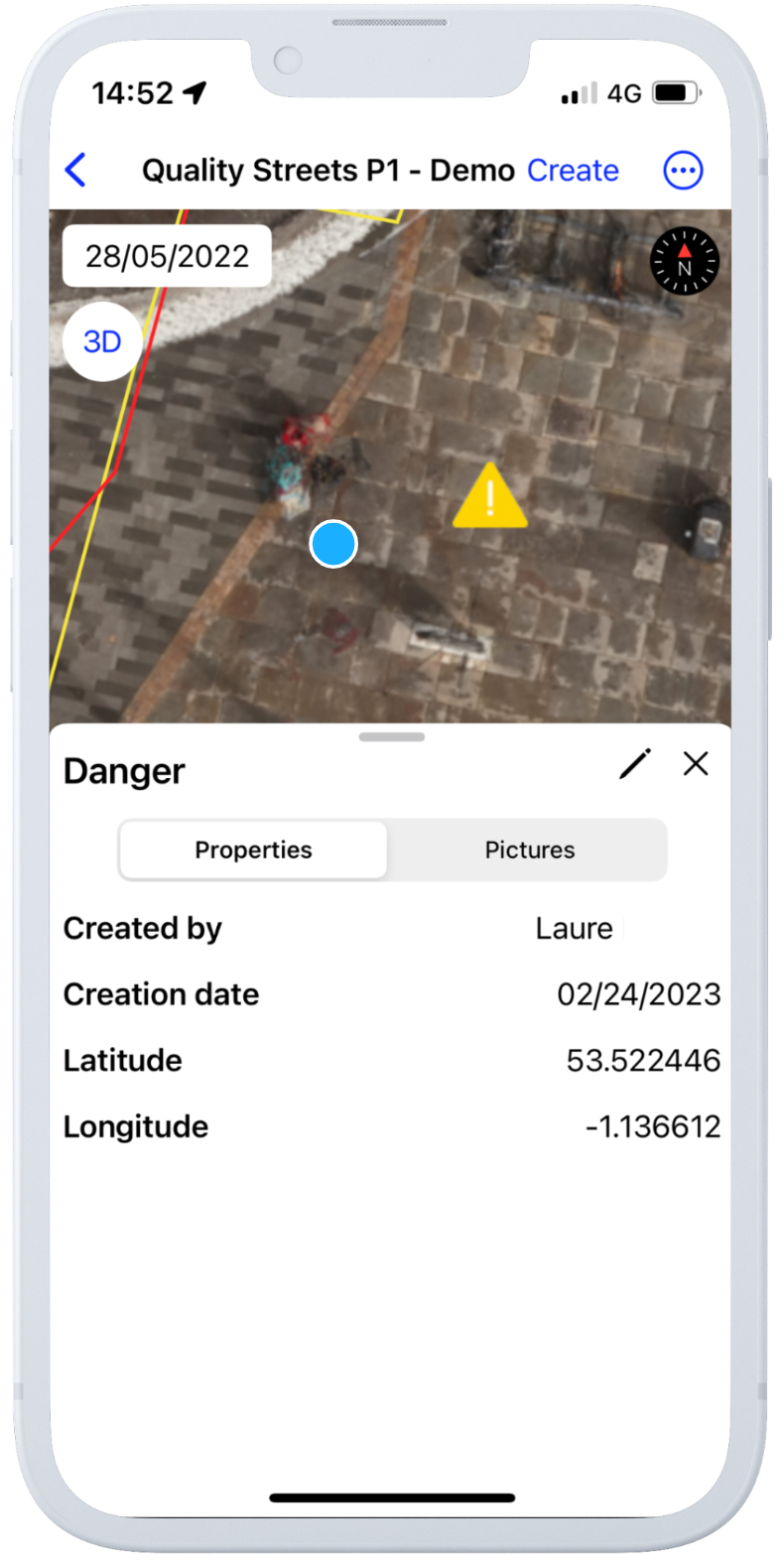
Create georeferenced annotations and add in-field information like pictures and descriptions.
With IOS and smartphone equipped with LiDAR create a close environment in 3D.
2.4 Enhance
Enhance models by modifying predictions via ground truthing.
2.5 Share
All site updates like georeferenced annotations via Infield are uploaded instantly on Aether and the same for Aether updates with an open site in Infield.
For more details on how to use Infield, check out this article: Infield Mobile App
3. Examples of use cases
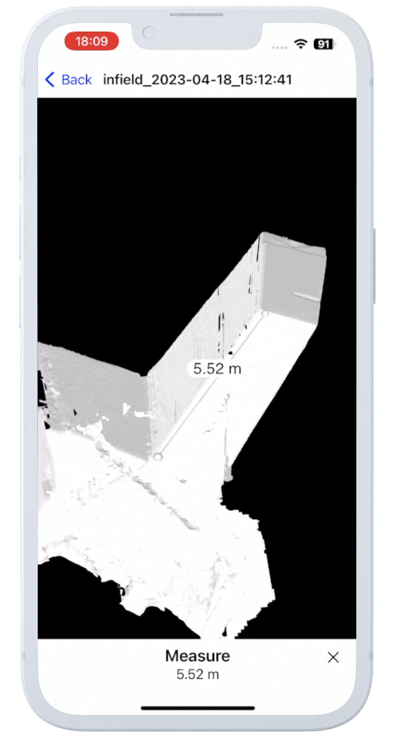
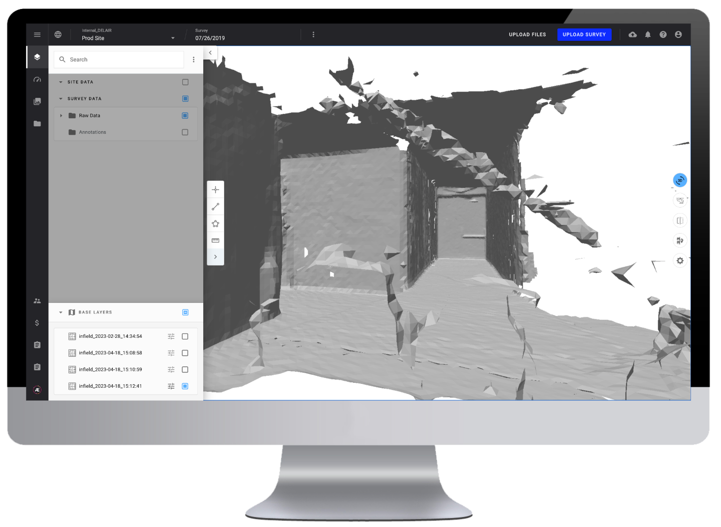
3.1 Use Infield to map your close environment in 3D (available only on IOS)
- Create a 3D model from your smartphone with a device equipped with a LiDAR scanner, and use the 3D button and the scan menu within an existing project.
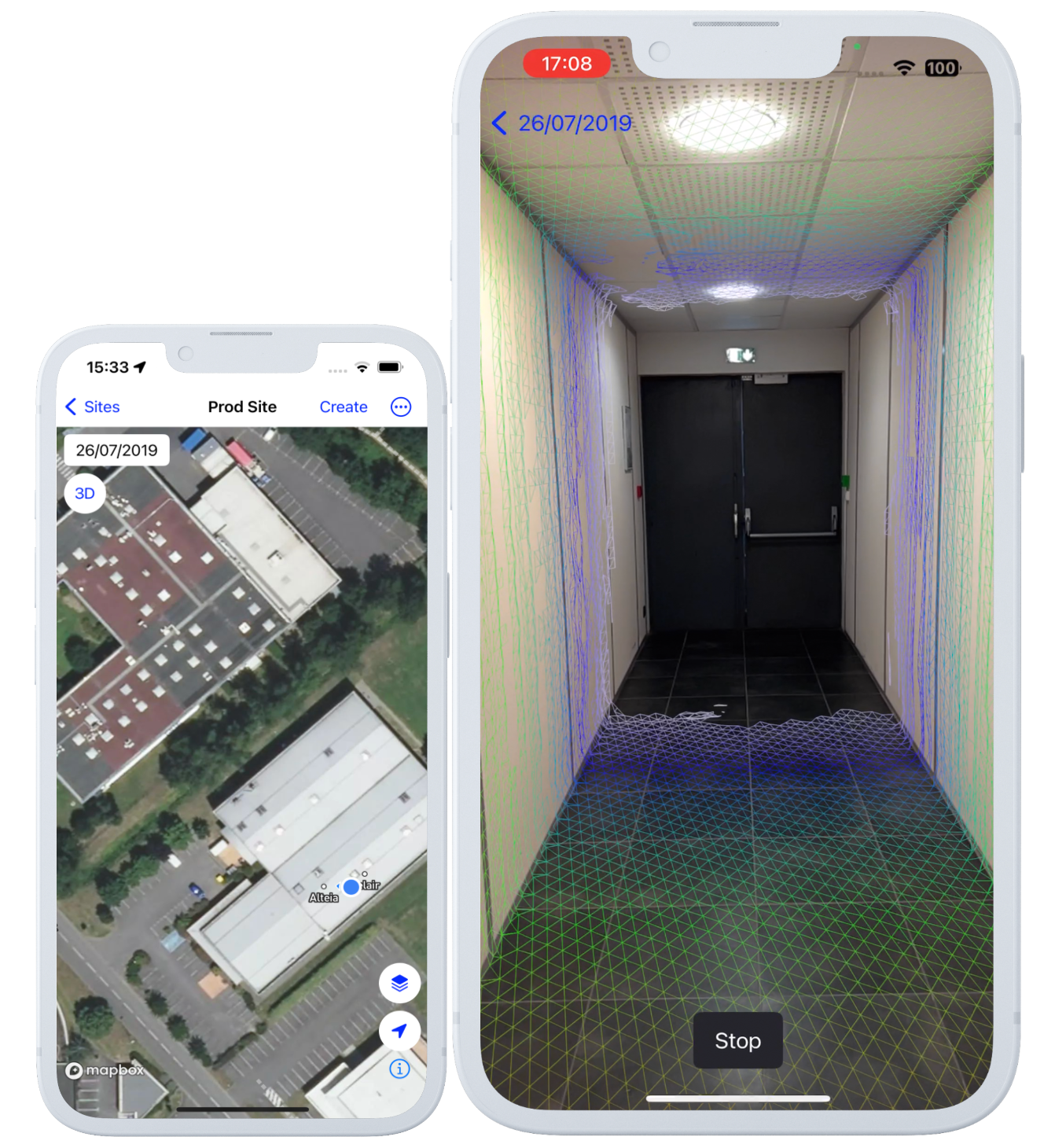
- Upload your 3D model - Process and import your 3D model to the Infield app
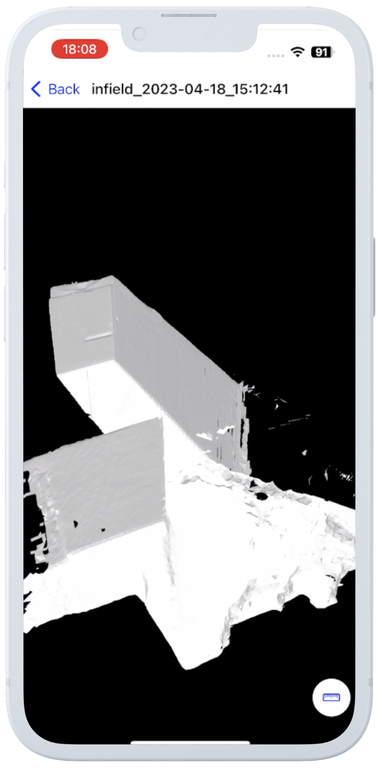
- Navigate through your 3D model - Visualize your model, change the view orientation, and make 3D measurements
- Push to the cloud - Automatically push your 3D model to the Aether platform or your Alteia application for advanced analysis
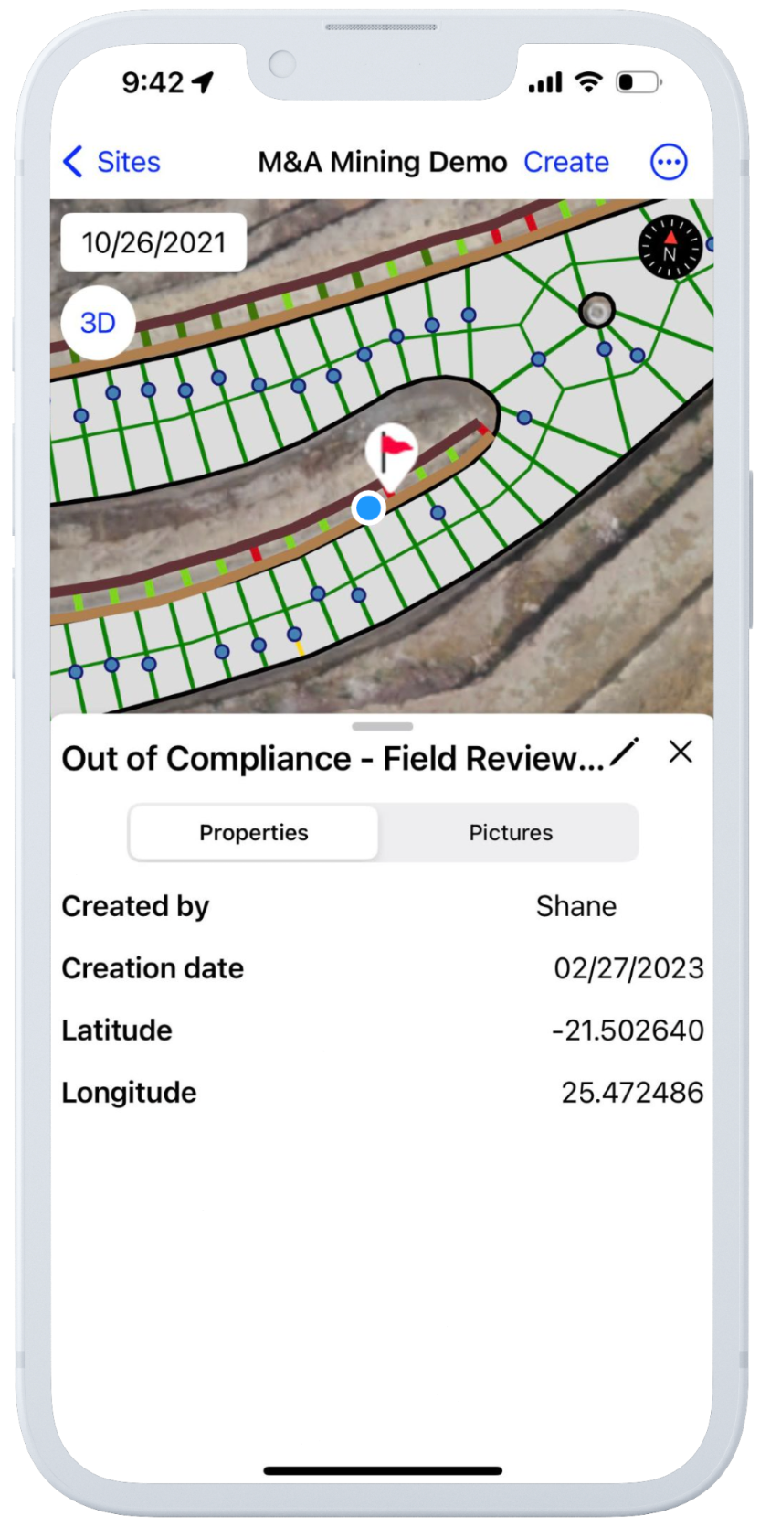
3.2 Infield module for mining safety analysis
- Safety analysis must be performed from the Aether platform or mining productivity application
- System returns analysis showing 5 safety blocks are out of compliance based on user parameters
- The user physically goes to the mine/quarry and opens the Alteia Infield app System displays the user’s current position on the project site
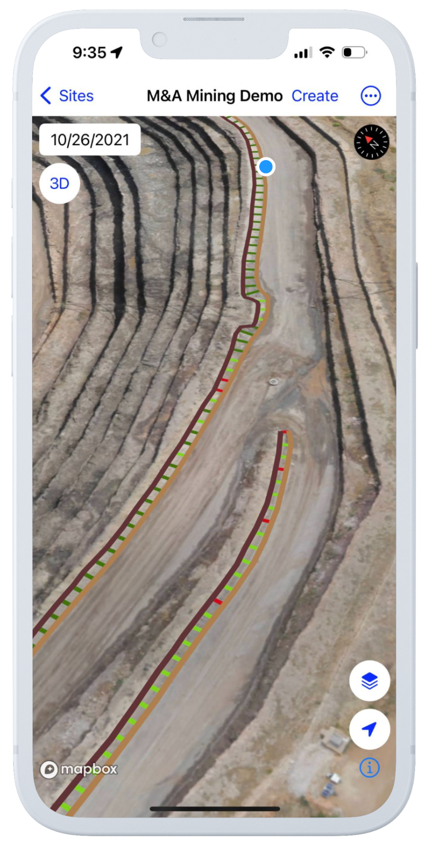
- The user starts walking by the safety blocks along the analyzed haul road
- The user locates the target safety block using the device's GPS
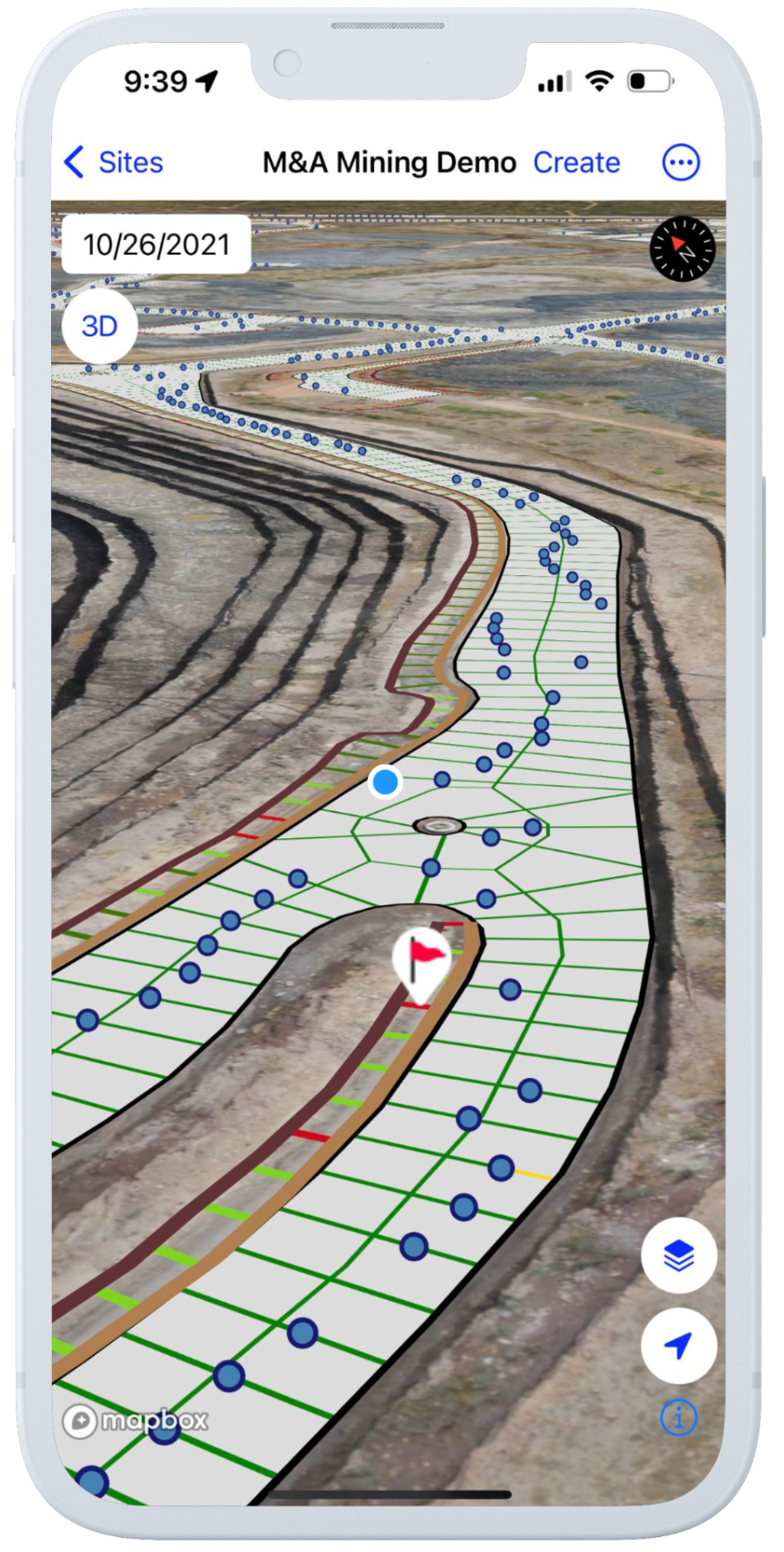
- The user physically measures the safety block and confirms that it fails to meet the site specification
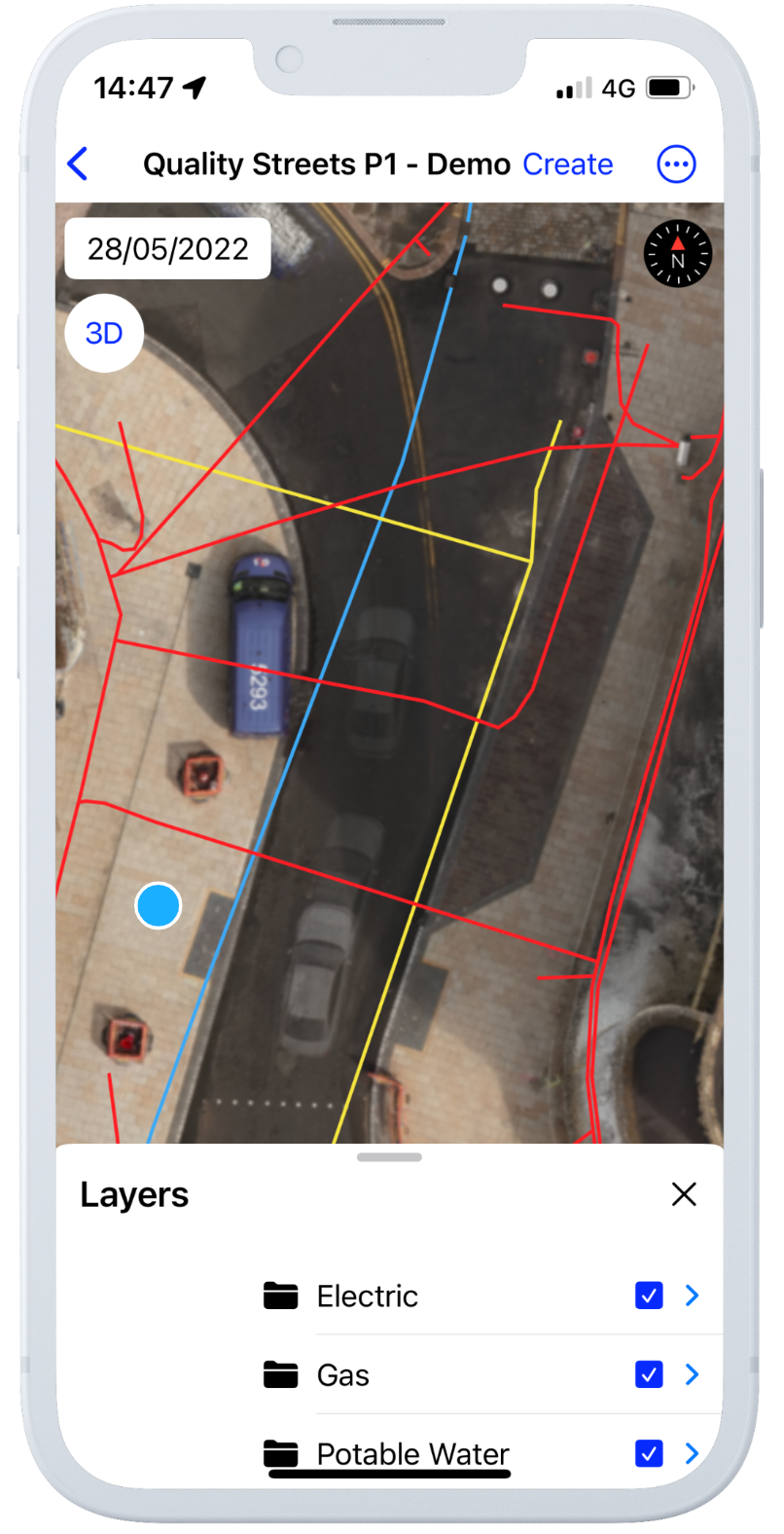
3.3 Infield module for underground gas pipeline earthwork monitoring
- The system stores and manages design files or existing underground infrastructure
- The user physically enters the site and opens the Alteia Infield app
- User selects the design file of a specific underground gas line to be built
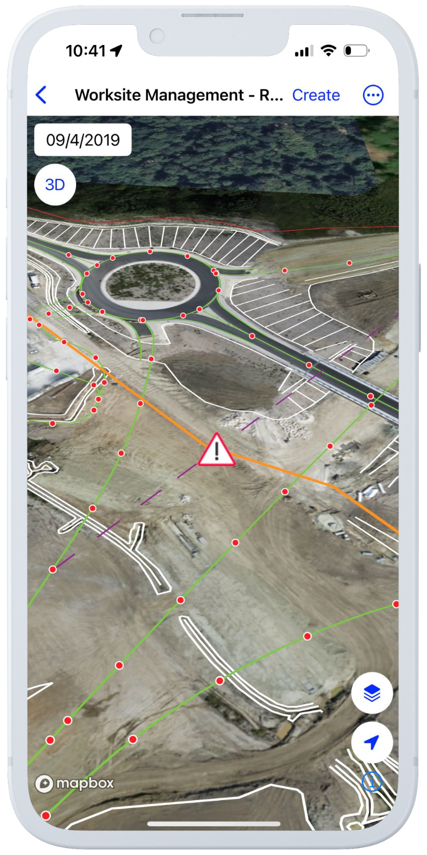
- The user leverages the device GPS to locate the path of the future gas line and check encroachment with an existing power line
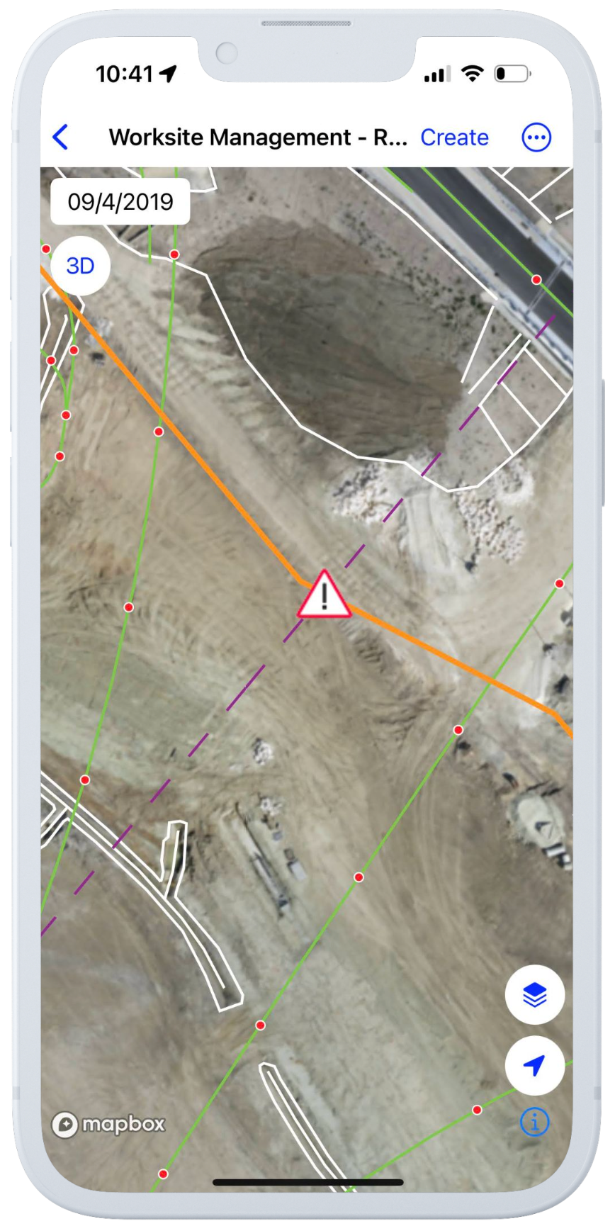
- User marks the location of the area to be carried out and potential encroachment with chalk/paint
- The user marks the job and danger zone with annotation in the Infield app
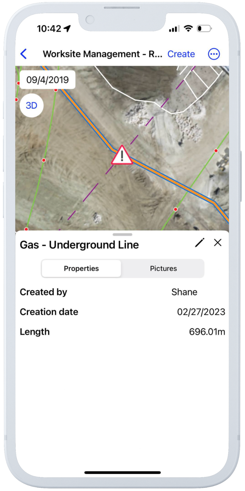
- The system publishes annotations for specific operators to view on all devices
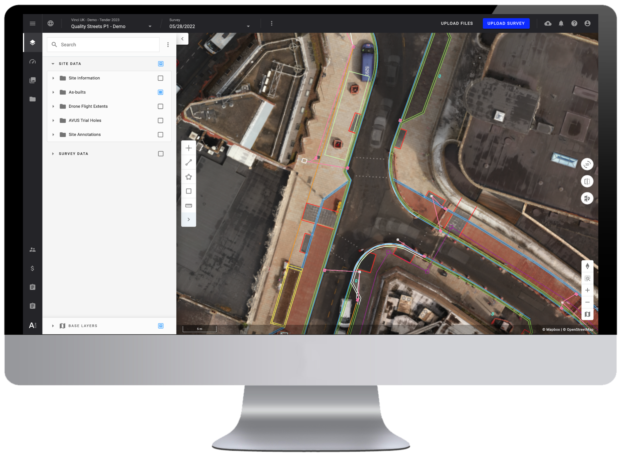
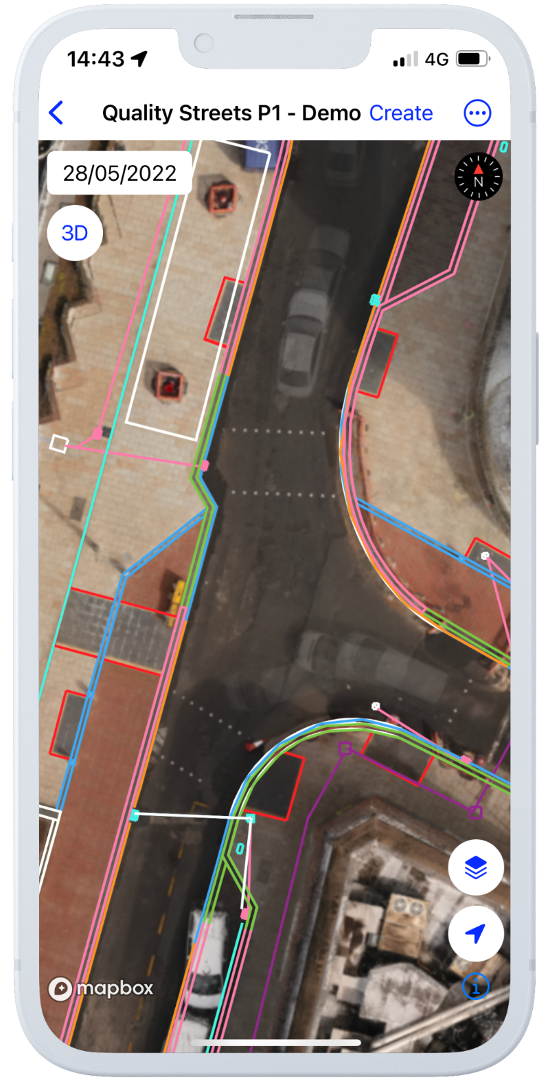
3.4 Infield module for road work planning and monitoring
- Check progress and deviations by using surveys and design comparison
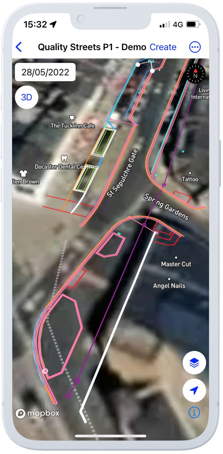
- Improve project safety by displaying critical information, such as electricity and water networks
- Create annotations from the field to enrich your site data (like hazardous areas)
- Commissioning and validation to ensure compliance in project delivery
- Sync your field data with the Aether or Alteia application for advanced analysis