

Contour Line In Local CRS
1. Description
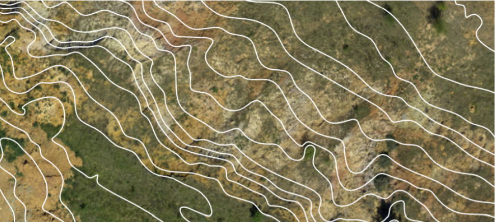
Contour Lines are defined as lines joining all points of the same elevation on a map. Aether calculates and displays these lines using a Digital Surface Model (DSM). These lines can notably be used to assess how the terrain is profiled.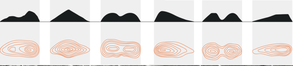
2. Generating Contour Lines
Contour lines can be obtained once a Photogrammetry process has been completed with an orthomap and a DSM available as layers, or after having imported these inputs processed from third-party software.
Step 1 - Open a Project and select a Survey.
Step 2 - Press the Analytics button from the left panel and select the Contour Line analytics.

Step 3 - Select the Elevation Model you wish to use as an input to generate the contour line.
Step 4 - Enter the following parameters:
- Output format : dxf, shapefile or json
- The other parameters are descibed here
Step 5 - Click on "LAUNCH LOCAL CRS CONTOUR LINE EXTRACTION FROM DSM".
4. Download Local Crs Contour Line
Go to the "Download" section to download the Contour Lines for further use with third-party software.

