

Infield - iOS
1. Onboarding
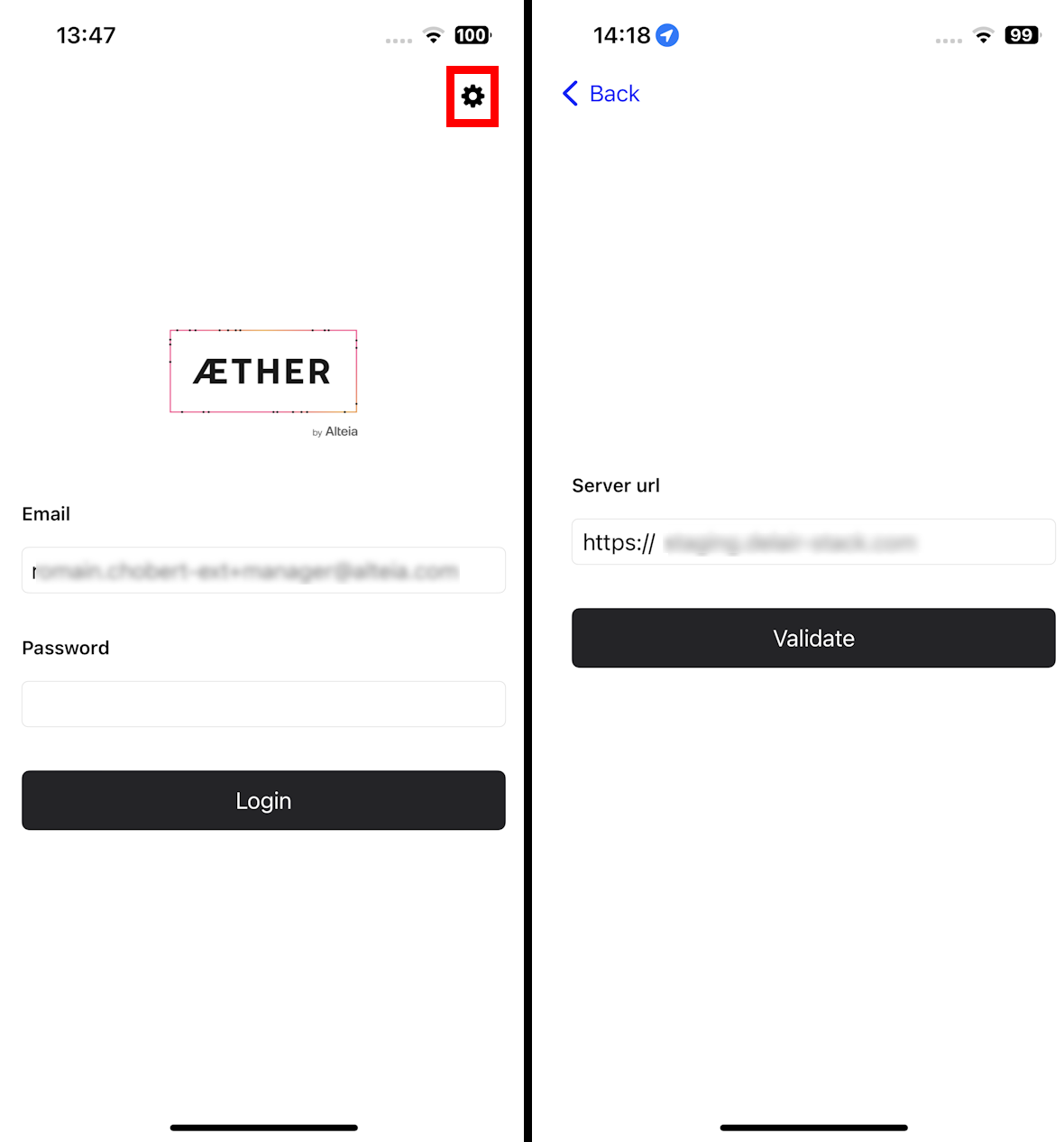
The application is installed on an Apple device (at least iOS 15), launch it and use an Aether account to log into the application.
Info
At the first launch, the user must validate Alteia's Terms of Use.
Login page with Aether Account or SSO account if the server is configured for SSO. If necessary, use the settings button to configure the platform URL (for example app.alteia.com).
2. Navigation
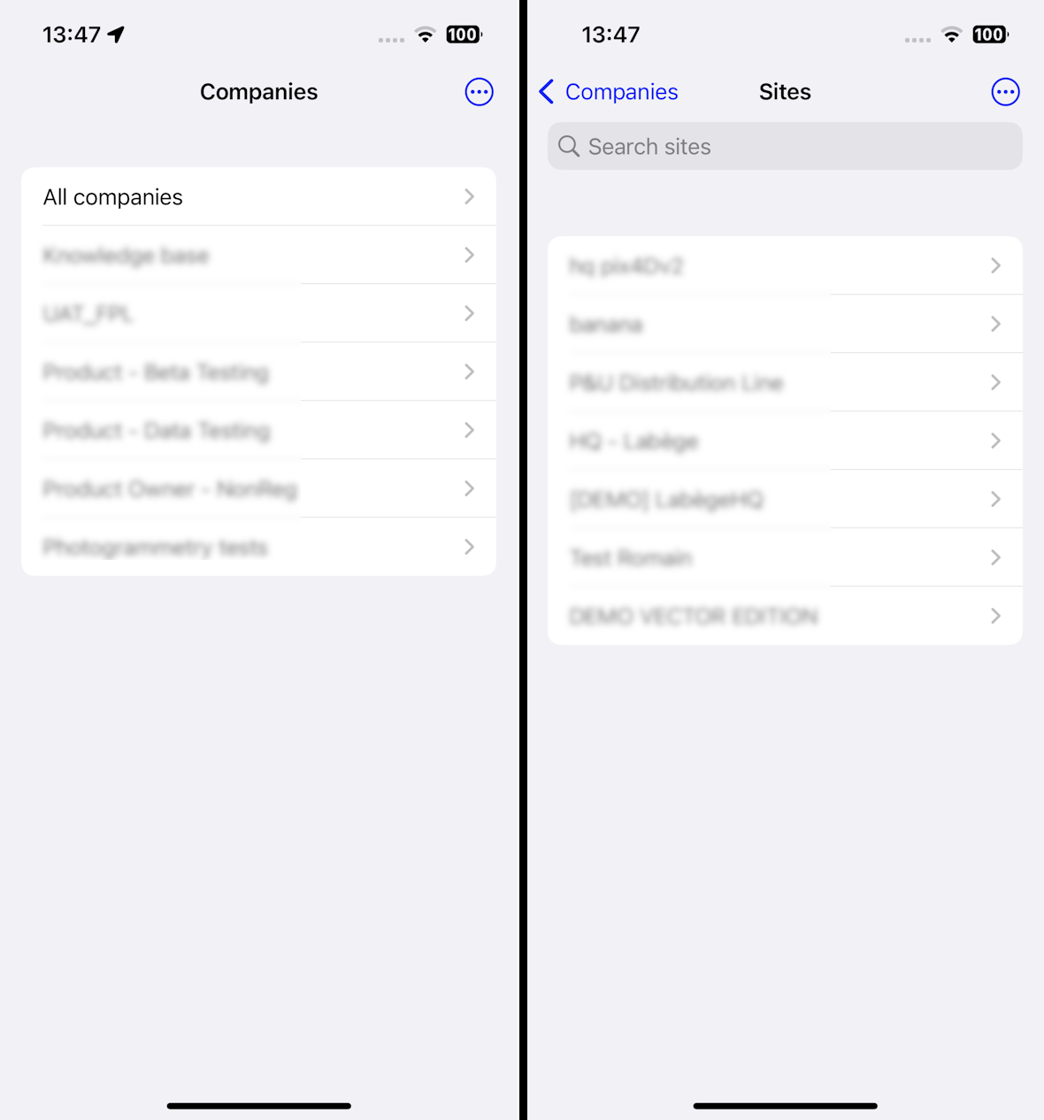
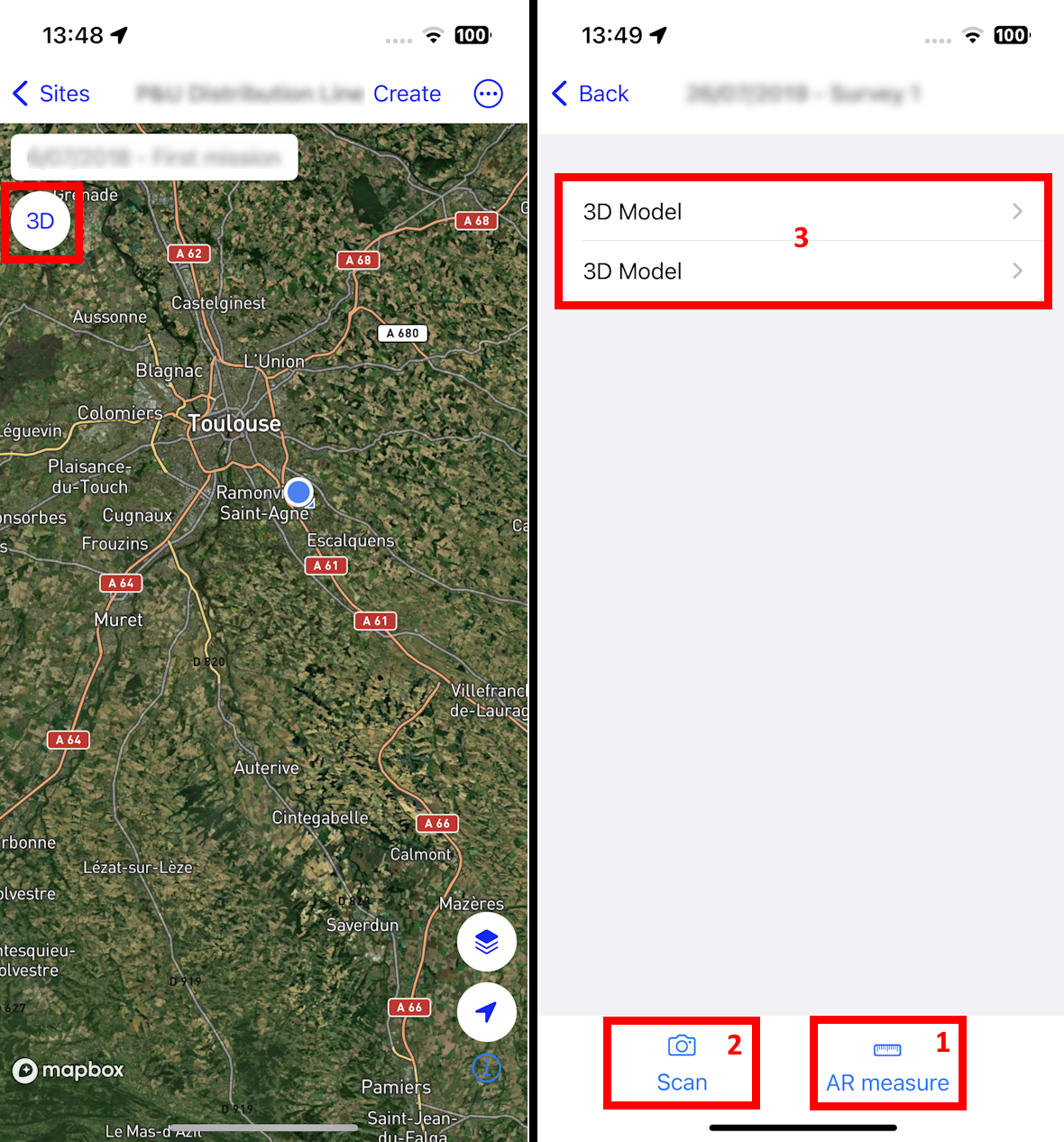
When logged into the application, select the Company and then the Project (sites).
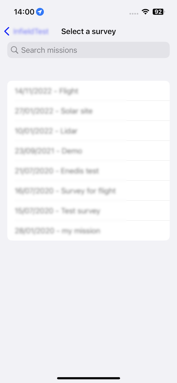
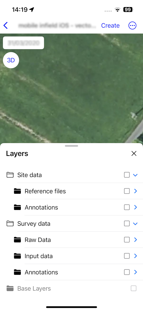
With the open project user can:
- Select a survey.
- Have access to the “Layers” panel as in the Aether platform and display/hide Base layers, annotations, vector layers, and the Raw data (Image Locations).
- Switch to the 3D Viewer
- AR measure (1)
- Scan a 3D model with Lidar (2)
- Visualize 3D model (3)
In the Infield application, navigating the map is a seamless and intuitive experience. Simply use your fingertips to explore the map, and drag your finger across the screen to smoothly move in any direction. For a closer look or a broader view, employ the two-finger pinch gesture to zoom in and out effortlessly, and Intuitively rotate the map with a two-finger twist, Use the location button to center the map on the user's location.
3. Annotations tools
With the button “CREATE” (1), use your finger to draw on the map line, polygon, or point (2), and click on next to fill in the annotation form (3). Save to finish the creation.
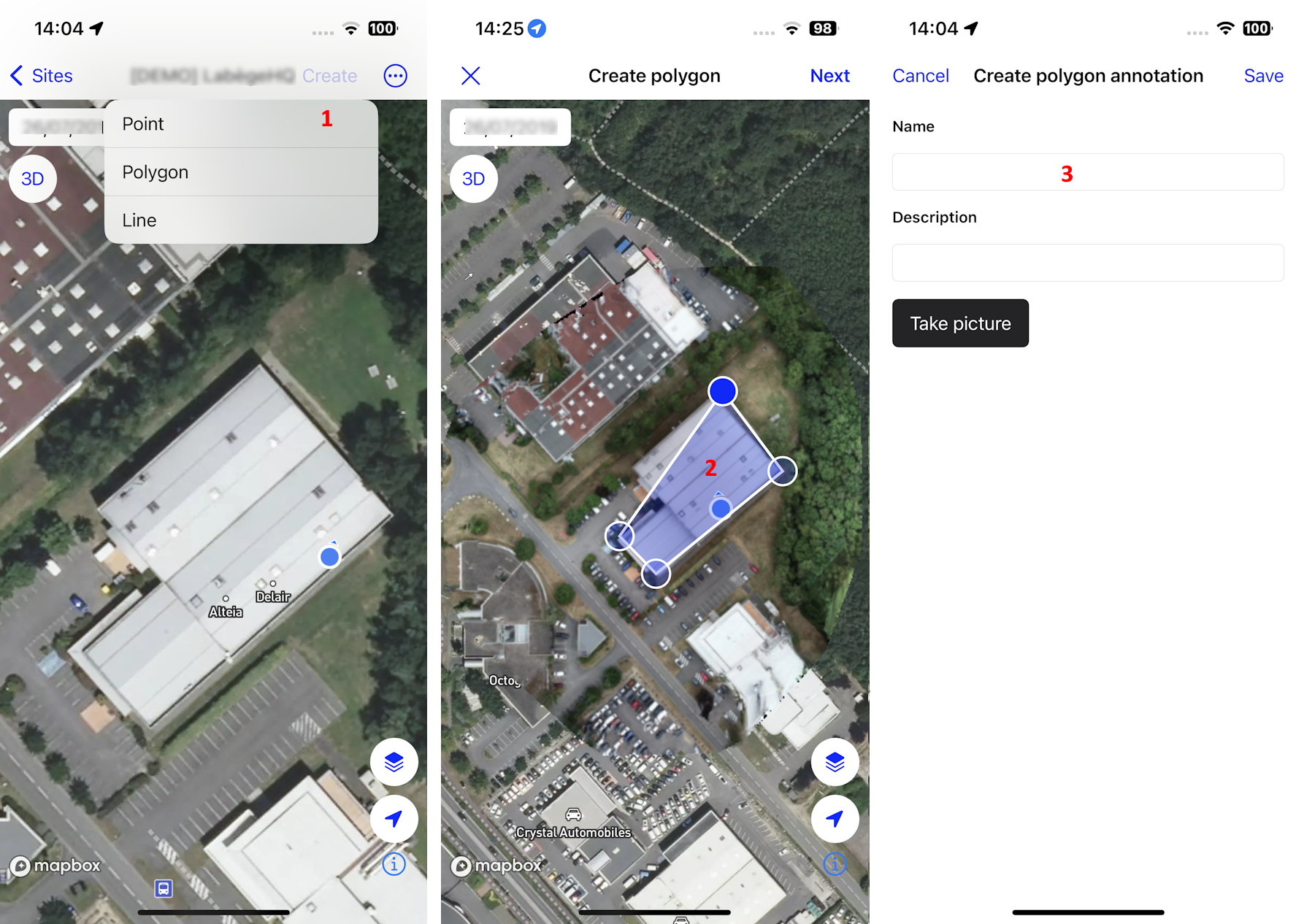
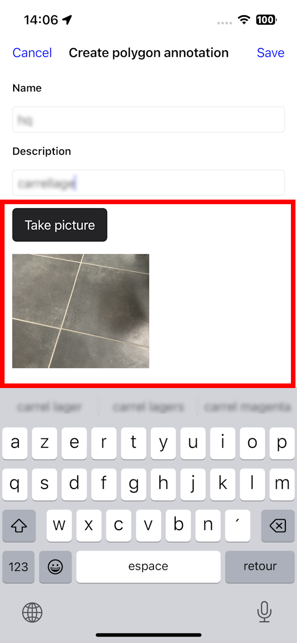
Take pictures live on-site and add them in annotations.
Select the annotations to consult (1), edit the annotation (2), or add a picture (3). It's not possible to modify the vector geometry of the annotation.
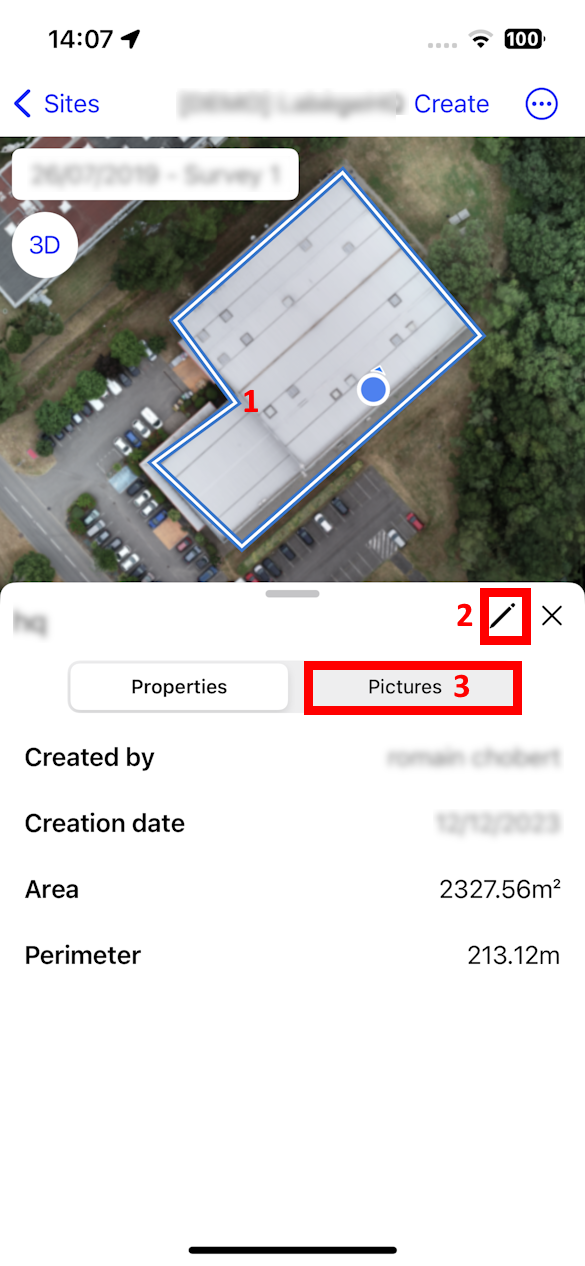
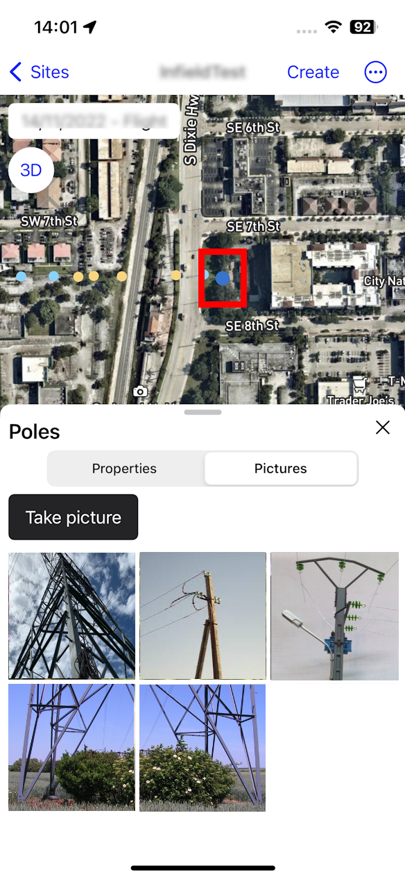
Select a vector to consult the vector details and add pictures.
4. Logout from the app
Click on the 3-dots menu and “Logout”. The login page is displayed.
