Field Boundaries Creation
1. Description
There are 2 ways to create field boundaries:
- Using the "create vector layer" tool: see the following article Create a New Vector Layer
- From an annotation: see workflow below
2. Workflow
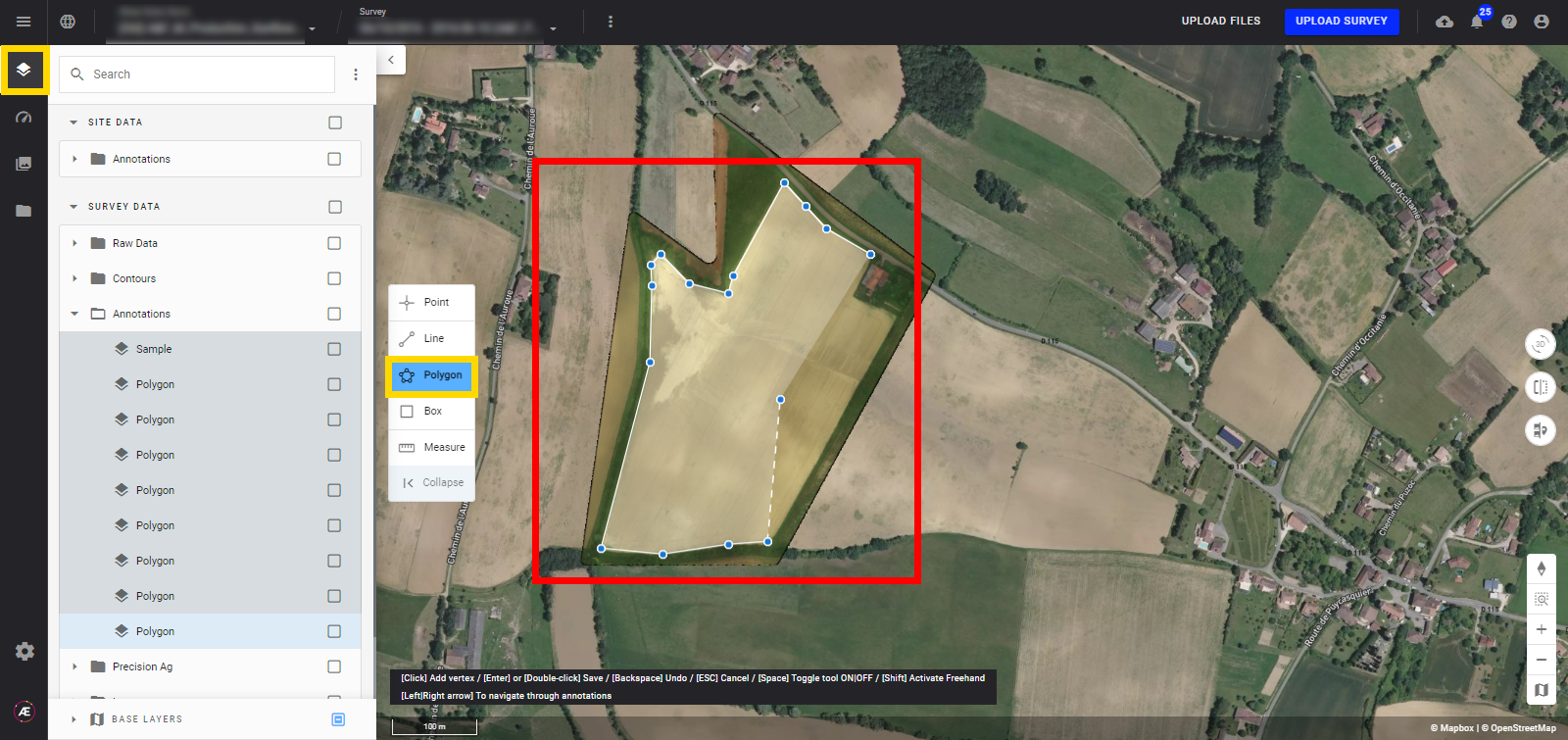
Step 1 - In an open project with a survey, use the polygon tool of the map view toolbar to draw an annotation that represents field boundaries.
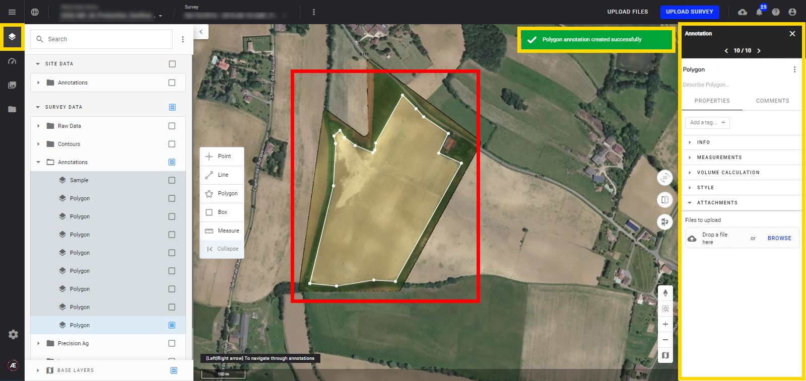
Step 2 - An information message will appear when the polygon creation is completed. The annotation info panel is also displayed on the right side of the window.
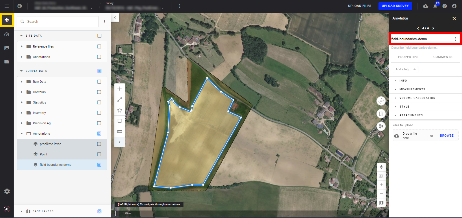
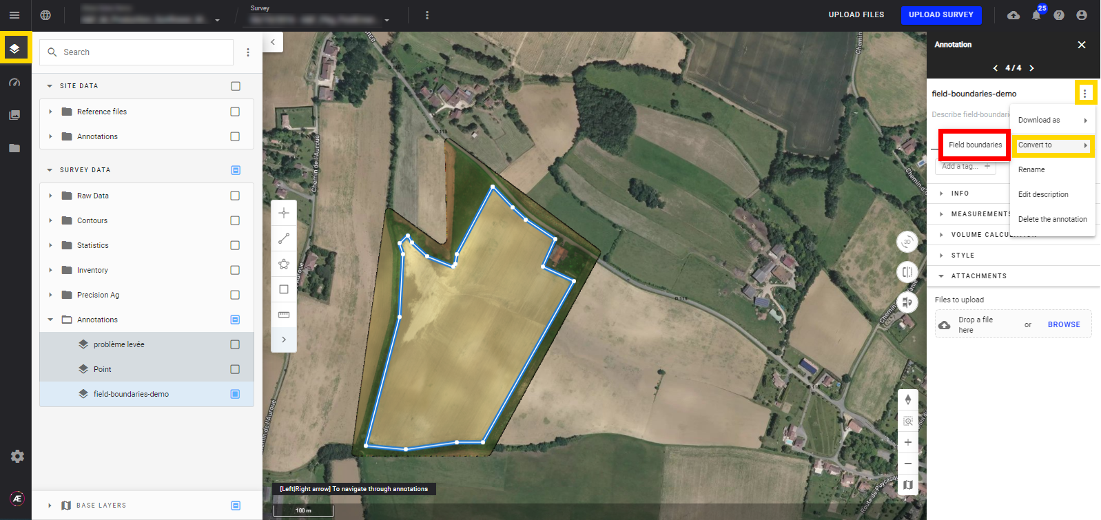
Step 3 - In the info panel, change the name of the annotation if needed and click on the "enter" key to validate your changes.
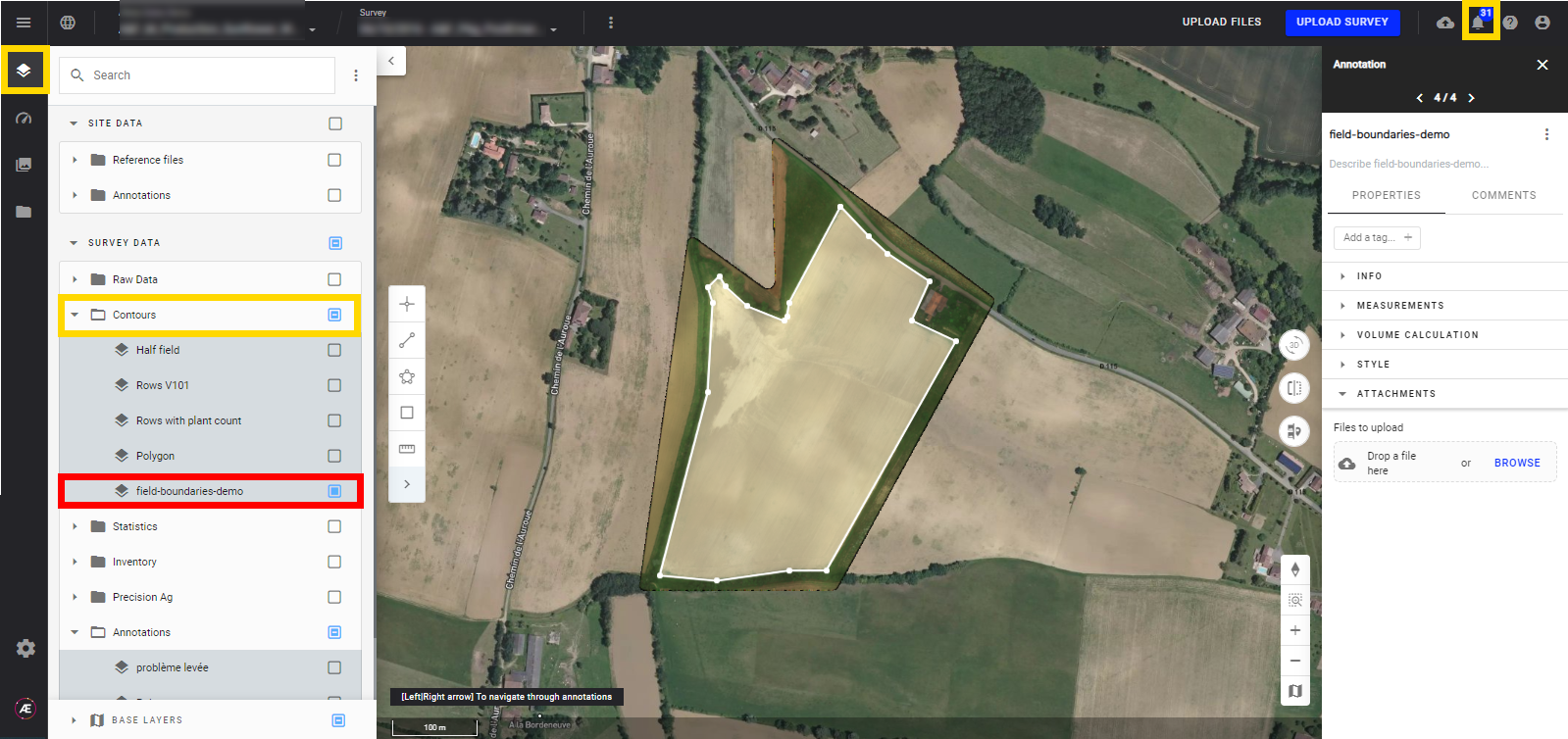
Step 4 - Click on the 3 dots next to the annotation name, "convert to" and "Field Boundaries".
Step 5 - After a few seconds, the annotation is converted into field boundaries and appears under the "Contours" folders. The platform will send a notification when the field boundary is complete.