Ground Coverage
1. Description
This tool generates ground-covered areas from the elevation model (DSM or DTM) in vector format.
2. Prerequisites
Elevation model (DSM or DTM)
3. Workflow
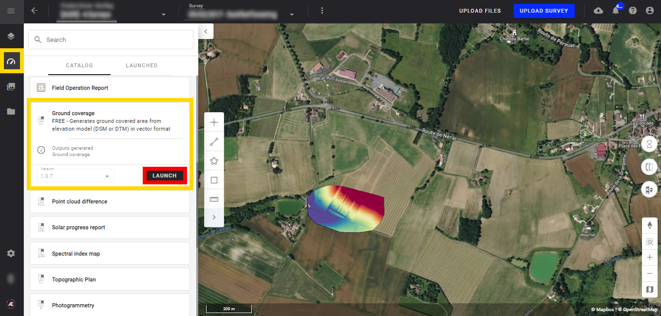
3.1 Step by step to launch the analytics
Step 1 - In the "Analytics" tab, search and select "Ground Coverage" and click on "LAUNCH".
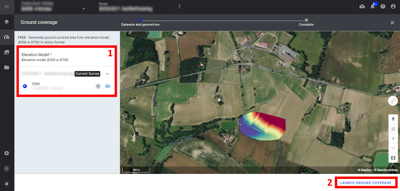
Step 2 - Select the "Elevation Model (1)" and click on "LAUNCH GROUND COVERAGE" (2).
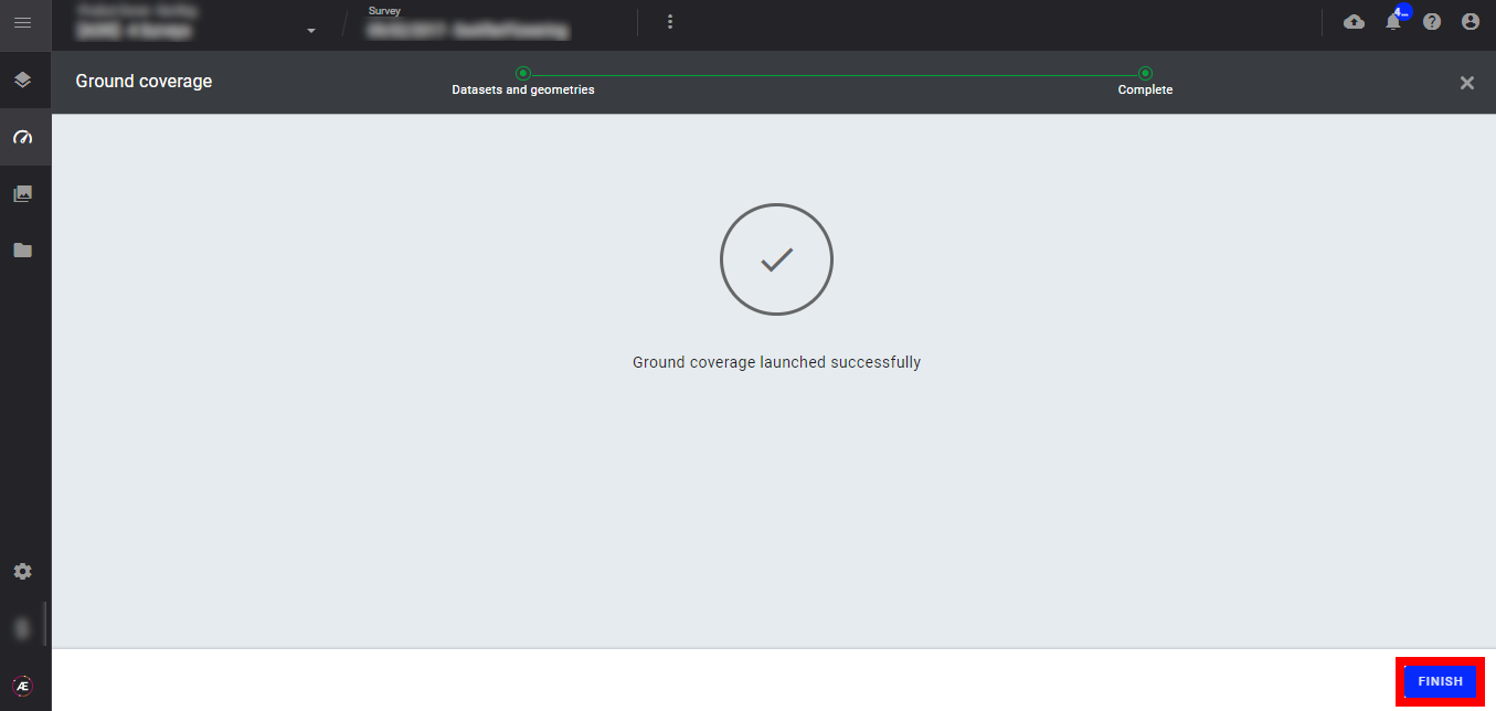
Step 3 - Click on "FINISH" to leave the analytics.
3.2 Status and Progression
Check in the "LAUNCHED" tab that the analytics is in progress.
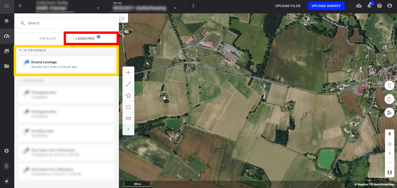
Aether will notify the user that the analytics results are available.
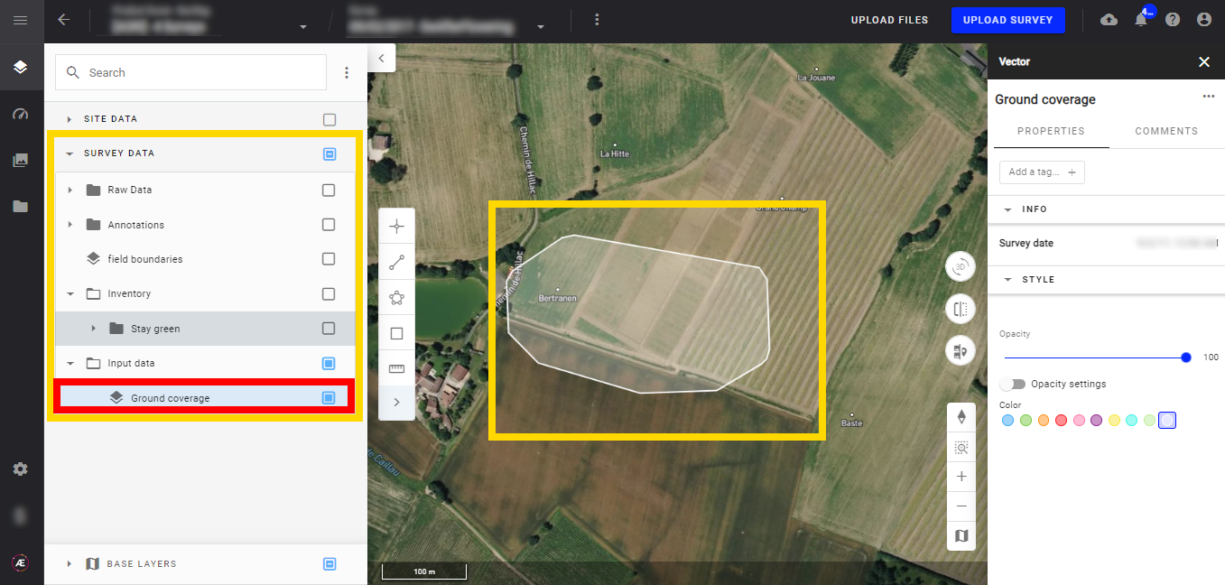
3.3 Results
In the "Input data" subgroup of "SURVEY DATA" a new vector layer "Ground coverage" is created.
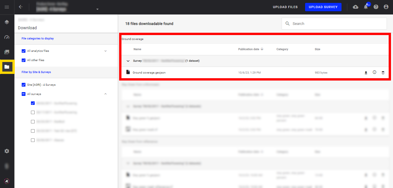
4. Export Capabilities
The analytics result files are located in the "Download" section.